
| Memorials | : | 57 |
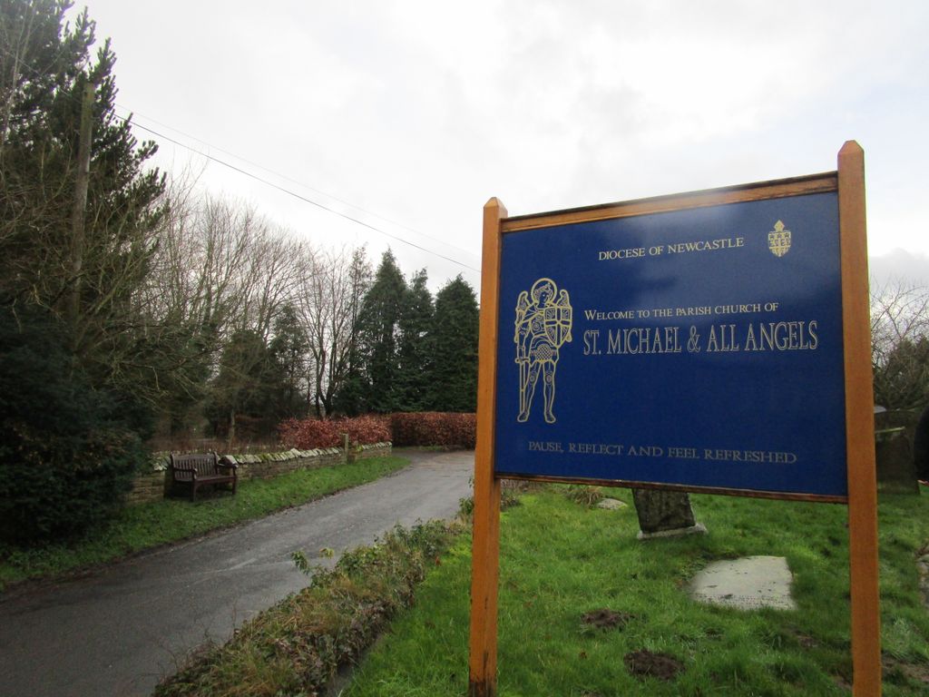
| Location | : | Felton, Northumberland Unitary Authority, England |
| Coordinate | : | 52.8203010, -2.9792430 |
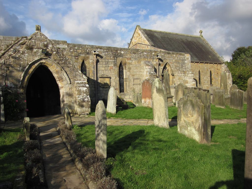
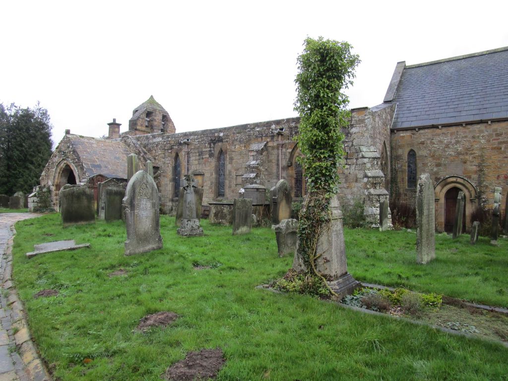
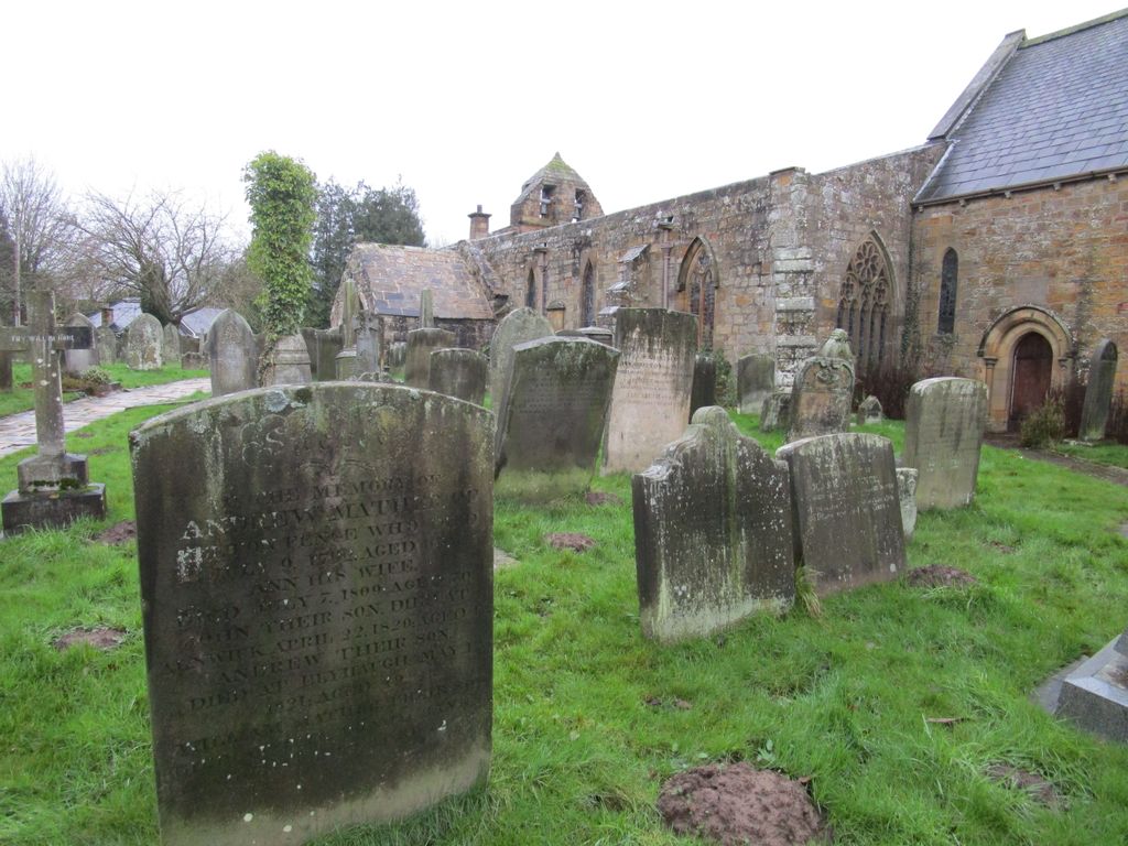
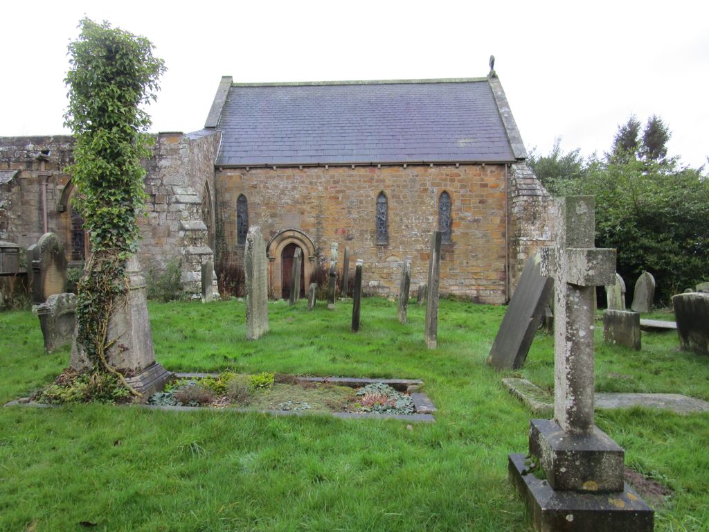
| Description | : | Church of Saint Michael and All Angels is a parish church located on Riverside in Felton, Northumberland, England. Built circa 1200, its many alterations and additions have caused it to be almost encased within another church. Some unusual features are that the nave and an aisle appear roofless, as well as a window with geometrical tracery that features an eight petalled flower patterned central circle cut from a single stone. Dedicated to Saint Michael, it is a Grade I listed building. |
frequently asked questions (FAQ):
-
Where is Saint Michael and All Angels Churchyard?
Saint Michael and All Angels Churchyard is located at Felton, Northumberland Unitary Authority ,Northumberland ,England.
-
Saint Michael and All Angels Churchyard cemetery's updated grave count on graveviews.com?
55 memorials
-
Where are the coordinates of the Saint Michael and All Angels Churchyard?
Latitude: 52.8203010
Longitude: -2.9792430


Nearby Cemetories:
1. St Mary the Virgin Parish Church
Hordley, Shropshire Unitary Authority, England
Coordinate: 52.8713670, -2.9208050
2. All Saints Churchyard
Baschurch, Shropshire Unitary Authority, England
Coordinate: 52.7913710, -2.8586210
3. St. Barnabas Churchyard
Hengoed, Shropshire Unitary Authority, England
Coordinate: 52.8883855, -3.0562708
4. Preeshenlle United Reformed Churchyard
Gobowen, Shropshire Unitary Authority, England
Coordinate: 52.8991040, -3.0356200
5. St. Simon and St. Jude Churchyard
Cockshutt, Shropshire Unitary Authority, England
Coordinate: 52.8577297, -2.8412706
6. Alberbury Priory
Alberbury, Shropshire Unitary Authority, England
Coordinate: 52.7311000, -2.9267000
7. St. Michael and All Angels Churchyard
Alberbury, Shropshire Unitary Authority, England
Coordinate: 52.7236380, -2.9509280
8. Saint Mary's Churchyard
Ellesmere, Shropshire Unitary Authority, England
Coordinate: 52.9075740, -2.8894550
9. Ellesmere Cemetery
Ellesmere, Shropshire Unitary Authority, England
Coordinate: 52.9111900, -2.8906500
10. St. Matthew's Churchyard
Ellesmere Rural, Shropshire Unitary Authority, England
Coordinate: 52.9240135, -2.9467180
11. St Peter and St Paul Churchyard
Fitz, Shropshire Unitary Authority, England
Coordinate: 52.7553657, -2.8182247
12. All Saints Churchyard
Alberbury, Shropshire Unitary Authority, England
Coordinate: 52.7062510, -3.0333570
13. St Mary's Churchyard Dudleston
Ellesmere, Shropshire Unitary Authority, England
Coordinate: 52.9392780, -2.9745280
14. St. Michael Churchyard
Ford, Shropshire Unitary Authority, England
Coordinate: 52.7184248, -2.8715080
15. St. Michael’s Churchyard
Cardeston, Shropshire Unitary Authority, England
Coordinate: 52.7050600, -2.8960090
16. Bomere Heath Methodist Church Burial Ground
Bomere Heath, Shropshire Unitary Authority, England
Coordinate: 52.7734260, -2.7833720
17. Bicton Cemetery
Bicton, Shropshire Unitary Authority, England
Coordinate: 52.7284870, -2.8183830
18. St John the Baptist Churchyard
Albrighton, Shropshire Unitary Authority, England
Coordinate: 52.7572400, -2.7462600
19. All Saints Church
Clive, Shropshire Unitary Authority, England
Coordinate: 52.8116250, -2.7212930
20. St Thomas Churchyard
Great Hanwood, Shropshire Unitary Authority, England
Coordinate: 52.6812150, -2.8242660
21. St. Mary Magdalene Church
Hadnall, Shropshire Unitary Authority, England
Coordinate: 52.7759670, -2.7100180
22. St. Mary's Churchyard
Edstaston, Shropshire Unitary Authority, England
Coordinate: 52.8830727, -2.7182040
23. Coton Primitive Methodist Chapel
Cotonwood, Shropshire Unitary Authority, England
Coordinate: 52.9191890, -2.6926830
24. Habberley St Mary's Church
Atcham, Shropshire Unitary Authority, England
Coordinate: 52.6266060, -2.8897140