
| Memorials | : | 0 |
| Location | : | Gobowen, Shropshire Unitary Authority, England |
| Coordinate | : | 52.8991040, -3.0356200 |
frequently asked questions (FAQ):
-
Where is Preeshenlle United Reformed Churchyard?
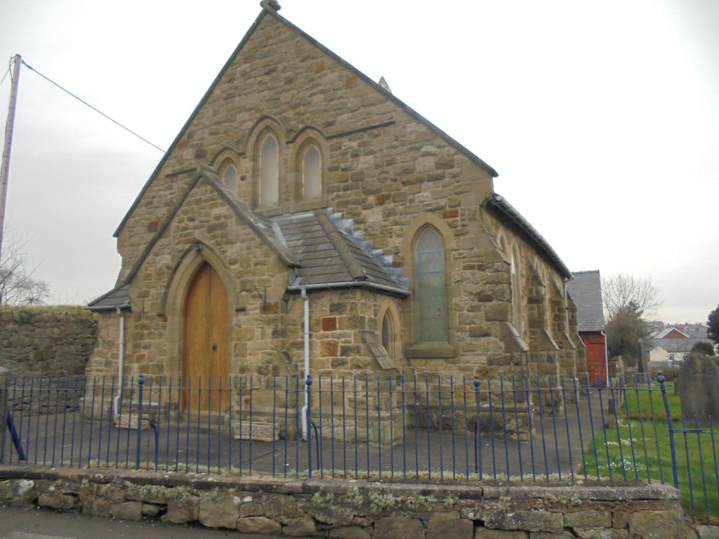
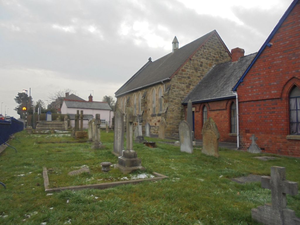
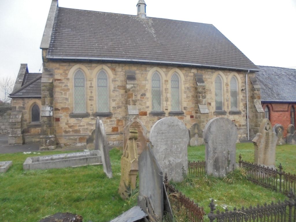
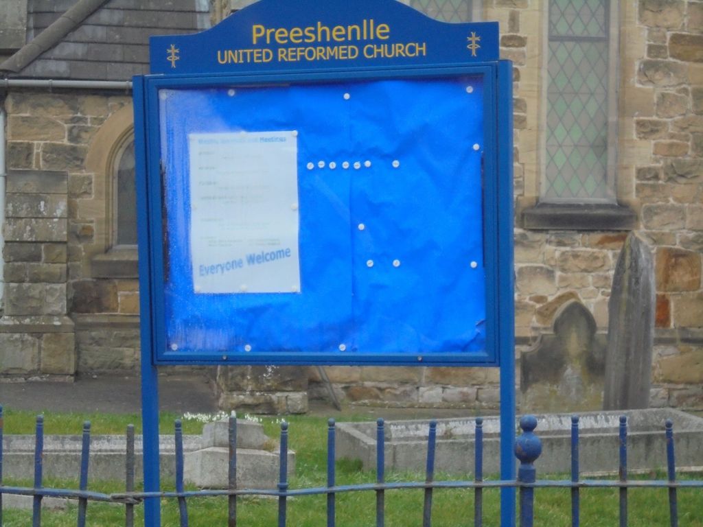
Preeshenlle United Reformed Churchyard is located at St Martins Road Gobowen, Shropshire Unitary Authority ,Shropshire , SY11 3PHEngland.
-
Preeshenlle United Reformed Churchyard cemetery's updated grave count on graveviews.com?
0 memorials
-
Where are the coordinates of the Preeshenlle United Reformed Churchyard?
Latitude: 52.8991040
Longitude: -3.0356200
Nearby Cemetories:
1. St. Barnabas Churchyard
Hengoed, Shropshire Unitary Authority, England
Coordinate: 52.8883855, -3.0562708
2. St Mary's Churchyard Dudleston
Ellesmere, Shropshire Unitary Authority, England
Coordinate: 52.9392780, -2.9745280
3. St. Matthew's Churchyard
Ellesmere Rural, Shropshire Unitary Authority, England
Coordinate: 52.9240135, -2.9467180
4. St Mary the Virgin Parish Church
Hordley, Shropshire Unitary Authority, England
Coordinate: 52.8713670, -2.9208050
5. Saint Michael and All Angels Churchyard
Felton, Northumberland Unitary Authority, England
Coordinate: 52.8203010, -2.9792430
6. Ellesmere Cemetery
Ellesmere, Shropshire Unitary Authority, England
Coordinate: 52.9111900, -2.8906500
7. Saint Mary's Churchyard
Ellesmere, Shropshire Unitary Authority, England
Coordinate: 52.9075740, -2.8894550
8. St. Simon and St. Jude Churchyard
Cockshutt, Shropshire Unitary Authority, England
Coordinate: 52.8577297, -2.8412706
9. British Cemetery
Mar del Plata, Partido de General Pueyrredón, Argentina
Coordinate: 53.0386111, -3.0052778
10. All Saints Churchyard
Baschurch, Shropshire Unitary Authority, England
Coordinate: 52.7913710, -2.8586210
11. St. John's Churchyard
Threapwood, Cheshire West and Chester Unitary Authority, England
Coordinate: 53.0023350, -2.8359540
12. Alberbury Priory
Alberbury, Shropshire Unitary Authority, England
Coordinate: 52.7311000, -2.9267000
13. St. Michael and All Angels Churchyard
Alberbury, Shropshire Unitary Authority, England
Coordinate: 52.7236380, -2.9509280
14. St Edith Churchyard
Shocklach, Cheshire West and Chester Unitary Authority, England
Coordinate: 53.0457000, -2.8487100
15. St. Mary's Churchyard
Edstaston, Shropshire Unitary Authority, England
Coordinate: 52.8830727, -2.7182040
16. All Saints Churchyard
Alberbury, Shropshire Unitary Authority, England
Coordinate: 52.7062510, -3.0333570
17. St Peter and St Paul Churchyard
Fitz, Shropshire Unitary Authority, England
Coordinate: 52.7553657, -2.8182247
18. Bomere Heath Methodist Church Burial Ground
Bomere Heath, Shropshire Unitary Authority, England
Coordinate: 52.7734260, -2.7833720
19. St. Oswald's Churchyard
Malpas, Cheshire West and Chester Unitary Authority, England
Coordinate: 53.0194240, -2.7669350
20. United Reformed Church Burial Ground
Malpas, Cheshire West and Chester Unitary Authority, England
Coordinate: 53.0198355, -2.7673954
21. St. Michael Churchyard
Ford, Shropshire Unitary Authority, England
Coordinate: 52.7184248, -2.8715080
22. Malpas Cemetery
Malpas, Cheshire West and Chester Unitary Authority, England
Coordinate: 53.0262800, -2.7633600
23. Coton Primitive Methodist Chapel
Cotonwood, Shropshire Unitary Authority, England
Coordinate: 52.9191890, -2.6926830
24. St. Chad's Churchyard
Farndon, Cheshire West and Chester Unitary Authority, England
Coordinate: 53.0840000, -2.8774000