
| Memorials | : | 579 |
| Location | : | Ray, Williams County, USA |
| Coordinate | : | 48.3483009, -103.1781006 |
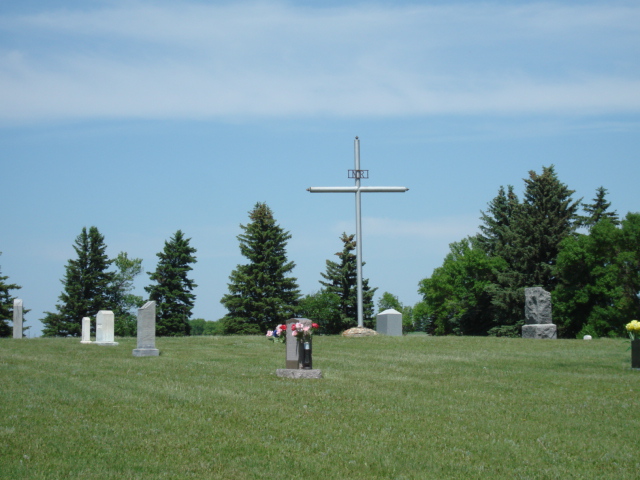
| Description | : | Township 156 - Range 97 - Section 8 of Equality Township. 1/2 mile West of Ray on Highway #2, 1/2 mile North on County Rd #17, turn West on gravel Road. Highland Cemetery was the first organized cemetery for the Ray community and the land was platted and owned by 1905. An addition was made in 1907 and another addition known as St. Michael's Cemetery was added in 1920. Dr. Walter Scott had ownership of the cemetery at one time and after his death, the records were destroyed. For this reason many unmarked graves remain unidentified today. There... Read More |
frequently asked questions (FAQ):
-
Where is Saint Michaels Cemetery?
Saint Michaels Cemetery is located at Ray, Williams County ,North Dakota ,USA.
-
Saint Michaels Cemetery cemetery's updated grave count on graveviews.com?
579 memorials
-
Where are the coordinates of the Saint Michaels Cemetery?
Latitude: 48.3483009
Longitude: -103.1781006
Nearby Cemetories:
1. Sunset Rest Cemetery
Ray, Williams County, USA
Coordinate: 48.3431015, -103.1905975
2. Soine Family Cemetery
Ray, Williams County, USA
Coordinate: 48.3349990, -103.1952670
3. Dunkard Church Cemetery
Wheelock, Williams County, USA
Coordinate: 48.3431620, -103.2371250
4. Hilltop Cemetery
Wheelock, Williams County, USA
Coordinate: 48.2915560, -103.1414530
5. Wheelock Cemetery
Wheelock, Williams County, USA
Coordinate: 48.2874985, -103.2596970
6. Emmanual Lutheran German Cemetery
Ray, Williams County, USA
Coordinate: 48.3278008, -103.0580978
7. Temple Cemetery
Temple, Williams County, USA
Coordinate: 48.3871994, -103.0475006
8. Rainbow Valley Lutheran Cemetery
Wildrose, Williams County, USA
Coordinate: 48.4802361, -103.2330551
9. Saint Mary Catholic Cemetery
Epping, Williams County, USA
Coordinate: 48.2671380, -103.3453700
10. Epping Cemetery
Epping, Williams County, USA
Coordinate: 48.2602997, -103.3550034
11. Bethany Valley Cemetery
Epping, Williams County, USA
Coordinate: 48.4056015, -103.3842010
12. Trinity Lutheran Cemetery
Tioga, Williams County, USA
Coordinate: 48.2980800, -102.9476700
13. Minton Cemetery
Williams County, USA
Coordinate: 48.3867760, -102.9412060
14. Zion Lutheran Cemetery
Tioga, Williams County, USA
Coordinate: 48.3911018, -102.9411011
15. United Cemetery
Tioga, Williams County, USA
Coordinate: 48.3885994, -102.9396973
16. Betaini Lutheran Cemetery
Tioga, Williams County, USA
Coordinate: 48.2691994, -102.9558029
17. Eastside Cemetery
Tioga, Williams County, USA
Coordinate: 48.3939018, -102.9235992
18. Bakken Cemetery
Tioga, Williams County, USA
Coordinate: 48.4160995, -102.9216995
19. Saint Paul Lutheran Cemetery
Wildrose, Williams County, USA
Coordinate: 48.5321999, -103.1857986
20. Saint Olaf Cemetery
Temple, Williams County, USA
Coordinate: 48.5069008, -103.0160980
21. Beaver Creek Cemetery
Tioga, Williams County, USA
Coordinate: 48.1751900, -103.0217650
22. Barstad Cemetery
Tioga, Williams County, USA
Coordinate: 48.1746560, -102.9990800
23. Stordahl Cemetery
Hamlet, Williams County, USA
Coordinate: 48.5614014, -103.1231003
24. Springbrook Cemetery #2
Spring Brook, Williams County, USA
Coordinate: 48.2556839, -103.4734116