
| Memorials | : | 5 |
| Location | : | Napoleon, Lafayette County, USA |
| Phone | : | 816-934-8239 |
| Coordinate | : | 39.1304092, -94.0753021 |
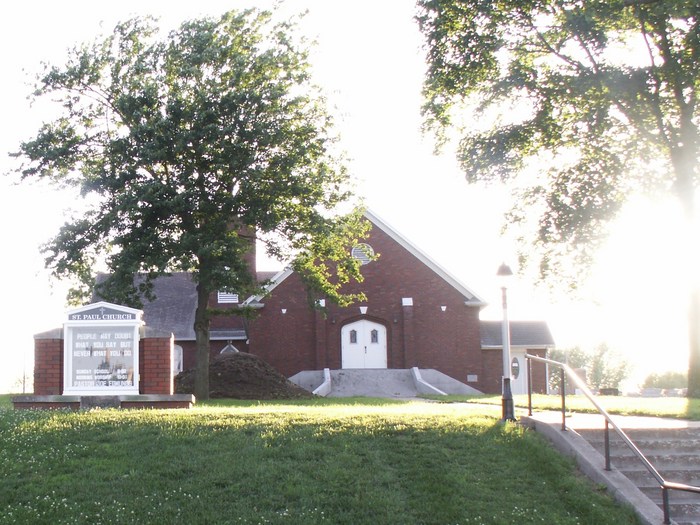
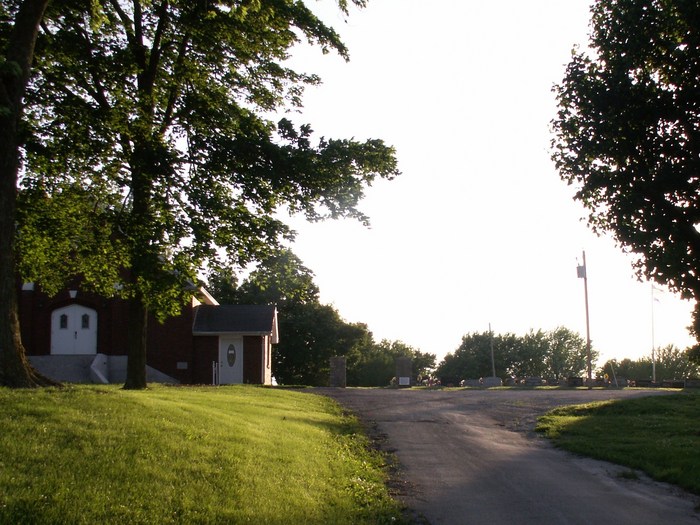
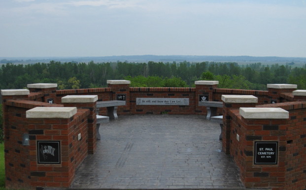
| Description | : | It is actually in the town of Napoleon, at 205 Hill Street, on between West 2nd St. and Church Street. Formerly, this was called St Paul Evangelical Christian Church. The cemetery lies to the right and back of the church. It is a small cemetery and the Missouri River can be seen from the hill the cemetery sits on. There is a very nice area built where several people can sit and view the cemetery and the river. |
frequently asked questions (FAQ):
-
Where is Saint Paul United Church of Christ Cemetery?
Saint Paul United Church of Christ Cemetery is located at 2272 Blue Valley Dr Napoleon, Lafayette County ,Missouri , 64097USA.
-
Saint Paul United Church of Christ Cemetery cemetery's updated grave count on graveviews.com?
5 memorials
-
Where are the coordinates of the Saint Paul United Church of Christ Cemetery?
Latitude: 39.1304092
Longitude: -94.0753021
Nearby Cemetories:
1. Napoleon United Methodist Church Cemetery
Napoleon, Lafayette County, USA
Coordinate: 39.1299802, -94.0763417
2. Anderson Cemetery
Napoleon, Lafayette County, USA
Coordinate: 39.1208400, -94.1010600
3. Arnold Cemetery
Wellington, Lafayette County, USA
Coordinate: 39.1176300, -94.0428619
4. Pleasant Prairie Cemetery
Napoleon, Lafayette County, USA
Coordinate: 39.0866674, -94.0924384
5. Ebenezer United Church of Christ Cemetery
Levasy, Jackson County, USA
Coordinate: 39.1100006, -94.1340027
6. Bierbaum - Kidd Cemetery
Levasy, Jackson County, USA
Coordinate: 39.1216200, -94.1430100
7. Martin-Carr Cemetery
Wellington, Lafayette County, USA
Coordinate: 39.1306000, -93.9978027
8. Saint Lukes Evangelical Church Cemetery
Wellington, Lafayette County, USA
Coordinate: 39.1308200, -93.9926400
9. Wellington City Cemetery
Wellington, Lafayette County, USA
Coordinate: 39.1324806, -93.9907837
10. Mount Olivet Cemetery
Wellington, Lafayette County, USA
Coordinate: 39.1327400, -93.9903900
11. Camden City Cemetery
Camden, Ray County, USA
Coordinate: 39.1936700, -94.0470800
12. Smith-Jackson-Remley Cemetery
Fleming, Ray County, USA
Coordinate: 39.1951500, -94.0532100
13. Greens Chapel Cemetery
Buckner, Jackson County, USA
Coordinate: 39.0938988, -94.1528015
14. Dorton Cemetery
Orrick, Ray County, USA
Coordinate: 39.1960900, -94.1137100
15. Mecklin Cemetery
Oak Grove, Jackson County, USA
Coordinate: 39.0661011, -94.1264038
16. Happy Cemetery
Ray County, USA
Coordinate: 39.2121560, -94.0392570
17. Jackson Family Cemetery
Richmond, Ray County, USA
Coordinate: 39.2174030, -94.0568710
18. Sunshine Cemetery
Richmond, Ray County, USA
Coordinate: 39.1611500, -93.9679000
19. Moore Family Cemetery
Oak Grove, Jackson County, USA
Coordinate: 39.0468900, -94.1246200
20. Brockman-Hudgeons Cemetery
Camden, Ray County, USA
Coordinate: 39.2153900, -94.0238700
21. South Point Cemetery
Orrick, Ray County, USA
Coordinate: 39.2233009, -94.0978012
22. Saint Clair Cemetery
Grain Valley, Jackson County, USA
Coordinate: 39.0717010, -94.1710968
23. Brasher Cemetery
Orrick, Ray County, USA
Coordinate: 39.2262573, -94.0856857
24. Buckner Hill Cemetery
Buckner, Jackson County, USA
Coordinate: 39.1253014, -94.1994019