
| Memorials | : | 0 |
| Location | : | Brainerd, Crow Wing County, USA |
| Coordinate | : | 46.2752980, -94.3352060 |
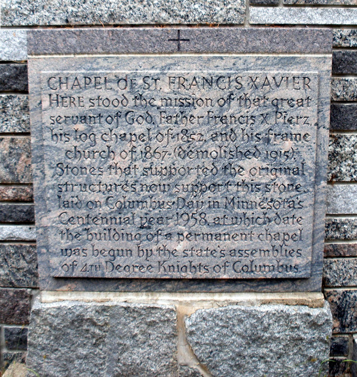
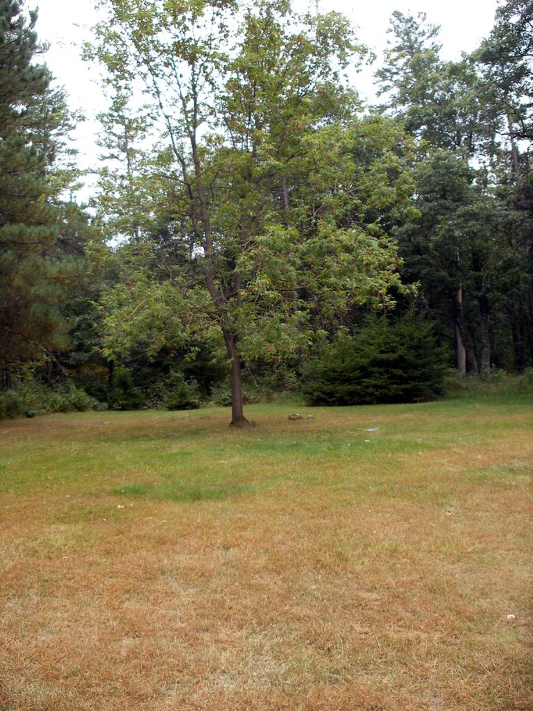
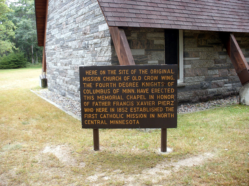
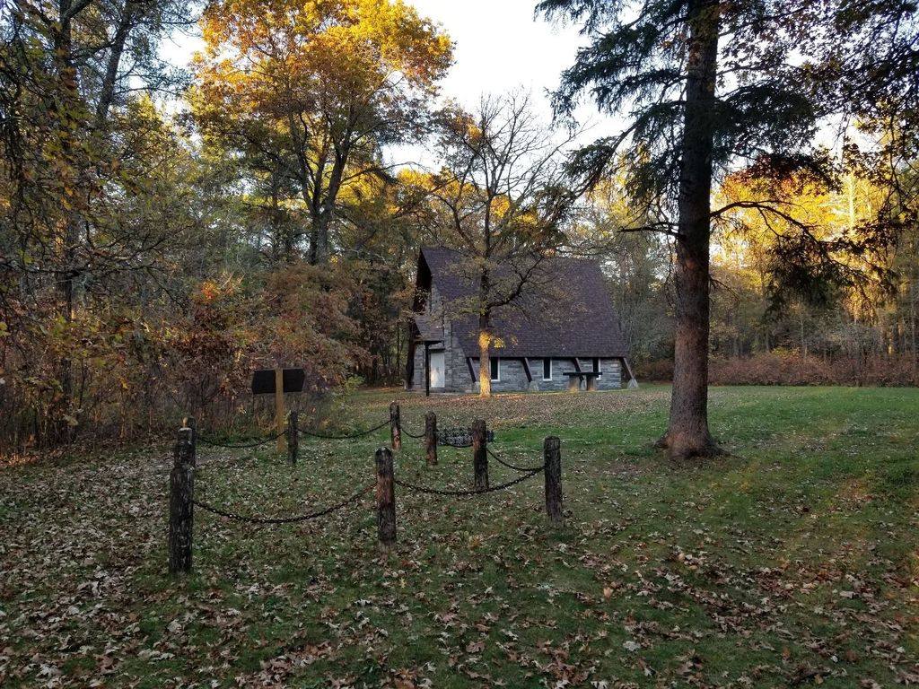
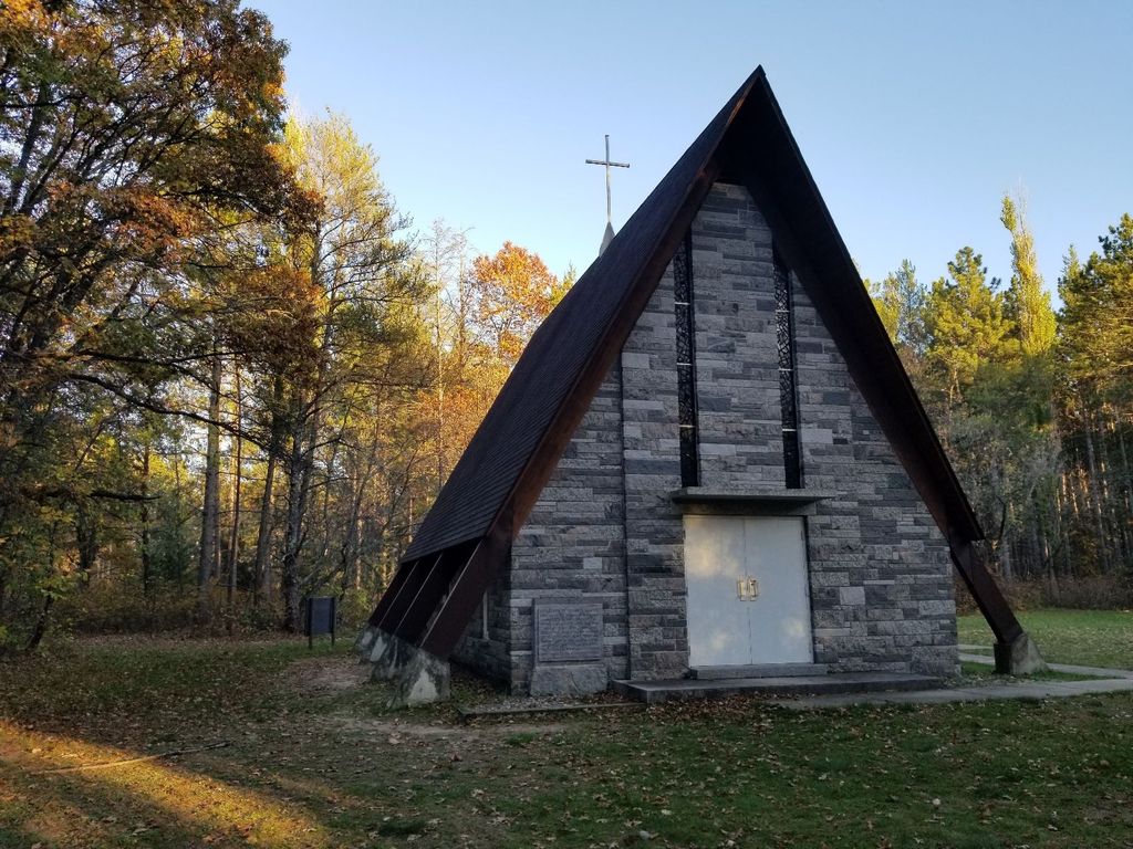
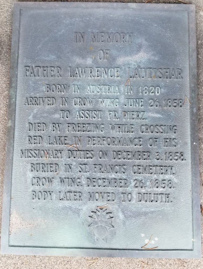
| Description | : | This cemetery is within Crow Wing State Park. The address of the park is 3124 State Park Road, Brainerd, MN. A map of the park is available at the park entrance. Most of the stones surround a small tree in the cemetery (pictured at right, taken from the chapel). The others are off to the right of the tree. The cemetery is inactive. Please be respectful and leave the stones as they are. The Minnesota GenWeb Project: Crow Wing County - Cemetery Directory "According to Anna Himrod (1937 WPA Project), at least 50 burials. Contains 18 known graves. Last burial 1947.... Read More |
frequently asked questions (FAQ):
-
Where is Saint Francis Assisi Cemetery?
Saint Francis Assisi Cemetery is located at Brainerd, Crow Wing County ,Minnesota ,USA.
-
Saint Francis Assisi Cemetery cemetery's updated grave count on graveviews.com?
0 memorials
-
Where are the coordinates of the Saint Francis Assisi Cemetery?
Latitude: 46.2752980
Longitude: -94.3352060
Nearby Cemetories:
1. Saint John Holy Cross Cemetery
Brainerd, Crow Wing County, USA
Coordinate: 46.2790970, -94.3328890
2. Oak Land Cemetery
Crow Wing County, USA
Coordinate: 46.2722015, -94.3043976
3. Oak Hill Cemetery
Crow Wing County, USA
Coordinate: 46.2158012, -94.3285980
4. Dixon Cemetery
Fort Ripley, Crow Wing County, USA
Coordinate: 46.2154930, -94.3246630
5. Gull River Cemetery
Cass County, USA
Coordinate: 46.3356018, -94.3685989
6. Baxter Cemetery
Baxter, Crow Wing County, USA
Coordinate: 46.3455600, -94.2855600
7. Sylvan Cemetery
Sylvan, Cass County, USA
Coordinate: 46.3333300, -94.4113900
8. Saint Mathias Catholic Cemetery
Saint Mathias, Crow Wing County, USA
Coordinate: 46.2200000, -94.2517000
9. Franzen Family Cemetery
Little Falls, Morrison County, USA
Coordinate: 46.3158970, -94.4431250
10. Fort Ripley Cemetery
Fort Ripley, Crow Wing County, USA
Coordinate: 46.1761000, -94.3615700
11. Wildwood Cemetery
Pillager, Cass County, USA
Coordinate: 46.3311005, -94.4627991
12. Pine Grove Cemetery
Crow Wing County, USA
Coordinate: 46.1713000, -94.2725000
13. Rail Prairie Union Cemetery
Morrison County, USA
Coordinate: 46.2519900, -94.4962200
14. Riverside Cemetery
Crow Wing County, USA
Coordinate: 46.2224998, -94.1893997
15. Pillager Frontier Cemetery
Pillager, Cass County, USA
Coordinate: 46.3171997, -94.4944000
16. Saint Thomas of the Pines Cemetery
East Gull Lake, Cass County, USA
Coordinate: 46.3921300, -94.3809900
17. Saint Pauls Episcopal Church Columbarium
Brainerd, Crow Wing County, USA
Coordinate: 46.3604205, -94.1988906
18. Lutheran Cemetery
Morrison County, USA
Coordinate: 46.2378490, -94.5171960
19. Evergreen Cemetery
Brainerd, Crow Wing County, USA
Coordinate: 46.3708000, -94.1859000
20. Ogema Point Cemetery
Cushing, Morrison County, USA
Coordinate: 46.2146988, -94.5393982
21. Scandia Valley Cemetery West
Cushing, Morrison County, USA
Coordinate: 46.2138890, -94.5400000
22. Pine Tree Cemetery
Crow Wing County, USA
Coordinate: 46.2122000, -94.1214000
23. Hillside Cemetery
Long Lake Township, Crow Wing County, USA
Coordinate: 46.2577000, -94.1037000
24. Evergreen Memorial Gardens
Brainerd, Crow Wing County, USA
Coordinate: 46.4010010, -94.1740036