
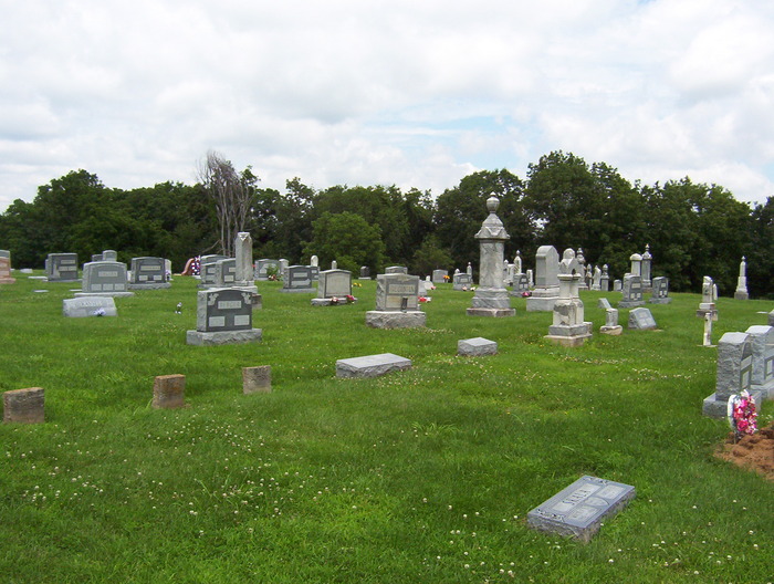
| Memorials | : | 1 |
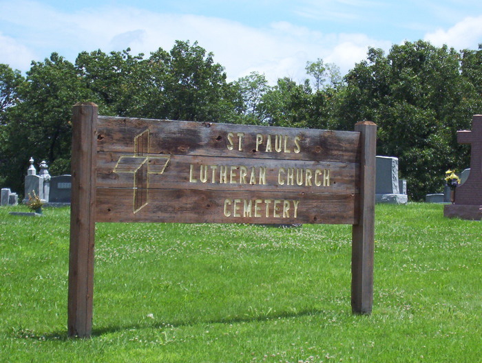
| Location | : | Antonia, Jefferson County, USA |
| Coordinate | : | 38.3703600, -90.4990600 |
frequently asked questions (FAQ):
-
Where is Saint Pauls Lutheran Cemetery?
Saint Pauls Lutheran Cemetery is located at Antonia, Jefferson County ,Missouri ,USA.
-
Saint Pauls Lutheran Cemetery cemetery's updated grave count on graveviews.com?
1 memorials
-
Where are the coordinates of the Saint Pauls Lutheran Cemetery?
Latitude: 38.3703600
Longitude: -90.4990600
Nearby Cemetories:
1. Antonia Cemetery
Antonia, Jefferson County, USA
Coordinate: 38.3641357, -90.4659500
2. Burgess Cemetery
Antonia, Jefferson County, USA
Coordinate: 38.3610000, -90.4376000
3. Our Lady Queen of Peace Catholic Cemetery
House Springs, Jefferson County, USA
Coordinate: 38.4103200, -90.5673300
4. Langehennig Family Plot
Antonia, Jefferson County, USA
Coordinate: 38.3591670, -90.4147220
5. Johnston Cemetery
Pevely, Jefferson County, USA
Coordinate: 38.3022400, -90.5045500
6. Bechler Family Cemetery
Belews Creek, Jefferson County, USA
Coordinate: 38.3304900, -90.5707100
7. Czech-Slav Benevolent Society Cemetery
High Ridge, Jefferson County, USA
Coordinate: 38.4401360, -90.4974480
8. Saint John Cemetery
High Ridge, Jefferson County, USA
Coordinate: 38.4406013, -90.4974976
9. Shepherd Hills Cemetery
Barnhart, Jefferson County, USA
Coordinate: 38.3558300, -90.4110100
10. Christian Outreach Church Cemetery
Hillsboro, Jefferson County, USA
Coordinate: 38.3016450, -90.5227920
11. Liguori Cemetery
Barnhart, Jefferson County, USA
Coordinate: 38.3431700, -90.4057390
12. Everlawn Gardens Cemetery
High Ridge, Jefferson County, USA
Coordinate: 38.4359190, -90.5703050
13. Evangelical Lutheran Cross Cemetery
Hillsboro, Jefferson County, USA
Coordinate: 38.2825030, -90.4858610
14. Saint Martins Cemetery
High Ridge, Jefferson County, USA
Coordinate: 38.4538000, -90.5385000
15. Sandy Baptist Church Cemetery
Hillsboro, Jefferson County, USA
Coordinate: 38.2819970, -90.4852000
16. Glade Chapel Cemetery
Hillsboro, Jefferson County, USA
Coordinate: 38.2952300, -90.5665500
17. Mahler Cemetery
Jefferson County, USA
Coordinate: 38.2807999, -90.4713974
18. Forest Lawn Pet Cemetery
High Ridge, Jefferson County, USA
Coordinate: 38.4449700, -90.5727800
19. Richardson Cemetery
Arnold, Jefferson County, USA
Coordinate: 38.4207993, -90.3961029
20. Kimmswick City Cemetery
Imperial, Jefferson County, USA
Coordinate: 38.3666610, -90.3765580
21. Rauschenbach Cemetery
Imperial, Jefferson County, USA
Coordinate: 38.3668240, -90.3765440
22. Immanuel Lutheran Church Cemetery
Pevely, Jefferson County, USA
Coordinate: 38.3119600, -90.3980390
23. Jarvis Cemetery
Jefferson County, USA
Coordinate: 38.2700320, -90.5022620
24. Local Cedar Hill Cemetery
Cedar Hill, Jefferson County, USA
Coordinate: 38.3659400, -90.6271800