
| Memorials | : | 1 |
| Location | : | Punxsutawney, Jefferson County, USA |
| Coordinate | : | 40.9515150, -78.9616910 |
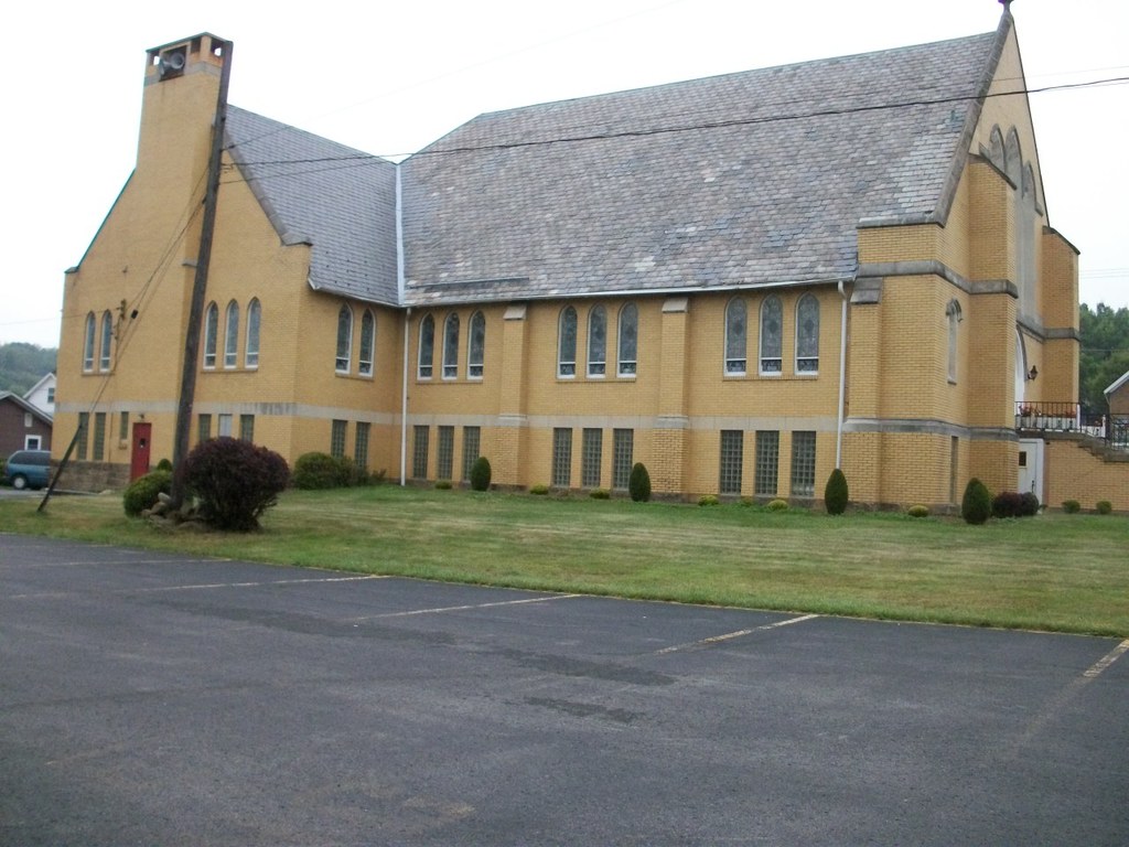
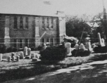
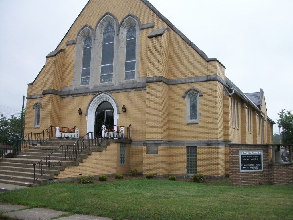
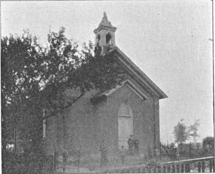
| Description | : | ********************************** This cemetery no longer exists. Burials in this cemetery, were made from about as early as,1848 to 1852 up until about 1917. ********************************** St.Peters United Church of Christ, is located at the intersection of Graffius Avenue & Orchard Street,in the Elk Run section of the Boro of Punxsutawney,Jefferson county,Pennsylvania. ********************************** This church and the old cemetery have been seen and known by many different names: ~ The Graffius Church and Graveyard; ~ The German Reformed Church; ~ The Reformed Church of Punxsutawney; ~ Dutch Meeting House; ~ the Punxsutawney German Reformed Church & Cemetery; ~ The Graffius Reformed Church; ~ St. Peter's German Reformed; ~ St.Peter's Reformed & Presbyterian Church; ~ Elk Run... Read More |
frequently asked questions (FAQ):
-
Where is Saint Peters Reformed Cemetery?
Saint Peters Reformed Cemetery is located at Punxsutawney, Jefferson County ,Pennsylvania ,USA.
-
Saint Peters Reformed Cemetery cemetery's updated grave count on graveviews.com?
1 memorials
-
Where are the coordinates of the Saint Peters Reformed Cemetery?
Latitude: 40.9515150
Longitude: -78.9616910
Nearby Cemetories:
1. North Findley Street Cemetery
Punxsutawney, Jefferson County, USA
Coordinate: 40.9466000, -78.9724000
2. Circle Hill Cemetery
Punxsutawney, Jefferson County, USA
Coordinate: 40.9486008, -78.9496994
3. Clayville Cemetery
Punxsutawney, Jefferson County, USA
Coordinate: 40.9470000, -78.9880000
4. Saints Peter and Paul Byzantine Cemetery
Punxsutawney, Jefferson County, USA
Coordinate: 40.9750000, -78.9706000
5. Calvary Cemetery
Punxsutawney, Jefferson County, USA
Coordinate: 40.9358215, -78.9930725
6. Oak Lawn Cemetery
Cloe, Jefferson County, USA
Coordinate: 40.9300003, -78.9356003
7. Cherva Agudath Achuin Hebrew Cemetery
Cloe, Jefferson County, USA
Coordinate: 40.9293210, -78.9359090
8. Ridgemount Cemetery
Punxsutawney, Jefferson County, USA
Coordinate: 40.9719009, -78.9317017
9. Mount Zion Memorial Cemetery
Jefferson County, USA
Coordinate: 40.9794000, -78.9254000
10. Horatio Cemetery
Punxsutawney, Jefferson County, USA
Coordinate: 40.9392000, -79.0133000
11. Anita Community Cemetery
Anita, Jefferson County, USA
Coordinate: 40.9932450, -78.9790390
12. Adrian-Anita Roman Catholic Cemetery
Anita, Jefferson County, USA
Coordinate: 40.9958000, -78.9805984
13. Saints Peter And Paul Byzantine Catholic Cemetery
Horatio, Jefferson County, USA
Coordinate: 40.9324989, -79.0180969
14. Anita Cemetery
Anita, Jefferson County, USA
Coordinate: 40.9972500, -78.9770700
15. Pearce Cemetery
Rossiter, Indiana County, USA
Coordinate: 40.9028015, -78.9225006
16. Mount Tabor United Methodist Church Cemetery
Battle Hollow, Jefferson County, USA
Coordinate: 41.0030000, -78.9970000
17. Hopewell United Methodist Church Cemetery
Frostburg, Jefferson County, USA
Coordinate: 40.9620000, -79.0393000
18. Pleasant Grove Cemetery
Jefferson County, USA
Coordinate: 40.9398000, -78.8835000
19. Brooks Cemetery
Punxsutawney, Jefferson County, USA
Coordinate: 40.9247250, -78.8881340
20. Pifer Cemetery
Jefferson County, USA
Coordinate: 41.0068000, -78.9210000
21. Olive Cemetery
Oliveburg, Jefferson County, USA
Coordinate: 40.9940000, -79.0270000
22. Bowers Cemetery
Gaskill Township, Jefferson County, USA
Coordinate: 40.9472008, -78.8716965
23. McClure Cemetery
Big Run, Jefferson County, USA
Coordinate: 40.9706100, -78.8750300
24. Rhoades Cemetery
Big Run, Jefferson County, USA
Coordinate: 40.9318000, -78.8719000