
| Memorials | : | 0 |
| Location | : | Hedgerley, South Bucks District, England |
| Coordinate | : | 51.5765630, -0.6006320 |
| Description | : | Hedgerley is a village and civil parish in South Bucks district in Buckinghamshire, England. The parish is 1.5 miles (2.4 km) west of Gerrards Cross and 3 miles (4.8 km) south-east of Beaconsfield. The parish has incorporated the formerly separate parish of Hedgerley Dean since 1934 (which was once a hamlet in parish of Farnham Royal). The toponym name "Hedgerley" is derived from the Old English meaning "Hycga's woodland clearing". In manorial rolls in 1195 it was recorded as Huggeleg. There is a village street of red brick and timber framed cottages, amongst which Victoria Cottages date from the 16th century. Above... Read More |
frequently asked questions (FAQ):
-
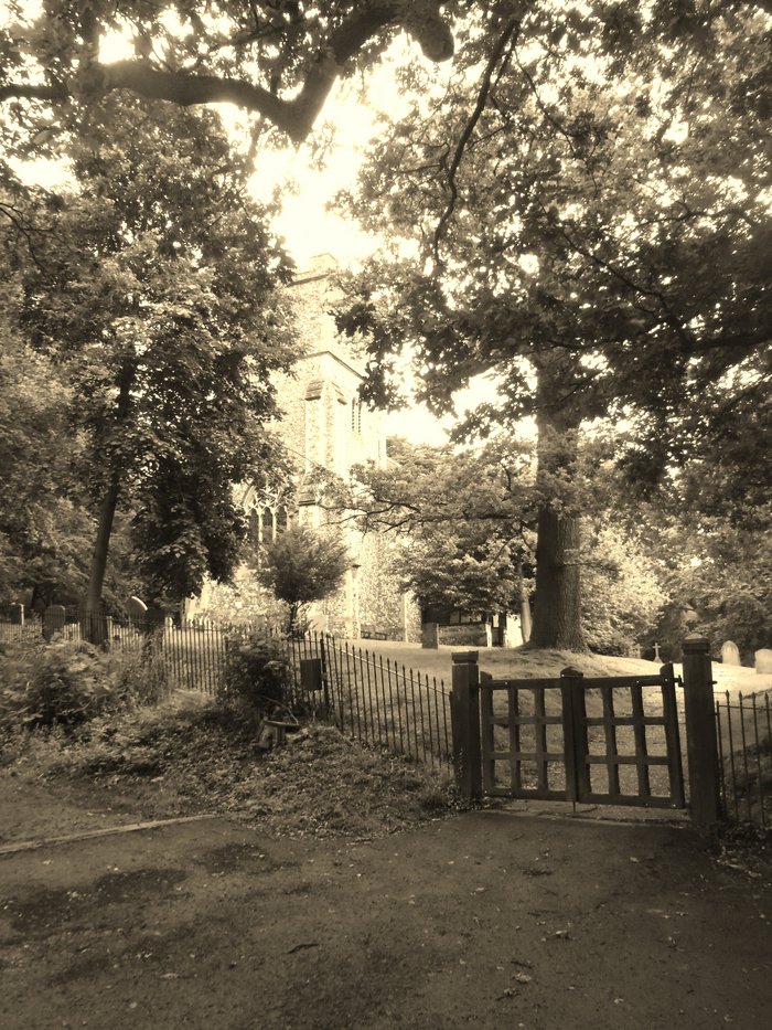
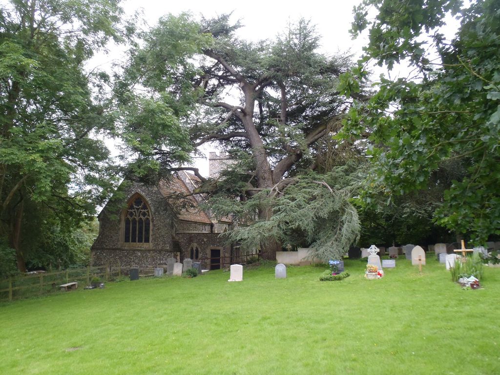
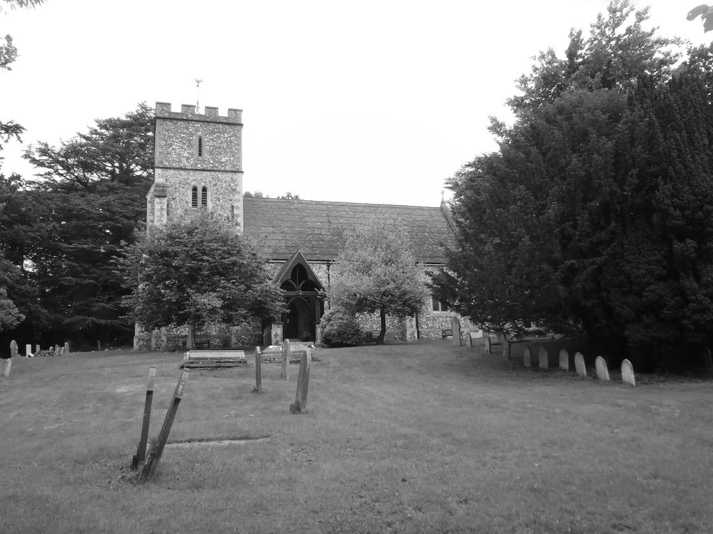
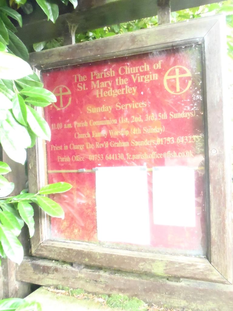
Where is St Marys Churchyard?
St Marys Churchyard is located at Village Lane Hedgerley, South Bucks District ,Buckinghamshire , SL2 3XBEngland.
-
St Marys Churchyard cemetery's updated grave count on graveviews.com?
0 memorials
-
Where are the coordinates of the St Marys Churchyard?
Latitude: 51.5765630
Longitude: -0.6006320
Nearby Cemetories:
1. Parkside Cemetery
Gerrards Cross, South Bucks District, England
Coordinate: 51.5669090, -0.5829160
2. GreenAcres Chiltern
Jordans, Chiltern District, England
Coordinate: 51.6014230, -0.6060130
3. St James Churchyard
Gerrards Cross, South Bucks District, England
Coordinate: 51.5812960, -0.5567610
4. St. Joseph's Churchyard
Gerrards Cross, South Bucks District, England
Coordinate: 51.5997700, -0.5629150
5. St Mary and All Saints Churchyard
Beaconsfield, South Bucks District, England
Coordinate: 51.6009660, -0.6370800
6. Jordans Friends Burial Ground
Jordans, Chiltern District, England
Coordinate: 51.6096640, -0.5938360
7. St Joseph Priory
Chalfont St Peter, Chiltern District, England
Coordinate: 51.5999100, -0.5622200
8. St Anne Churchyard
Dropmore, South Bucks District, England
Coordinate: 51.5693020, -0.6530820
9. Bethesda Chapel Burial Ground
Beaconsfield, South Bucks District, England
Coordinate: 51.6028180, -0.6375190
10. Shepherds Lane Cemetery
Beaconsfield, South Bucks District, England
Coordinate: 51.6044380, -0.6345890
11. Seer Green Cemetery
Seer Green, Chiltern District, England
Coordinate: 51.6152990, -0.6056860
12. Chalfont St. Peter Baptist Chapel Burial Ground
Chalfont St Peter, Chiltern District, England
Coordinate: 51.6074220, -0.5595870
13. St Peter Churchyard
Chalfont St Peter, Chiltern District, England
Coordinate: 51.6077930, -0.5566610
14. Holy Trinity Churchyard
Seer Green, Chiltern District, England
Coordinate: 51.6180960, -0.6059000
15. St. Giles Churchyard
Stoke Poges, South Bucks District, England
Coordinate: 51.5350100, -0.5948900
16. St. Mary Churchyard
Farnham Royal, South Bucks District, England
Coordinate: 51.5351250, -0.6149910
17. Stoke Poges Memorial Gardens
Stoke Poges, South Bucks District, England
Coordinate: 51.5339900, -0.5925200
18. Holtspur Cemetery
Beaconsfield, South Bucks District, England
Coordinate: 51.5964280, -0.6663890
19. Chalfont St. Peter Garden of Rest
Chalfont St Peter, Chiltern District, England
Coordinate: 51.6110110, -0.5427340
20. Bowstridge Lane Cemetery
Chalfont St Giles, Chiltern District, England
Coordinate: 51.6258711, -0.5687373
21. Nashdom Abbey Cemetery
Burnham, South Bucks District, England
Coordinate: 51.5490600, -0.6739000
22. Zion Chapel Burial Ground
Burnham, South Bucks District, England
Coordinate: 51.5358700, -0.6594930
23. St. Paul's Churchyard
Wooburn, Wycombe District, England
Coordinate: 51.5816640, -0.6886330
24. Slough Cemetery and Crematorium
Slough, Slough Borough, England
Coordinate: 51.5216350, -0.5917440