
| Memorials | : | 0 |
| Location | : | Edgewood, Kenton County, USA |
| Coordinate | : | 38.9905320, -84.5563500 |
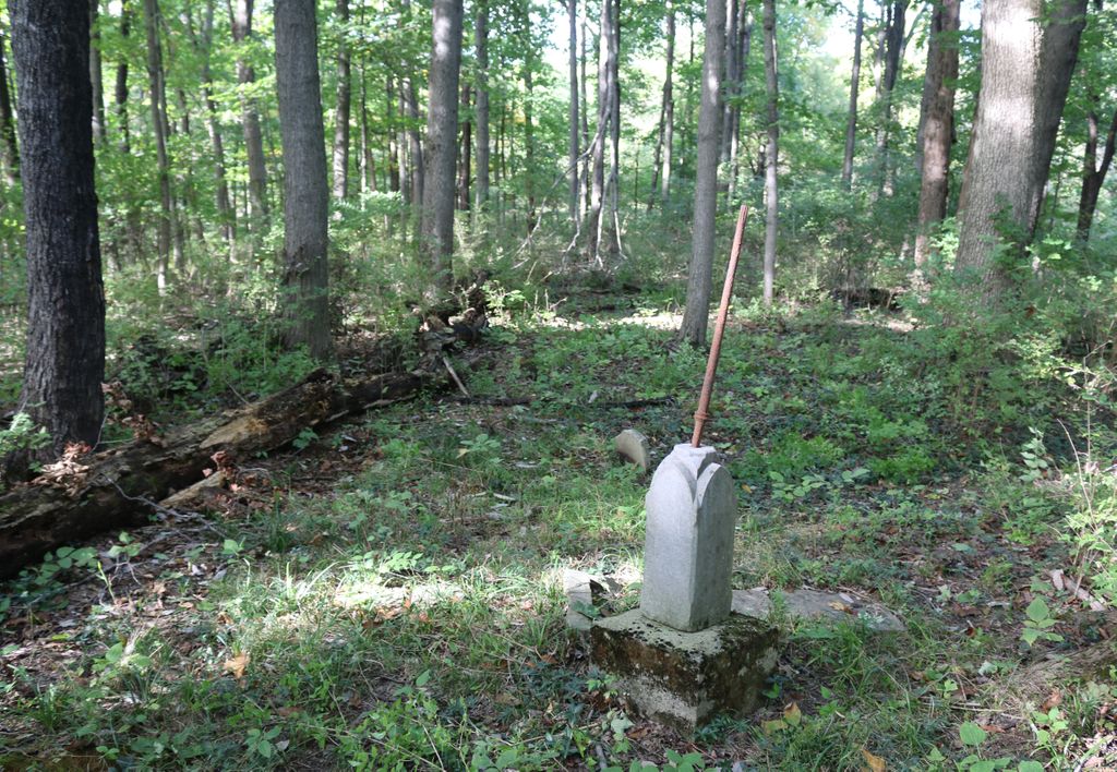
| Description | : | The cemetery is listed as Senour Cemetery on page 96 of Small Kenton County, Kentucky, Cemeteries, published by the Kenton County Historical Society, Cemetery Committee, and on page 96 of Kenton County Cemeteries, published by the Kenton County Historical Society, Covington, Kentucky, 1981. The cemetery inscriptions were recorded in October 1977, reporting 4 graves identifiable by inscription and 20 unidentifiable graves. The cemetery location is given as latitude 38° 59’ 28” and longitude 84° 33’ 21” in the Independence Quadrangle. The cemetery location is described as “Hemlock Dr. off Charter Oak Rd.”. |
frequently asked questions (FAQ):
-
Where is Senour Cemetery?
Senour Cemetery is located at Bullock Pen Road Edgewood, Kenton County ,Kentucky , 41017USA.
-
Senour Cemetery cemetery's updated grave count on graveviews.com?
0 memorials
-
Where are the coordinates of the Senour Cemetery?
Latitude: 38.9905320
Longitude: -84.5563500
Nearby Cemetories:
1. Cain Cemetery
Edgewood, Kenton County, USA
Coordinate: 38.9905560, -84.5611110
2. Blume Cemetery
Edgewood, Kenton County, USA
Coordinate: 38.9877780, -84.5527780
3. Holt Family Cemetery
Independence, Kenton County, USA
Coordinate: 38.9825630, -84.5571290
4. Aaron Wayman Cemetery
Independence, Kenton County, USA
Coordinate: 38.9819440, -84.5469440
5. Jarrell Cemetery
Erlanger, Kenton County, USA
Coordinate: 38.9901000, -84.5754870
6. Scott Cemetery
Edgewood, Kenton County, USA
Coordinate: 39.0013890, -84.5422220
7. Wayman Cemetery
Independence, Kenton County, USA
Coordinate: 38.9847220, -84.5347220
8. Ellis Cemetery
Covington, Kenton County, USA
Coordinate: 39.0069440, -84.5288890
9. Dedman Cemetery
Covington, Kenton County, USA
Coordinate: 39.0080560, -84.5294440
10. John Richardson Cemetery
Latonia Lakes, Kenton County, USA
Coordinate: 38.9855560, -84.5194440
11. Hoffman Cemetery
Independence, Kenton County, USA
Coordinate: 38.9616670, -84.5630560
12. Yager Cemetery
Erlanger, Kenton County, USA
Coordinate: 39.0027780, -84.5933330
13. Mary E. Smith Cemetery
Elsmere, Kenton County, USA
Coordinate: 39.0029060, -84.5938560
14. Dry Creek Baptist Church Cemetery
Edgewood, Kenton County, USA
Coordinate: 39.0183330, -84.5769440
15. Cox Cemetery
Taylor Mill, Kenton County, USA
Coordinate: 39.0005560, -84.5166670
16. Augustus Richardson Cemetery
Latonia Lakes, Kenton County, USA
Coordinate: 38.9811110, -84.5141670
17. French Cemetery
Elsmere, Kenton County, USA
Coordinate: 39.0077780, -84.5944500
18. Cox Cemetery
Covington, Kenton County, USA
Coordinate: 38.9716670, -84.5188890
19. Pelly Cemetery
Latonia Lakes, Kenton County, USA
Coordinate: 38.9611110, -84.5294440
20. William Richardson Cemetery
Taylor Mill, Kenton County, USA
Coordinate: 38.9905560, -84.5094440
21. B'Hymer Cemetery
Independence, Kenton County, USA
Coordinate: 38.9525000, -84.5575000
22. Bannister Cemetery
Taylor Mill, Kenton County, USA
Coordinate: 38.9758333, -84.5111110
23. Forest Lawn Memorial Park
Erlanger, Kenton County, USA
Coordinate: 39.0163994, -84.5932999
24. Woodsdale Cemetery
Taylor Mill, Kenton County, USA
Coordinate: 38.9898900, -84.5064530