
| Memorials | : | 0 |
| Location | : | Erlanger, Kenton County, USA |
| Coordinate | : | 38.9901000, -84.5754870 |
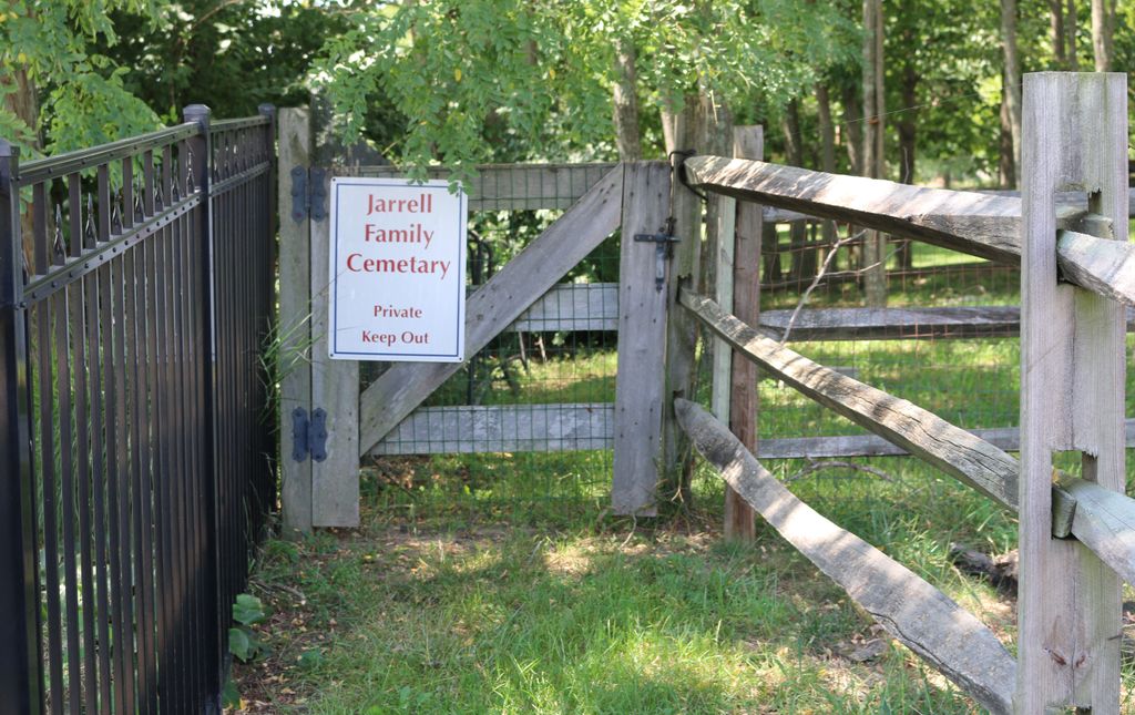
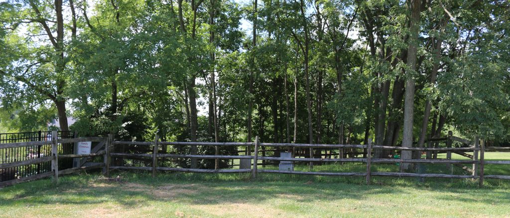
| Description | : | The cemetery is listed as Jarrell Cemetery on page 49 of Small Kenton County, Kentucky, Cemeteries, published by the Kenton County Historical Society, Cemetery Committee, and on page 49 of Kenton County Cemeteries, published by the Kenton County Historical Society, Covington, Kentucky, 1981. The cemetery inscriptions were recorded in 1975, reporting 2 graves identifiable by inscription and no unidentifiable graves. The cemetery was listed as being on the Staat farm on Narrows Road. Since that time, the farm has been converted into a residential development. The cemetery is now located on the west side of Shade Lane about... Read More |
frequently asked questions (FAQ):
-
Where is Jarrell Cemetery?
Jarrell Cemetery is located at 3854 Shade Lane Erlanger, Kenton County ,Kentucky , 41018USA.
-
Jarrell Cemetery cemetery's updated grave count on graveviews.com?
0 memorials
-
Where are the coordinates of the Jarrell Cemetery?
Latitude: 38.9901000
Longitude: -84.5754870
Nearby Cemetories:
1. Cain Cemetery
Edgewood, Kenton County, USA
Coordinate: 38.9905560, -84.5611110
2. Senour Cemetery
Edgewood, Kenton County, USA
Coordinate: 38.9905320, -84.5563500
3. Holt Family Cemetery
Independence, Kenton County, USA
Coordinate: 38.9825630, -84.5571290
4. Blume Cemetery
Edgewood, Kenton County, USA
Coordinate: 38.9877780, -84.5527780
5. Yager Cemetery
Erlanger, Kenton County, USA
Coordinate: 39.0027780, -84.5933330
6. Mary E. Smith Cemetery
Elsmere, Kenton County, USA
Coordinate: 39.0029060, -84.5938560
7. French Cemetery
Elsmere, Kenton County, USA
Coordinate: 39.0077780, -84.5944500
8. Aaron Wayman Cemetery
Independence, Kenton County, USA
Coordinate: 38.9819440, -84.5469440
9. Scott Cemetery
Edgewood, Kenton County, USA
Coordinate: 39.0013890, -84.5422220
10. Dry Creek Baptist Church Cemetery
Edgewood, Kenton County, USA
Coordinate: 39.0183330, -84.5769440
11. Forest Lawn Memorial Park
Erlanger, Kenton County, USA
Coordinate: 39.0163994, -84.5932999
12. Hoffman Cemetery
Independence, Kenton County, USA
Coordinate: 38.9616670, -84.5630560
13. Stevenson Cemetery (Defunct)
Edgewood, Kenton County, USA
Coordinate: 39.0163320, -84.5980660
14. Wayman Cemetery
Independence, Kenton County, USA
Coordinate: 38.9847220, -84.5347220
15. Wilhoit Cemetery
Florence, Boone County, USA
Coordinate: 38.9974070, -84.6187990
16. John Stephens Cemetery
Florence, Boone County, USA
Coordinate: 38.9779730, -84.6171670
17. Stephens Family Cemetery
Erlanger, Kenton County, USA
Coordinate: 38.9684470, -84.6119950
18. Casey Cemetery
Edgewood, Kenton County, USA
Coordinate: 39.0254170, -84.5865000
19. Dixon Cemetery
Florence, Boone County, USA
Coordinate: 38.9702780, -84.6152780
20. Ellis Cemetery
Covington, Kenton County, USA
Coordinate: 39.0069440, -84.5288890
21. Dedman Cemetery
Covington, Kenton County, USA
Coordinate: 39.0080560, -84.5294440
22. B'Hymer Cemetery
Independence, Kenton County, USA
Coordinate: 38.9525000, -84.5575000
23. Beechwood Farm Cemetery
Crestview Hills, Kenton County, USA
Coordinate: 39.0304020, -84.5756360
24. Hoffman-Grubbs Cemetery
Florence, Boone County, USA
Coordinate: 38.9841670, -84.6283330