
| Memorials | : | 0 |
| Location | : | Elsmere, Kenton County, USA |
| Coordinate | : | 39.0077780, -84.5944500 |
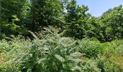
| Description | : | The cemetery is listed as French Cemetery on page 132 of Small Kenton County, Kentucky, Cemeteries, published by the Kenton County Historical Society, Cemetery Committee, and on page 132 of Kenton County Cemeteries, published by the Kenton County Historical Society, Covington, Kentucky, 1981. No cemetery inscriptions were recorded. The cemetery location is given as latitude 39° 28’ 0” and longitude 84° 35’ 240” in the Covington Quadrangle. The cemetery location is described as “Stevenson Rd., Erlanger near Arnett School”. |
frequently asked questions (FAQ):
-
Where is French Cemetery?
French Cemetery is located at Shaw Avenue Elsmere, Kenton County ,Kentucky , 41018USA.
-
French Cemetery cemetery's updated grave count on graveviews.com?
0 memorials
-
Where are the coordinates of the French Cemetery?
Latitude: 39.0077780
Longitude: -84.5944500
Nearby Cemetories:
1. Mary E. Smith Cemetery
Elsmere, Kenton County, USA
Coordinate: 39.0029060, -84.5938560
2. Yager Cemetery
Erlanger, Kenton County, USA
Coordinate: 39.0027780, -84.5933330
3. Forest Lawn Memorial Park
Erlanger, Kenton County, USA
Coordinate: 39.0163994, -84.5932999
4. Stevenson Cemetery (Defunct)
Edgewood, Kenton County, USA
Coordinate: 39.0163320, -84.5980660
5. Dry Creek Baptist Church Cemetery
Edgewood, Kenton County, USA
Coordinate: 39.0183330, -84.5769440
6. Casey Cemetery
Edgewood, Kenton County, USA
Coordinate: 39.0254170, -84.5865000
7. Wilhoit Cemetery
Florence, Boone County, USA
Coordinate: 38.9974070, -84.6187990
8. Jarrell Cemetery
Erlanger, Kenton County, USA
Coordinate: 38.9901000, -84.5754870
9. Beechwood Farm Cemetery
Crestview Hills, Kenton County, USA
Coordinate: 39.0304020, -84.5756360
10. Clutterbuck Cemetery
Florence, Boone County, USA
Coordinate: 39.0041670, -84.6297230
11. Ashbrook-Cheek Cemetery (Defunct)
Florence, Boone County, USA
Coordinate: 39.0116670, -84.6308350
12. Florence Cemetery
Florence, Boone County, USA
Coordinate: 39.0001000, -84.6309800
13. Perry Family Burying Ground
Lakeside Park, Kenton County, USA
Coordinate: 39.0333600, -84.5724130
14. Cain Cemetery
Edgewood, Kenton County, USA
Coordinate: 38.9905560, -84.5611110
15. Carpenter Family Cemetery
Florence, Boone County, USA
Coordinate: 38.9914700, -84.6298610
16. Saint Pius X Seminary Cemetery
Florence, Boone County, USA
Coordinate: 39.0289460, -84.6280990
17. Senour Cemetery
Edgewood, Kenton County, USA
Coordinate: 38.9905320, -84.5563500
18. John Stephens Cemetery
Florence, Boone County, USA
Coordinate: 38.9779730, -84.6171670
19. Hoffman-Grubbs Cemetery
Florence, Boone County, USA
Coordinate: 38.9841670, -84.6283330
20. Ephriam Tanner Cemetery
Florence, Boone County, USA
Coordinate: 38.9880810, -84.6350260
21. Blume Cemetery
Edgewood, Kenton County, USA
Coordinate: 38.9877780, -84.5527780
22. Holt Family Cemetery
Independence, Kenton County, USA
Coordinate: 38.9825630, -84.5571290
23. Passionist Monastery Cemetery
Erlanger, Kenton County, USA
Coordinate: 39.0350600, -84.6305300
24. Joshua Zimmerman Cemetery
Florence, Boone County, USA
Coordinate: 39.0074220, -84.6462590