
| Memorials | : | 136 |
| Location | : | West Liberty, Ohio County, USA |
| Coordinate | : | 40.1568985, -80.6389008 |
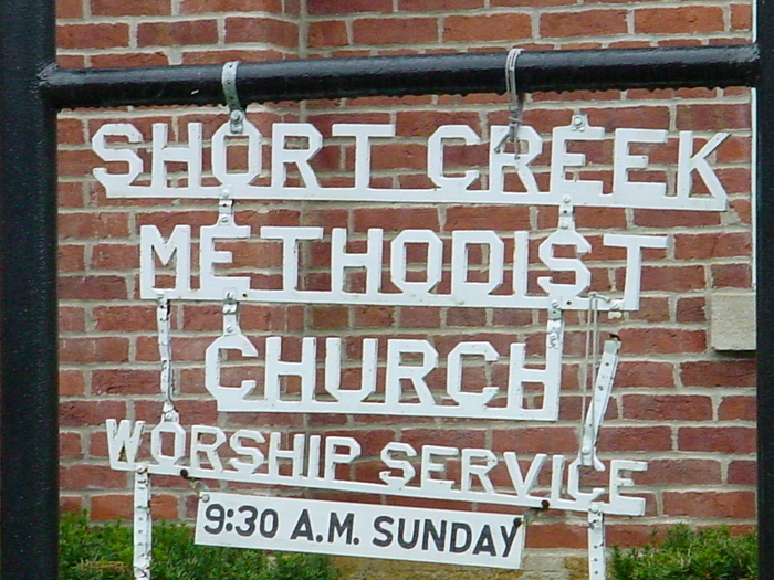
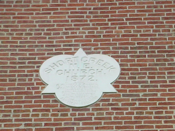
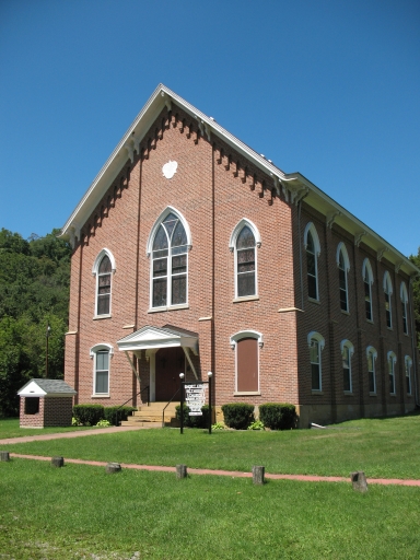
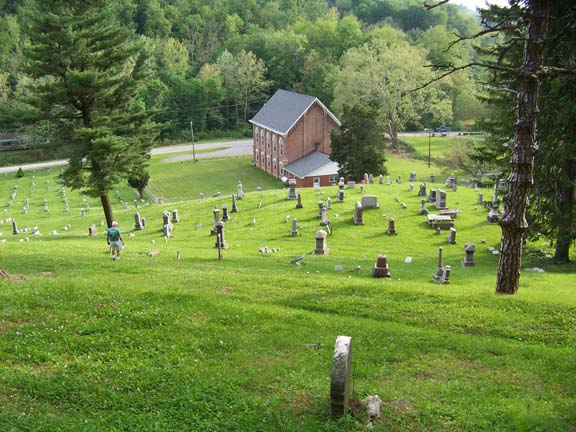
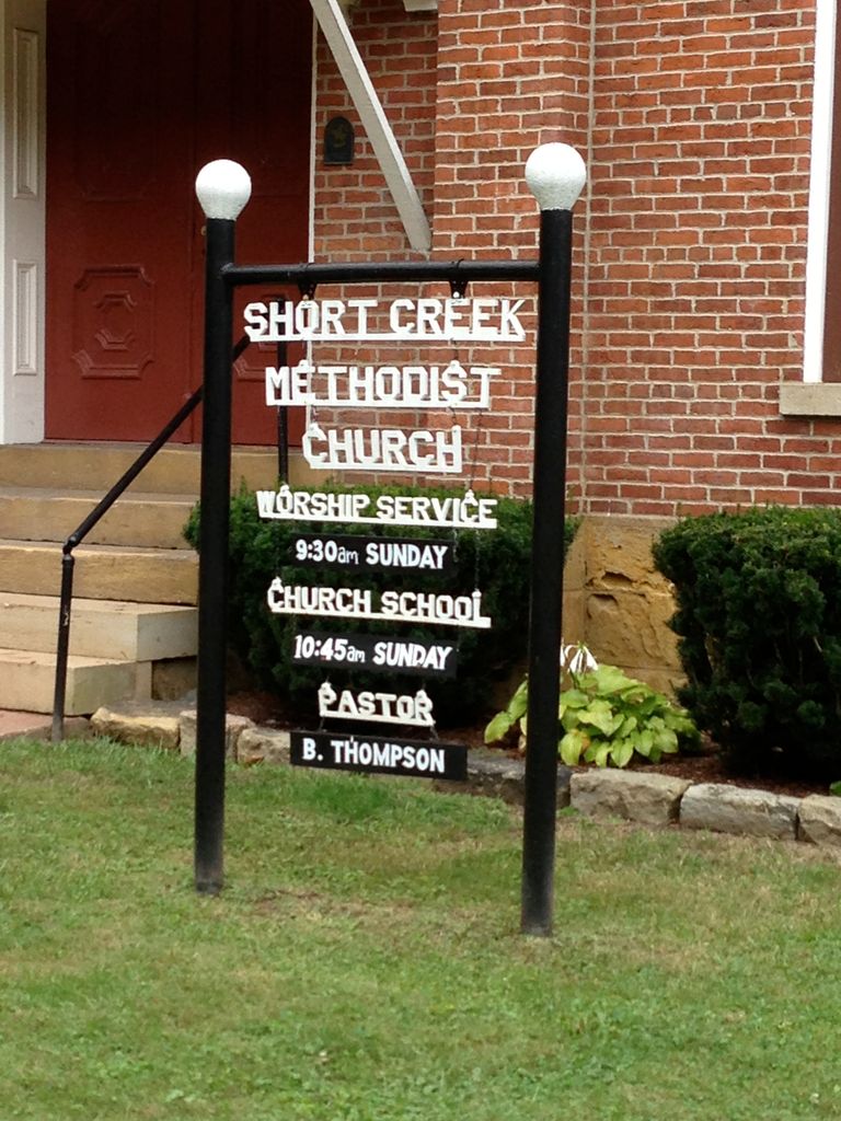
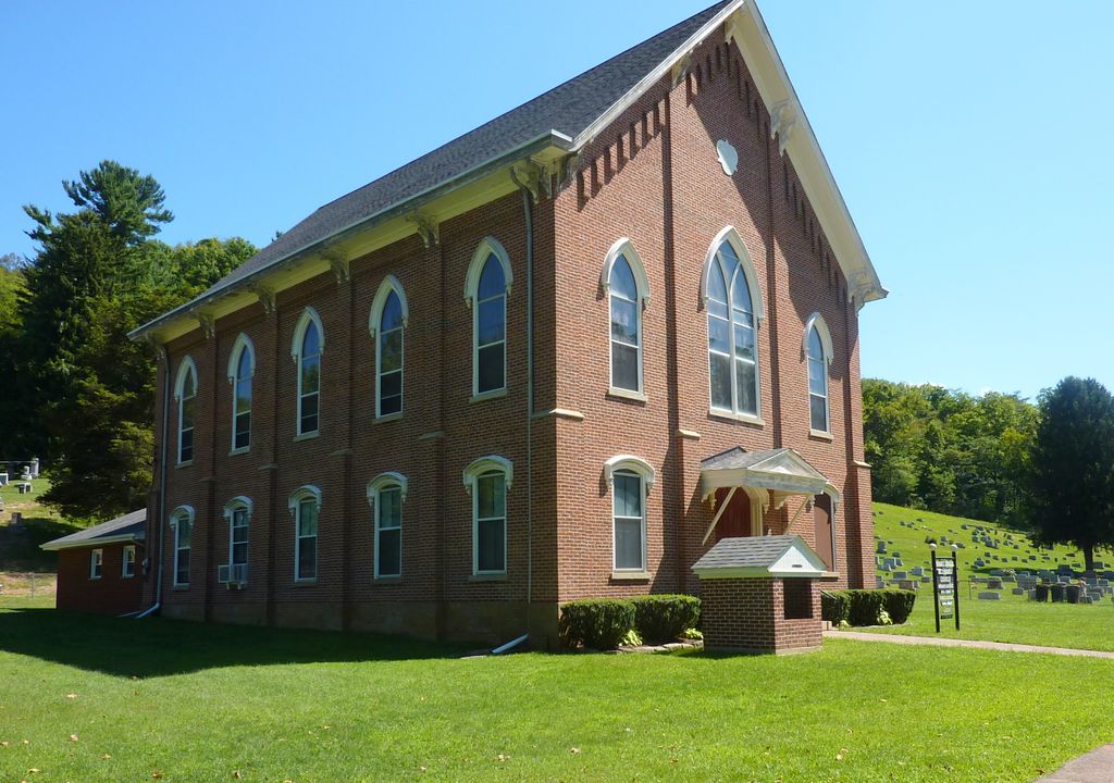
| Description | : | The Short Creek Cemetery dates from 1785 (a year after the formal introduction of Methodism to America) when it, and the adjacent Short Creek Methodist Church, were on the Redstone Methodist Church Circuit (Southwestern Pennsylvania and Northern West Virginia). The Cemetery holds the familial remains of historically prominent area citizens including: Hedges, Morgans, McCollochs, and Spahrs --- all early residents of Ohio County (West Virginia). The original church was organized by Reverend Wilson Lee (while traveling in the Circuit) and deeded in 1805. The current structure was completed in 1872 and is the oldest Methodist Church... Read More |
frequently asked questions (FAQ):
-
Where is Short Creek Methodist Church Cemetery?
Short Creek Methodist Church Cemetery is located at N Fork Rd West Liberty, Ohio County ,West Virginia ,USA.
-
Short Creek Methodist Church Cemetery cemetery's updated grave count on graveviews.com?
135 memorials
-
Where are the coordinates of the Short Creek Methodist Church Cemetery?
Latitude: 40.1568985
Longitude: -80.6389008


Nearby Cemetories:
1. Morgan Cemetery
West Liberty, Ohio County, USA
Coordinate: 40.1469002, -80.6042023
2. Prall Cemetery
West Liberty, Ohio County, USA
Coordinate: 40.1675040, -80.5992960
3. Wilson Cemetery
Clearview, Ohio County, USA
Coordinate: 40.1608009, -80.6813965
4. Lawrencefield Parish Church Cemetery
Ohio County, USA
Coordinate: 40.1281310, -80.6615600
5. West Liberty Cemetery
West Liberty, Ohio County, USA
Coordinate: 40.1674995, -80.5939026
6. Oaklawn Memorial Park
Clearview, Ohio County, USA
Coordinate: 40.1469002, -80.6931000
7. Riley Hill Road Cemetery
Clearview, Ohio County, USA
Coordinate: 40.1456299, -80.6941910
8. Mound Cemetery
Tiltonsville, Jefferson County, USA
Coordinate: 40.1744003, -80.6949997
9. Cox Cemetery
West Liberty, Ohio County, USA
Coordinate: 40.1707993, -80.5802994
10. Old Tent Cemetery
Wheeling, Ohio County, USA
Coordinate: 40.1090164, -80.6372910
11. Dement Cemetery
West Liberty, Ohio County, USA
Coordinate: 40.1244380, -80.5911110
12. Kadesh Chapel Cemetery
Beech Bottom, Brooke County, USA
Coordinate: 40.2053000, -80.6293700
13. Warrenton Cemetery
Rayland, Jefferson County, USA
Coordinate: 40.1937700, -80.6838900
14. Clendenen Cemetery
Beech Bottom, Brooke County, USA
Coordinate: 40.2100870, -80.6591180
15. King Family Cemetery
Rayland, Jefferson County, USA
Coordinate: 40.1689423, -80.7109297
16. Faris Family Cemetery
Ohio County, USA
Coordinate: 40.1201000, -80.5727800
17. Wells Cemetery
Beech Bottom, Brooke County, USA
Coordinate: 40.2221985, -80.6322021
18. Parkview Memorial Gardens
Wheeling, Ohio County, USA
Coordinate: 40.0917015, -80.6560974
19. Roneys Point Cemetery
Wheeling, Ohio County, USA
Coordinate: 40.0932530, -80.6105200
20. Cochran Family Cemetery
Martins Ferry, Belmont County, USA
Coordinate: 40.1361110, -80.7230570
21. Upland Heights Cemetery
Warren Township, Jefferson County, USA
Coordinate: 40.1608009, -80.7285995
22. Henschel Cemetery
Pease Township, Belmont County, USA
Coordinate: 40.1197200, -80.7177840
23. Nixon Farm Cemetery
Martins Ferry, Belmont County, USA
Coordinate: 40.1325000, -80.7277780
24. West Cemetery
Upland Heights, Jefferson County, USA
Coordinate: 40.1606241, -80.7343555