
| Memorials | : | 17 |
| Location | : | Tiltonsville, Jefferson County, USA |
| Coordinate | : | 40.1744003, -80.6949997 |
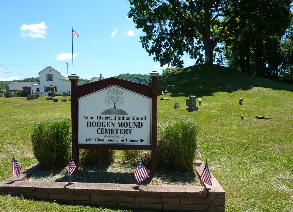
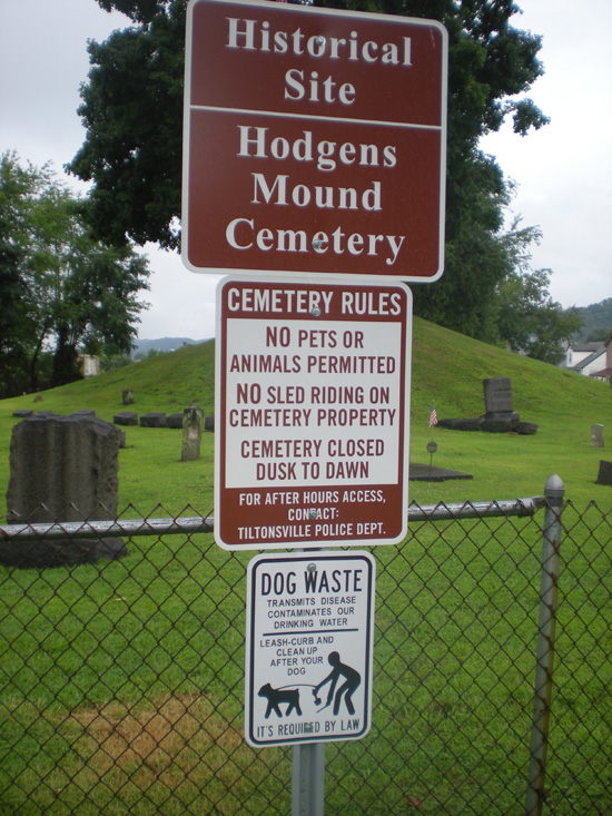
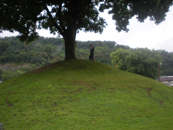
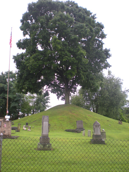
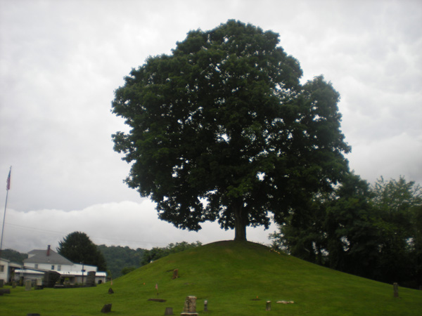
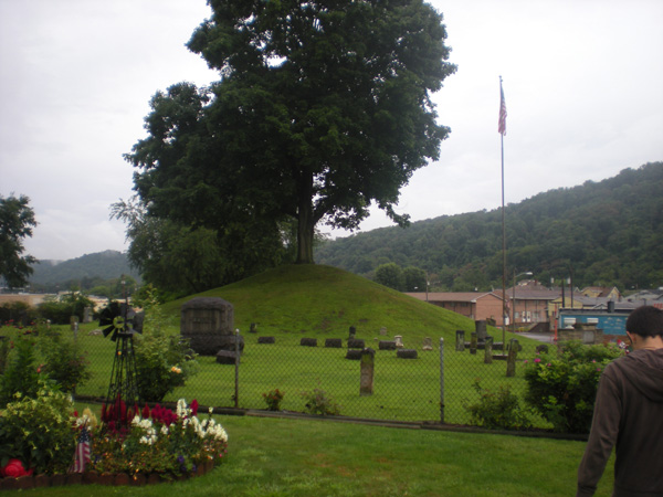
| Description | : | Hodgens was the name they used for Mound Cemetery in the 1800's. During the nineteenth century, residents of the village of Tiltonsville founded a cemetery around a small hill on the northern side of their village. A round, cone-shaped knoll with a tree growing from its top. At some point since that time, erosion of the hillside revealed human bones, including a skull with evidence of artificial cranial deformation. This practice was common among the prehistoric Adena culture; consequently, the bones allowed archaeologists to determine that the hill was a burial mound built by the Adena who... Read More |
frequently asked questions (FAQ):
-
Where is Mound Cemetery?
Mound Cemetery is located at Tiltonsville, Jefferson County ,Ohio ,USA.
-
Mound Cemetery cemetery's updated grave count on graveviews.com?
17 memorials
-
Where are the coordinates of the Mound Cemetery?
Latitude: 40.1744003
Longitude: -80.6949997
Nearby Cemetories:
1. King Family Cemetery
Rayland, Jefferson County, USA
Coordinate: 40.1689423, -80.7109297
2. Wilson Cemetery
Clearview, Ohio County, USA
Coordinate: 40.1608009, -80.6813965
3. Warrenton Cemetery
Rayland, Jefferson County, USA
Coordinate: 40.1937700, -80.6838900
4. Oaklawn Memorial Park
Clearview, Ohio County, USA
Coordinate: 40.1469002, -80.6931000
5. Riley Hill Road Cemetery
Clearview, Ohio County, USA
Coordinate: 40.1456299, -80.6941910
6. Upland Heights Cemetery
Warren Township, Jefferson County, USA
Coordinate: 40.1608009, -80.7285995
7. West Cemetery
Upland Heights, Jefferson County, USA
Coordinate: 40.1606241, -80.7343555
8. Bayless Cemetery
Rayland, Jefferson County, USA
Coordinate: 40.2122930, -80.7123024
9. Cochran Family Cemetery
Martins Ferry, Belmont County, USA
Coordinate: 40.1361110, -80.7230570
10. Clendenen Cemetery
Beech Bottom, Brooke County, USA
Coordinate: 40.2100870, -80.6591180
11. Short Creek Methodist Church Cemetery
West Liberty, Ohio County, USA
Coordinate: 40.1568985, -80.6389008
12. Nixon Farm Cemetery
Martins Ferry, Belmont County, USA
Coordinate: 40.1325000, -80.7277780
13. Hopewell Methodist Cemetery
Warren Township, Jefferson County, USA
Coordinate: 40.2236824, -80.7117462
14. Saint Adalbert Cemetery
Warren Township, Jefferson County, USA
Coordinate: 40.2033005, -80.7518997
15. Lawrencefield Parish Church Cemetery
Ohio County, USA
Coordinate: 40.1281310, -80.6615600
16. Oak Grove Cemetery
Mount Pleasant, Jefferson County, USA
Coordinate: 40.1769060, -80.7655010
17. Henschel Cemetery
Pease Township, Belmont County, USA
Coordinate: 40.1197200, -80.7177840
18. Kadesh Chapel Cemetery
Beech Bottom, Brooke County, USA
Coordinate: 40.2053000, -80.6293700
19. Scotch Ridge Cemetery
Martins Ferry, Belmont County, USA
Coordinate: 40.1303490, -80.7606390
20. Wells Cemetery
Beech Bottom, Brooke County, USA
Coordinate: 40.2221985, -80.6322021
21. Prall Cemetery
West Liberty, Ohio County, USA
Coordinate: 40.1675040, -80.5992960
22. Riverview Cemetery
Martins Ferry, Belmont County, USA
Coordinate: 40.1032000, -80.7207600
23. McGee-Stringers Cemetery
Wells Township, Jefferson County, USA
Coordinate: 40.2431440, -80.6590810
24. Morgan Cemetery
West Liberty, Ohio County, USA
Coordinate: 40.1469002, -80.6042023