
| Memorials | : | 0 |
| Location | : | Sindorf, Rhein-Erft-Kreis, Germany |
| Coordinate | : | 50.9145778, 6.6794133 |
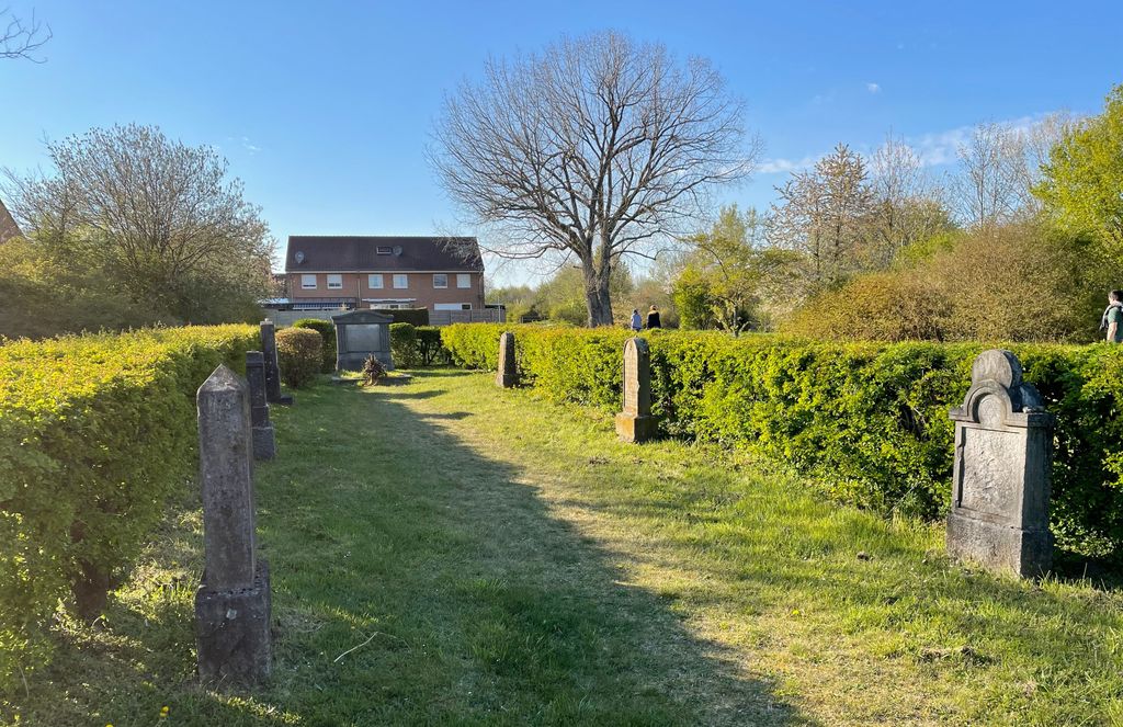
| Description | : | The Jewish Cemetery was founded before the year 1830 and was in use until 1938 when it was partly destroyed by the Nazis. It later came into private ownership but was returned to the community in 1947 and reconstructed. Today the cemetery is no longer in use, however it reminds us of the rich Jewish history of the past. |
frequently asked questions (FAQ):
-
Where is Sindorf Jewish Cemetery?
Sindorf Jewish Cemetery is located at Anna-Seghers-Weg Sindorf, Rhein-Erft-Kreis ,Nordrhein-Westfalen , 50170Germany.
-
Sindorf Jewish Cemetery cemetery's updated grave count on graveviews.com?
0 memorials
-
Where are the coordinates of the Sindorf Jewish Cemetery?
Latitude: 50.9145778
Longitude: 6.6794133
Nearby Cemetories:
1. Friedhof Horrem
Horrem, Rhein-Erft-Kreis, Germany
Coordinate: 50.9091424, 6.7189828
2. Jewish Cemetery
Kerpen, Rhein-Erft-Kreis, Germany
Coordinate: 50.8820475, 6.6902439
3. Frechen-Grefrath Cemetery
Frechen, Rhein-Erft-Kreis, Germany
Coordinate: 50.9022543, 6.7521958
4. Waldfriedhof
Oberaussem, Rhein-Erft-Kreis, Germany
Coordinate: 50.9700860, 6.6877530
5. Friedhof Bergheim
Bergheim, Rhein-Sieg-Kreis, Germany
Coordinate: 50.9723430, 6.6827380
6. Kleinkönigsdorfer Friedhof
Königsdorf, Rhein-Erft-Kreis, Germany
Coordinate: 50.9430976, 6.7651562
7. Friedhof Königsdorf-Süd
Frechen, Rhein-Erft-Kreis, Germany
Coordinate: 50.9328850, 6.7749860
8. Bergheim-Paffendorf
Paffendorf, Rhein-Erft-Kreis, Germany
Coordinate: 50.9635988, 6.6088651
9. Brauweiler Cemetery
Pulheim, Rhein-Erft-Kreis, Germany
Coordinate: 50.9581130, 6.7753765
10. Brauweiler Abbey
Pulheim, Rhein-Erft-Kreis, Germany
Coordinate: 50.9611400, 6.7828300
11. Jüdischer Friedhof
Frechen, Rhein-Erft-Kreis, Germany
Coordinate: 50.9015312, 6.8057133
12. Jüdischer Friedhof Gymnich
Gymnich, Rhein-Erft-Kreis, Germany
Coordinate: 50.8407093, 6.7331470
13. Jewish Cemetery
Brüggen, Rhein-Erft-Kreis, Germany
Coordinate: 50.8494922, 6.7678541
14. Kirchhof Sankt Audomar
Frechen, Rhein-Erft-Kreis, Germany
Coordinate: 50.9090500, 6.8152100
15. Friedhof Sankt Audomar
Frechen, Rhein-Erft-Kreis, Germany
Coordinate: 50.9066800, 6.8167500
16. Friedhof Bachem
Frechen, Rhein-Erft-Kreis, Germany
Coordinate: 50.9017300, 6.8167700
17. Friedhof Elsdorf-Esch
Elsdorf, Rhein-Erft-Kreis, Germany
Coordinate: 50.9451339, 6.5422841
18. Friedhof Lövenich
Cologne, Stadtkreis Köln, Germany
Coordinate: 50.9432800, 6.8183800
19. Friedhof Albert-Kindle-Straße Weiden neu
Cologne, Stadtkreis Köln, Germany
Coordinate: 50.9404000, 6.8209600
20. Friedhof Gartenweg Weiden alt
Cologne, Stadtkreis Köln, Germany
Coordinate: 50.9402200, 6.8287500
21. Friedhof Erftstadt-Dirmerzheim
Dirmerzheim, Rhein-Erft-Kreis, Germany
Coordinate: 50.8278705, 6.7632957
22. Jewish Cemetery
Bedburg, Rhein-Erft-Kreis, Germany
Coordinate: 50.9982359, 6.5837033
23. Friedhof Turmgasse Widdersdorf alt
Cologne, Stadtkreis Köln, Germany
Coordinate: 50.9635800, 6.8274900
24. Friedhof Hauptstraße Widdersdorf neu
Cologne, Stadtkreis Köln, Germany
Coordinate: 50.9653200, 6.8291100