
| Memorials | : | 0 |
| Location | : | Brüggen, Rhein-Erft-Kreis, Germany |
| Coordinate | : | 50.8494922, 6.7678541 |
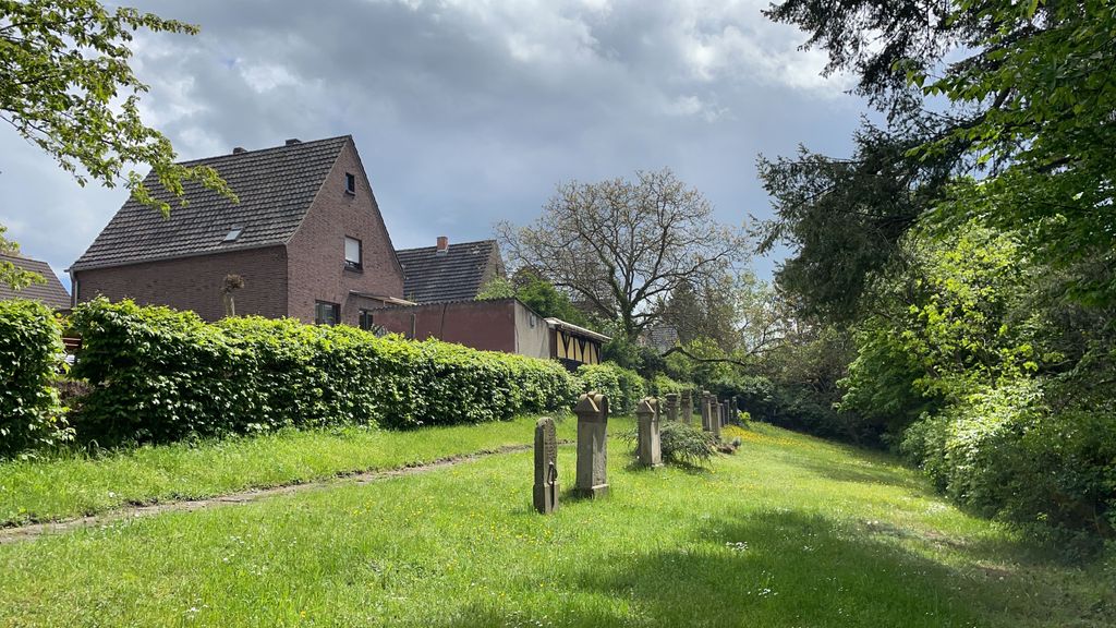
| Description | : | The former Jewish Cemetery in Kerpen-Brüggen was used by the small Jewish Community between the middle of the 19th. century and the year 1938. It is accessible from the entrance on Waldstrasse or from Brüggen's community cemetery (entrance on Friedhofweg). |
frequently asked questions (FAQ):
-
Where is Jewish Cemetery?
Jewish Cemetery is located at Waldstrasse Brüggen, Rhein-Erft-Kreis ,Nordrhein-Westfalen , 50169Germany.
-
Jewish Cemetery cemetery's updated grave count on graveviews.com?
0 memorials
-
Where are the coordinates of the Jewish Cemetery?
Latitude: 50.8494922
Longitude: 6.7678541
Nearby Cemetories:
1. Friedhof Erftstadt-Dirmerzheim
Dirmerzheim, Rhein-Erft-Kreis, Germany
Coordinate: 50.8278705, 6.7632957
2. Jüdischer Friedhof Gymnich
Gymnich, Rhein-Erft-Kreis, Germany
Coordinate: 50.8407093, 6.7331470
3. Friedhof Lechenich-Heddinghoven
Erftstadt, Rhein-Erft-Kreis, Germany
Coordinate: 50.8066700, 6.7621600
4. Old Jewish Cemetery / Alter Jüdischer Friedhof
Lechenich, Rhein-Erft-Kreis, Germany
Coordinate: 50.8022565, 6.7623217
5. New Jewish Cemetery / Neuer Jüdischer Friedhof
Lechenich, Rhein-Erft-Kreis, Germany
Coordinate: 50.7991693, 6.7760406
6. Frechen-Grefrath Cemetery
Frechen, Rhein-Erft-Kreis, Germany
Coordinate: 50.9022543, 6.7521958
7. Jüdischer Friedhof
Frechen, Rhein-Erft-Kreis, Germany
Coordinate: 50.9015312, 6.8057133
8. Jewish Cemetery
Kerpen, Rhein-Erft-Kreis, Germany
Coordinate: 50.8820475, 6.6902439
9. Friedhof Bachem
Frechen, Rhein-Erft-Kreis, Germany
Coordinate: 50.9017300, 6.8167700
10. Liblar Jewish Cemetery / Jüdischer Friedhof
Liblar, Rhein-Erft-Kreis, Germany
Coordinate: 50.8042225, 6.8330518
11. Friedhof Sankt Audomar
Frechen, Rhein-Erft-Kreis, Germany
Coordinate: 50.9066800, 6.8167500
12. Kirchhof Sankt Audomar
Frechen, Rhein-Erft-Kreis, Germany
Coordinate: 50.9090500, 6.8152100
13. Friedhof Horrem
Horrem, Rhein-Erft-Kreis, Germany
Coordinate: 50.9091424, 6.7189828
14. Friedhof Alt-Hürth
Hürth, Rhein-Erft-Kreis, Germany
Coordinate: 50.8763334, 6.8683863
15. Nordfriedhof Brühl
Brühl, Rhein-Erft-Kreis, Germany
Coordinate: 50.8431814, 6.8823332
16. Hürth-Kendenich Friedhof
Kendenich, Rhein-Erft-Kreis, Germany
Coordinate: 50.8656599, 6.8824201
17. Friedhof Königsdorf-Süd
Frechen, Rhein-Erft-Kreis, Germany
Coordinate: 50.9328850, 6.7749860
18. Friedhof Brühl Pingsdorf
Brühl, Rhein-Erft-Kreis, Germany
Coordinate: 50.8157610, 6.8911180
19. Sindorf Jewish Cemetery
Sindorf, Rhein-Erft-Kreis, Germany
Coordinate: 50.9145778, 6.6794133
20. Alter Friedhof
Brühl, Rhein-Erft-Kreis, Germany
Coordinate: 50.8294690, 6.9020310
21. Jüdischer Friedhof
Brühl, Rhein-Erft-Kreis, Germany
Coordinate: 50.8335030, 6.9071760
22. Südfriedhof
Brühl, Rhein-Erft-Kreis, Germany
Coordinate: 50.8204360, 6.9026590
23. Hürth-Efferen Friedhof
Efferen, Rhein-Erft-Kreis, Germany
Coordinate: 50.9029100, 6.8885100
24. Kleinkönigsdorfer Friedhof
Königsdorf, Rhein-Erft-Kreis, Germany
Coordinate: 50.9430976, 6.7651562