
| Memorials | : | 0 |
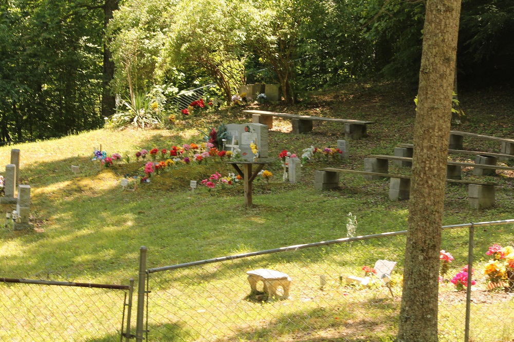
| Location | : | Brightshade, Clay County, USA |
| Coordinate | : | 36.9966200, -83.6330400 |
| Description | : | Take Hwy 1524 past Goose Rock Elementary for about 9 miles to the junction of Hwy 2467. Go straight ahead on Hwy 2467 about 1.2 miles to Hurricane Branch. Take the gravel road across the road from Hurricane Branch. Cross the creek, and go up the hill to the cemetery. |
frequently asked questions (FAQ):
-
Where is Smith Cemetery?
Smith Cemetery is located at Hwy 2467 Brightshade, Clay County ,Kentucky ,USA.
-
Smith Cemetery cemetery's updated grave count on graveviews.com?
0 memorials
-
Where are the coordinates of the Smith Cemetery?
Latitude: 36.9966200
Longitude: -83.6330400
Nearby Cemetories:
1. T J Jackson Cemetery
Brightshade, Clay County, USA
Coordinate: 36.9918300, -83.6309000
2. Stewart Cemetery
Brightshade, Clay County, USA
Coordinate: 36.9899340, -83.6327190
3. Abe Jackson Cemetery
Brightshade, Clay County, USA
Coordinate: 36.9867040, -83.6248960
4. Mills Cemetery
Ashers Fork, Clay County, USA
Coordinate: 37.0095600, -83.6357800
5. Lewis Family Cemetery
Ashers Fork, Clay County, USA
Coordinate: 37.0114160, -83.6161130
6. Ora Jackson Cemetery
Brightshade, Clay County, USA
Coordinate: 36.9763990, -83.6216880
7. Indian Grave Branch Cemetery
Brightshade, Clay County, USA
Coordinate: 36.9869200, -83.6068200
8. Hubbard Cemetery
Brightshade, Clay County, USA
Coordinate: 36.9802200, -83.6545700
9. Grubb Cemetery
Brightshade, Clay County, USA
Coordinate: 36.9749200, -83.6205900
10. Jackson Cemetery #3
Brightshade, Clay County, USA
Coordinate: 36.9721800, -83.6266400
11. Stewart Cemetery - Old Field Branch
Brightshade, Clay County, USA
Coordinate: 36.9708100, -83.6316600
12. Eversole Cemetery
Brightshade, Clay County, USA
Coordinate: 37.0218620, -83.6504270
13. Wagers Cemetery
Brightshade, Clay County, USA
Coordinate: 37.0220060, -83.6523220
14. Smith Family Cemetery
Ashers Fork, Clay County, USA
Coordinate: 37.0067500, -83.5902220
15. Andy Hubbard Cemetery
Brightshade, Clay County, USA
Coordinate: 37.0275400, -83.6584200
16. Darbys Branch Cemetery #1
Brightshade, Clay County, USA
Coordinate: 36.9627600, -83.6077900
17. Delph Cemetery
Spring Creek, Clay County, USA
Coordinate: 37.0299500, -83.6018600
18. Smith-Couch Cemetery
Plank, Clay County, USA
Coordinate: 37.0397230, -83.6299430
19. Asher Cemetery
Brightshade, Clay County, USA
Coordinate: 36.9651700, -83.5938100
20. Smallwood Cemetery
Brightshade, Clay County, USA
Coordinate: 37.0363130, -83.6608080
21. Mills Cemetery
Brightshade, Clay County, USA
Coordinate: 36.9909940, -83.6926450
22. Darbys Branch Cemetery #2
Brightshade, Clay County, USA
Coordinate: 36.9655200, -83.5873000
23. Mudlick Cemetery
Plank, Clay County, USA
Coordinate: 37.0486120, -83.6191600
24. Mayfork Community Cemetery
Otter Creek, Clay County, USA
Coordinate: 37.0295986, -83.6934598