
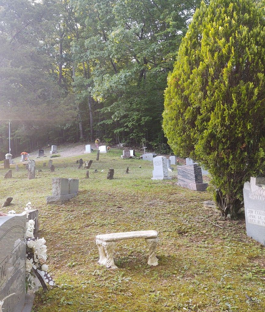
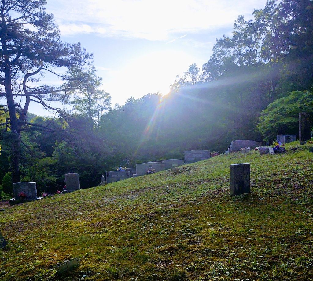
| Memorials | : | 10 |
| Location | : | Ashers Fork, Clay County, USA |
| Coordinate | : | 37.0067500, -83.5902220 |
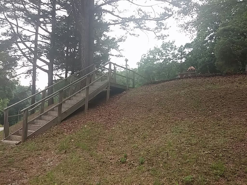
| Description | : | Take Hwy 1524 past Goose Rock Elementary for 8 miles until it turns. Continue on Hwy 1524 for 3 more miles until you reach the top of the hill. The cemetery will be on the left. |
frequently asked questions (FAQ):
-
Where is Smith Family Cemetery?
Smith Family Cemetery is located at Ashers Fork, Clay County ,Kentucky , 40962USA.
-
Smith Family Cemetery cemetery's updated grave count on graveviews.com?
9 memorials
-
Where are the coordinates of the Smith Family Cemetery?
Latitude: 37.0067500
Longitude: -83.5902220
Nearby Cemetories:
1. Lewis Family Cemetery
Ashers Fork, Clay County, USA
Coordinate: 37.0114160, -83.6161130
2. Indian Grave Branch Cemetery
Brightshade, Clay County, USA
Coordinate: 36.9869200, -83.6068200
3. Delph Cemetery
Spring Creek, Clay County, USA
Coordinate: 37.0299500, -83.6018600
4. Abe Jackson Cemetery
Brightshade, Clay County, USA
Coordinate: 36.9867040, -83.6248960
5. Smith Cemetery
Brightshade, Clay County, USA
Coordinate: 36.9966200, -83.6330400
6. T J Jackson Cemetery
Brightshade, Clay County, USA
Coordinate: 36.9918300, -83.6309000
7. Mills Cemetery
Ashers Fork, Clay County, USA
Coordinate: 37.0095600, -83.6357800
8. Stewart Cemetery
Brightshade, Clay County, USA
Coordinate: 36.9899340, -83.6327190
9. Ora Jackson Cemetery
Brightshade, Clay County, USA
Coordinate: 36.9763990, -83.6216880
10. Grubb Cemetery
Brightshade, Clay County, USA
Coordinate: 36.9749200, -83.6205900
11. Darbys Branch Cemetery #2
Brightshade, Clay County, USA
Coordinate: 36.9655200, -83.5873000
12. Asher Cemetery
Brightshade, Clay County, USA
Coordinate: 36.9651700, -83.5938100
13. Jackson Cemetery #3
Brightshade, Clay County, USA
Coordinate: 36.9721800, -83.6266400
14. Smith-Couch Cemetery
Plank, Clay County, USA
Coordinate: 37.0397230, -83.6299430
15. Darbys Branch Cemetery #1
Brightshade, Clay County, USA
Coordinate: 36.9627600, -83.6077900
16. Mudlick Cemetery
Plank, Clay County, USA
Coordinate: 37.0486120, -83.6191600
17. Stewart Cemetery - Old Field Branch
Brightshade, Clay County, USA
Coordinate: 36.9708100, -83.6316600
18. Asher Cemetery
Queendale, Clay County, USA
Coordinate: 37.0041000, -83.5277000
19. Eversole Cemetery
Brightshade, Clay County, USA
Coordinate: 37.0218620, -83.6504270
20. Dillion Asher Cemetery
Queendale, Clay County, USA
Coordinate: 37.0080240, -83.5270360
21. Asher Cemetery
Leslie County, USA
Coordinate: 37.0370010, -83.5391040
22. Asher Cemetery
Queendale, Clay County, USA
Coordinate: 37.0156800, -83.5262400
23. Wagers Cemetery
Brightshade, Clay County, USA
Coordinate: 37.0220060, -83.6523220
24. Hubbard Cemetery
Brightshade, Clay County, USA
Coordinate: 36.9802200, -83.6545700