
| Memorials | : | 12 |
| Location | : | Cadiz Junction, Harrison County, USA |
| Coordinate | : | 40.3428001, -80.9503021 |
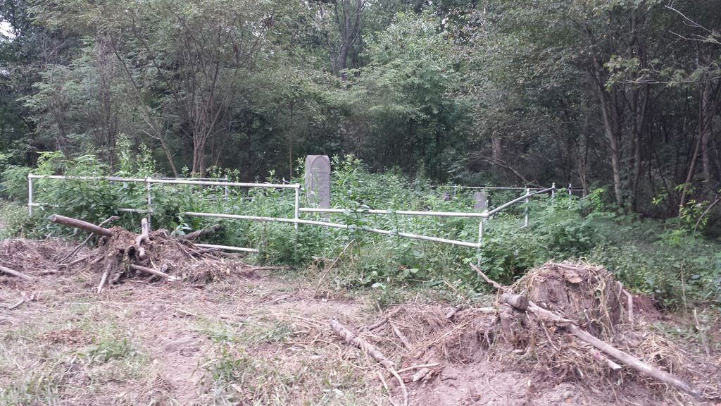
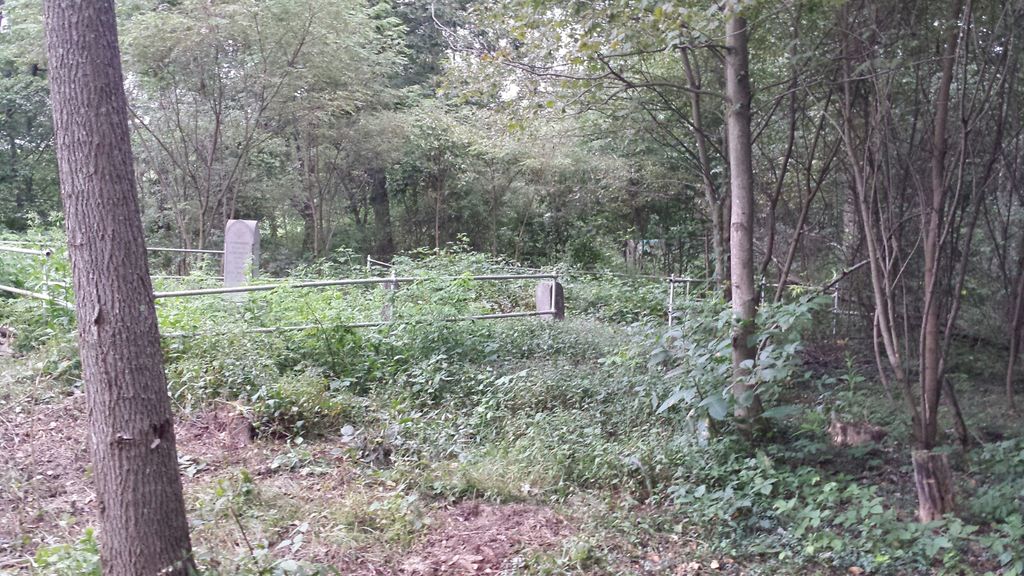
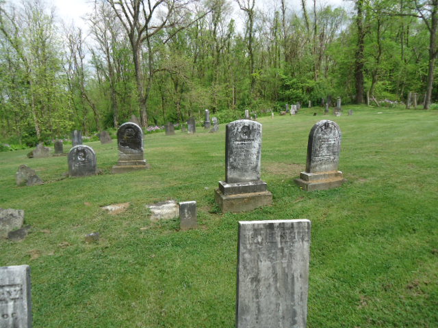
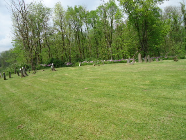
| Description | : | The cemetery is located on the south side of Jewett Hopedale Road (Ohio State Route 151) about 700 feet east of its intersection with Bakers Ridge Road (County Road 51). The cemetery is located in Green Township, Harrison County, Ohio, and is # 5004 (Orr Cemetery / Smith Cemetery) in “Ohio Cemeteries 1803-2003”, compiled by the Ohio Genealogical Society. The U.S. Geological Survey (USGS) Geographic Names Information System (GNIS) feature ID for the cemetery is 1699453 (Smith Cemetery). |
frequently asked questions (FAQ):
-
Where is Smith Cemetery?
Smith Cemetery is located at Jewett Hopedale Road (Ohio State Route 151) Cadiz Junction, Harrison County ,Ohio , 43986USA.
-
Smith Cemetery cemetery's updated grave count on graveviews.com?
12 memorials
-
Where are the coordinates of the Smith Cemetery?
Latitude: 40.3428001
Longitude: -80.9503021
Nearby Cemetories:
1. Bethel Cemetery
Harrison County, USA
Coordinate: 40.3424988, -80.9518967
2. Center Unity Cemetery
Cadiz, Harrison County, USA
Coordinate: 40.3671989, -80.9486008
3. Greenwood Cemetery
Hopedale, Harrison County, USA
Coordinate: 40.3153000, -80.9313965
4. Cannan Cemetery
Harrison County, USA
Coordinate: 40.3782997, -80.9431000
5. Mattern Cemetery
Harrison County, USA
Coordinate: 40.3064003, -80.9756012
6. Hopedale Cemetery
Hopedale, Harrison County, USA
Coordinate: 40.3189011, -80.8989029
7. Tedrow Cemetery
Harrison County, USA
Coordinate: 40.3857994, -80.9285965
8. Blue Ridge Cemetery
Hopedale, Harrison County, USA
Coordinate: 40.3671989, -80.8949966
9. Fairview Cemetery
Jewett, Harrison County, USA
Coordinate: 40.3806000, -81.0030975
10. Wheeler Cemetery
Hopedale, Harrison County, USA
Coordinate: 40.3632420, -80.8786110
11. Ferguson Cemetery
Hopedale, Harrison County, USA
Coordinate: 40.3311005, -80.8741989
12. Zion Cemetery
Germano, Harrison County, USA
Coordinate: 40.4030991, -80.9238968
13. Beech Spring Cemetery
Hopedale, Harrison County, USA
Coordinate: 40.2933006, -80.8936005
14. Buffalo Hill Cemetery
Harrison County, USA
Coordinate: 40.3911018, -80.8886032
15. Germano Cemetery
Germano, Harrison County, USA
Coordinate: 40.4108009, -80.9522018
16. Cadiz Union Cemetery
Cadiz, Harrison County, USA
Coordinate: 40.2705994, -80.9882965
17. Unionport Cemetery
Unionport, Jefferson County, USA
Coordinate: 40.3650440, -80.8496090
18. Harrison County Home Cemetery
Harrison County, USA
Coordinate: 40.2938400, -81.0345500
19. Old Cadiz Cemetery
Cadiz, Harrison County, USA
Coordinate: 40.2694016, -80.9981003
20. Evangelical Lutheran Cemetery
New Rumley, Harrison County, USA
Coordinate: 40.4019012, -81.0271988
21. Ridgeview Cemetery
Scio, Harrison County, USA
Coordinate: 40.3620900, -81.0566400
22. Sproat Cemetery
Harrison County, USA
Coordinate: 40.4039001, -80.8719025
23. Pine Run Cemetery
Unionport, Jefferson County, USA
Coordinate: 40.3703003, -80.8407974
24. New Rumley Methodist Cemetery
New Rumley, Harrison County, USA
Coordinate: 40.4028015, -81.0346985