
| Memorials | : | 13 |
| Location | : | Germano, Harrison County, USA |
| Coordinate | : | 40.4030991, -80.9238968 |
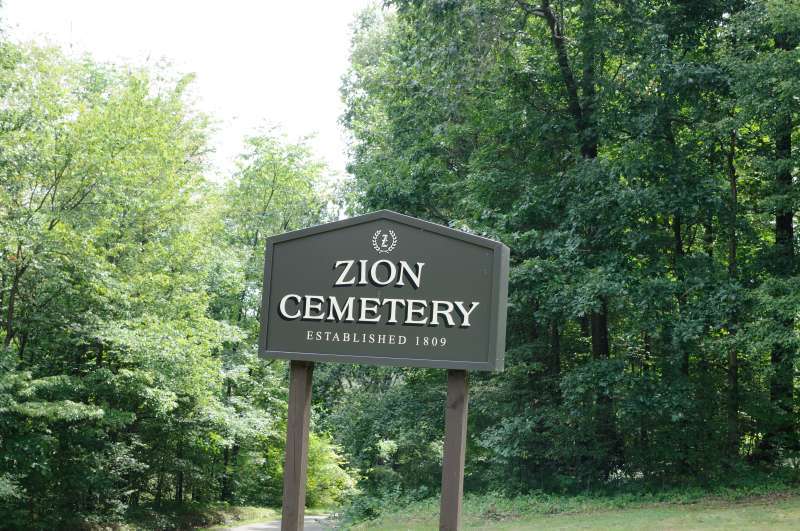
| Description | : | The cemetery is located on west side of Millers Station Road (County Road 4) about 0.4 mile south of its intersection with Annapolis Road (Ohio State Route 646). The cemetery was established in 1809 and is 1 acre in size. The cemetery is located in German Township, Harrison County, Ohio, and is # 4992 (Lutheran Cemetery / Zion Cemetery) in “Ohio Cemeteries 1803-2003”, compiled by the Ohio Genealogical Society. The cemetery is registered with the Ohio Division of Real Estate and Professional Licensing (ODRE) as Zion Cemetery with registration license number CGR.2005014269. The U.S. Geological Survey (USGS) Geographic Names... Read More |
frequently asked questions (FAQ):
-
Where is Zion Cemetery?
Zion Cemetery is located at Millers Station Road (County Road 4) Germano, Harrison County ,Ohio , 43976USA.
-
Zion Cemetery cemetery's updated grave count on graveviews.com?
13 memorials
-
Where are the coordinates of the Zion Cemetery?
Latitude: 40.4030991
Longitude: -80.9238968
Nearby Cemetories:
1. Tedrow Cemetery
Harrison County, USA
Coordinate: 40.3857994, -80.9285965
2. Germano Cemetery
Germano, Harrison County, USA
Coordinate: 40.4108009, -80.9522018
3. Mizer Cemetery
Amsterdam, Jefferson County, USA
Coordinate: 40.4318450, -80.9247940
4. Cannan Cemetery
Harrison County, USA
Coordinate: 40.3782997, -80.9431000
5. Buffalo Hill Cemetery
Harrison County, USA
Coordinate: 40.3911018, -80.8886032
6. Sproat Cemetery
Harrison County, USA
Coordinate: 40.4039001, -80.8719025
7. Center Unity Cemetery
Cadiz, Harrison County, USA
Coordinate: 40.3671989, -80.9486008
8. Blue Ridge Cemetery
Hopedale, Harrison County, USA
Coordinate: 40.3671989, -80.8949966
9. Annapolis Cemetery
Salem Township, Jefferson County, USA
Coordinate: 40.4100583, -80.8636942
10. Annapolis Lutheran Cemetery
Annapolis, Jefferson County, USA
Coordinate: 40.4130307, -80.8608010
11. Davidson Cemetery
Springfield Township, Jefferson County, USA
Coordinate: 40.4441986, -80.8818970
12. Wheeler Cemetery
Hopedale, Harrison County, USA
Coordinate: 40.3632420, -80.8786110
13. Miller Cemetery
Springfield Township, Jefferson County, USA
Coordinate: 40.4509580, -80.8913850
14. All Saints Russian Orthodox Church Cemetery
Wolf Run, Jefferson County, USA
Coordinate: 40.4598130, -80.8920900
15. Smith Cemetery
Cadiz Junction, Harrison County, USA
Coordinate: 40.3428001, -80.9503021
16. Bethel Cemetery
Harrison County, USA
Coordinate: 40.3424988, -80.9518967
17. Fairview Cemetery
Jewett, Harrison County, USA
Coordinate: 40.3806000, -81.0030975
18. Kisha Farm Cemetery
Wolf Run, Jefferson County, USA
Coordinate: 40.4646988, -80.8964005
19. Leas Cemetery
Salem Township, Jefferson County, USA
Coordinate: 40.4106710, -80.8383720
20. East Springfield Cemetery
East Springfield, Jefferson County, USA
Coordinate: 40.4490890, -80.8592080
21. Unionport Cemetery
Unionport, Jefferson County, USA
Coordinate: 40.3650440, -80.8496090
22. Pine Run Cemetery
Unionport, Jefferson County, USA
Coordinate: 40.3703003, -80.8407974
23. Simmons Cemetery
Carroll County, USA
Coordinate: 40.4622002, -80.9783020
24. Amsterdam Cemetery
Loudon Township, Carroll County, USA
Coordinate: 40.4752998, -80.9250031