| Memorials | : | 13 |
| Location | : | Hopedale, Harrison County, USA |
| Coordinate | : | 40.3671989, -80.8949966 |
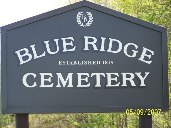
| Description | : | The cemetery is located on the southeast corner of the intersection of Blue Ridge Road (Township Road 165) and Murray Road (Township Road 1680). The cemetery was established in 1815 and is 0.7 acres in size. The cemetery is located in Moorefield Township, Harrison County, Ohio, and is # 4984 (Blue Ridge Cemetery / Hilldale Cemetery) in “Ohio Cemeteries 1803-2003”, compiled by the Ohio Genealogical Society. The cemetery is registered with the Ohio Division of Real Estate and Professional Licensing (ODRE) as Blue Ridge Cemetery with registration license number CGR.0000982183. The U.S. Geological Survey (USGS) Geographic Names Information System... Read More |
frequently asked questions (FAQ):
-
Where is Blue Ridge Cemetery?
Blue Ridge Cemetery is located at Blue Ridge Road and Murray Road Hopedale, Harrison County ,Ohio , 43976USA.
-
Blue Ridge Cemetery cemetery's updated grave count on graveviews.com?
13 memorials
-
Where are the coordinates of the Blue Ridge Cemetery?
Latitude: 40.3671989
Longitude: -80.8949966
Nearby Cemetories:
1. Wheeler Cemetery
Hopedale, Harrison County, USA
Coordinate: 40.3632420, -80.8786110
2. Buffalo Hill Cemetery
Harrison County, USA
Coordinate: 40.3911018, -80.8886032
3. Tedrow Cemetery
Harrison County, USA
Coordinate: 40.3857994, -80.9285965
4. Unionport Cemetery
Unionport, Jefferson County, USA
Coordinate: 40.3650440, -80.8496090
5. Cannan Cemetery
Harrison County, USA
Coordinate: 40.3782997, -80.9431000
6. Ferguson Cemetery
Hopedale, Harrison County, USA
Coordinate: 40.3311005, -80.8741989
7. Sproat Cemetery
Harrison County, USA
Coordinate: 40.4039001, -80.8719025
8. Center Unity Cemetery
Cadiz, Harrison County, USA
Coordinate: 40.3671989, -80.9486008
9. Pine Run Cemetery
Unionport, Jefferson County, USA
Coordinate: 40.3703003, -80.8407974
10. Zion Cemetery
Germano, Harrison County, USA
Coordinate: 40.4030991, -80.9238968
11. Hopedale Cemetery
Hopedale, Harrison County, USA
Coordinate: 40.3189011, -80.8989029
12. Smith Cemetery
Cadiz Junction, Harrison County, USA
Coordinate: 40.3428001, -80.9503021
13. Annapolis Cemetery
Salem Township, Jefferson County, USA
Coordinate: 40.4100583, -80.8636942
14. Bethel Cemetery
Harrison County, USA
Coordinate: 40.3424988, -80.9518967
15. Annapolis Lutheran Cemetery
Annapolis, Jefferson County, USA
Coordinate: 40.4130307, -80.8608010
16. Holy Family Hermitage Cemetery
Bloomingdale, Jefferson County, USA
Coordinate: 40.3840650, -80.8243020
17. Greenwood Cemetery
Hopedale, Harrison County, USA
Coordinate: 40.3153000, -80.9313965
18. Leas Cemetery
Salem Township, Jefferson County, USA
Coordinate: 40.4106710, -80.8383720
19. Germano Cemetery
Germano, Harrison County, USA
Coordinate: 40.4108009, -80.9522018
20. Bloomingdale Cemetery
Bloomingdale, Jefferson County, USA
Coordinate: 40.3418110, -80.8134230
21. Queen of All Saints Cemetery
Bloomingdale, Jefferson County, USA
Coordinate: 40.3841050, -80.8094450
22. Mizer Cemetery
Amsterdam, Jefferson County, USA
Coordinate: 40.4318450, -80.9247940
23. Mount Hope Cemetery
Salem Township, Jefferson County, USA
Coordinate: 40.4075012, -80.8182983
24. Beech Spring Cemetery
Hopedale, Harrison County, USA
Coordinate: 40.2933006, -80.8936005

