
| Memorials | : | 0 |
| Location | : | Utica, Clark County, USA |
| Coordinate | : | 38.3389000, -85.6764000 |
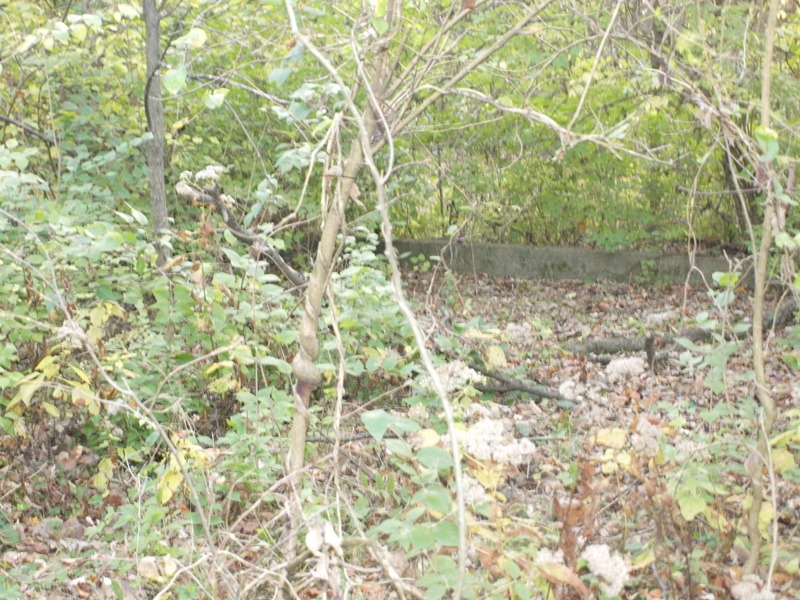
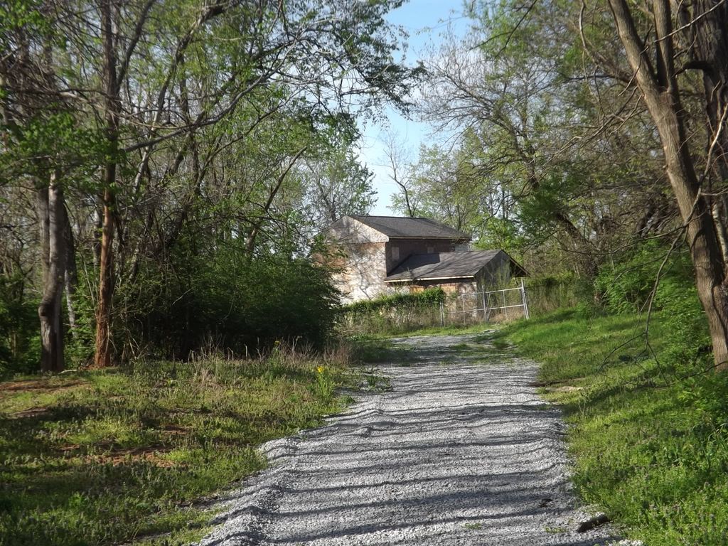
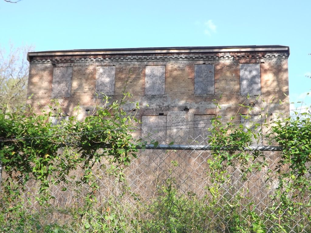
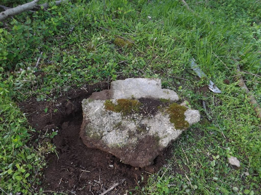
| Description | : | The Smith Family Farm and cemetery are located on private property in Utica Township. From Utica Pike, if you turn left onto Brown-Forman Rd, you need to drive approximately 1.3 miles. You will see an iron gate with a no-trespassing sign and the owner's phone number. Down that road is the old Smith Family Farm House. It has a 12 ft fence around it, but is still beautiful. The cemetery is reported to be behind the house. About 50 yards back , as it is all overgrown, I found the base of a grave marker about 2" underground. It started... Read More |
frequently asked questions (FAQ):
-
Where is Smith Family Cemetery?
Smith Family Cemetery is located at Fox Hollow Way (no road signs) Utica Township, Clark County ,Indiana ,USA.
-
Smith Family Cemetery cemetery's updated grave count on graveviews.com?
0 memorials
-
Where are the coordinates of the Smith Family Cemetery?
Latitude: 38.3389000
Longitude: -85.6764000
Nearby Cemetories:
1. Burtt Cemetery
Utica, Clark County, USA
Coordinate: 38.3496017, -85.6719971
2. New Chapel United Methodist Church Cemetery
Watson, Clark County, USA
Coordinate: 38.3546982, -85.6893005
3. Hillcrest Cemetery
Utica, Clark County, USA
Coordinate: 38.3391991, -85.6514969
4. Queen of Heaven Cemetery
Jeffersonville, Clark County, USA
Coordinate: 38.3543450, -85.6934020
5. Espy Cemetery
Clark County, USA
Coordinate: 38.3276863, -85.7010498
6. Lentz Heirs Cemetery
Utica, Clark County, USA
Coordinate: 38.3510017, -85.6511002
7. Lentz Family Cemetery
Utica, Clark County, USA
Coordinate: 38.3513780, -85.6510770
8. Adams Family Cemetery (Defunct)
Jeffersonville, Clark County, USA
Coordinate: 38.3150300, -85.6887200
9. Koonz Cemetery (Defunct)
Charlestown, Clark County, USA
Coordinate: 38.3710000, -85.6637000
10. Briar Hill Cemetery
Charlestown, Clark County, USA
Coordinate: 38.3747000, -85.6958000
11. McClintick-Sylvester Cemetery
Jeffersonville, Clark County, USA
Coordinate: 38.3497505, -85.7305832
12. Saint Francis in the Fields Memorial Garden
Harrods Creek, Jefferson County, USA
Coordinate: 38.3210520, -85.6248870
13. Ohio Valley Pet Cemetery
Sellersburg, Clark County, USA
Coordinate: 38.3456540, -85.7357970
14. Union Cemetery
Clark County, USA
Coordinate: 38.3871994, -85.6658020
15. Dailey Cemetery
Utica Township, Clark County, USA
Coordinate: 38.3824950, -85.6457370
16. Berry Hill Cemetery
Louisville, Jefferson County, USA
Coordinate: 38.2943910, -85.6404680
17. Foster-Lotich Cemetery
Prather, Clark County, USA
Coordinate: 38.3837130, -85.7131230
18. Barnett Cemetery
Utica, Clark County, USA
Coordinate: 38.3927994, -85.6781006
19. Stacy Cemetery
Charlestown, Clark County, USA
Coordinate: 38.3931000, -85.6950000
20. Phelps Family Cemetery
Sellersburg, Clark County, USA
Coordinate: 38.3874000, -85.7251000
21. Caldwell Cemetery
Charlestown, Clark County, USA
Coordinate: 38.4014000, -85.6628000
22. Civil War Cemetery #3
Jeffersonville, Clark County, USA
Coordinate: 38.2848790, -85.7217790
23. James Stewart Plantation Cemetery
Charlestown, Clark County, USA
Coordinate: 38.4010010, -85.7034560
24. Walnut Ridge Cemetery
Jeffersonville, Clark County, USA
Coordinate: 38.3025017, -85.7466965