
| Memorials | : | 1 |
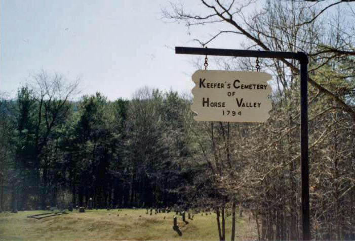
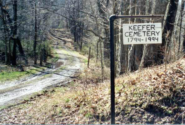
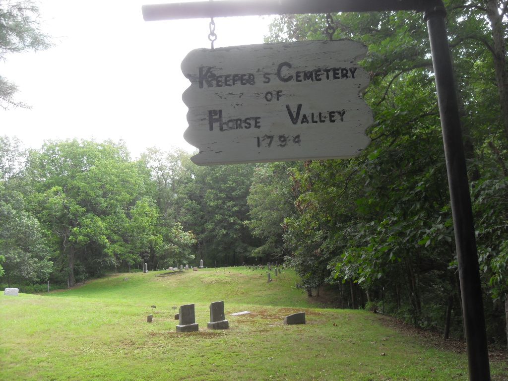
| Location | : | Upper Strasburg, Franklin County, USA |
| Coordinate | : | 40.0406550, -77.8079090 |
| Description | : | Driving directions to Horse Valley Rd, Upper Strasburg, PA 17265 from Chambersburg, PA. 10. Norland Ave turns right and becomes US-11 N/Philadelphia Ave 2.3 mi 11. Turn left onto PA-433 N/Sunset Pike Continue to follow PA-433 N 1.7 mi 12. Continue onto PA-997 N/Cumberland Hwy 4.0 mi 13. Turn left onto PA-533 W/Upper Strasburg Rd Continue to follow Upper Strasburg Rd 6.2 mi 14. Turn left onto State Route 4004/Upper Strasburg Rd 1.6 mi 15. Slight left onto Upper Horse Valley Rd 6.2 mi 16. Continue onto Horse Valley Rd 371 ft *See below for remainder of directions. A big thank you to Larry Hoover for the following directions. From... Read More |
frequently asked questions (FAQ):
-
Where is Keefers Cemetery?
Keefers Cemetery is located at Upper Horse Valley Road Upper Strasburg, Franklin County ,Pennsylvania , 17265USA.
-
Keefers Cemetery cemetery's updated grave count on graveviews.com?
1 memorials
-
Where are the coordinates of the Keefers Cemetery?
Latitude: 40.0406550
Longitude: -77.8079090
Nearby Cemetories:
1. Horse Valley Cemetery
Franklin County, USA
Coordinate: 40.0386009, -77.8058014
2. Forrester Family Cemetery
Freestone, Franklin County, USA
Coordinate: 40.0172290, -77.8317830
3. Lower Path Valley Cemetery
Fannettsburg, Franklin County, USA
Coordinate: 40.0531006, -77.8450012
4. Fannettsburg Reformed Church Cemetery
Fannettsburg, Franklin County, USA
Coordinate: 40.0735000, -77.8277000
5. Evert Farm Family Cemetery
Metal, Franklin County, USA
Coordinate: 40.0794670, -77.7987490
6. Metal Methodist Cemetery
Metal, Franklin County, USA
Coordinate: 40.0240000, -77.8725000
7. Flickinger Farm Family Cemetery
Franklin County, USA
Coordinate: 40.0927480, -77.8015170
8. Carrick United Methodist Church Cemetery
Metal, Franklin County, USA
Coordinate: 40.0151850, -77.8783810
9. Zion United Brethren Cemetery
Upper Strasburg, Franklin County, USA
Coordinate: 39.9909670, -77.8514330
10. Zion United Brethren Cemetery
Saint Thomas, Franklin County, USA
Coordinate: 39.9909893, -77.8516591
11. Wright Farm Family Cemetery
Metal, Franklin County, USA
Coordinate: 40.0213364, -77.8832249
12. Mount Olivet Cemetery
Chambersburg, Franklin County, USA
Coordinate: 39.9771000, -77.7921000
13. Snider Cemetery
Chambersburg, Franklin County, USA
Coordinate: 39.9928810, -77.7500360
14. Shetler Family Cemetery
Franklin County, USA
Coordinate: 40.1100000, -77.7833000
15. Cree Cemetery
Dublin Township, Huntingdon County, USA
Coordinate: 40.0982014, -77.8660481
16. Burnt Cabins Cemetery
Burnt Cabins, Fulton County, USA
Coordinate: 40.0754000, -77.8963000
17. Upper Strasburg Methodist Church Cemetery
Upper Strasburg, Franklin County, USA
Coordinate: 40.0596000, -77.7105000
18. New Hope Mennonite Cemetery
Upper Strasburg, Franklin County, USA
Coordinate: 40.0628950, -77.7099840
19. Hessian Cemetery
Upper Strasburg, Franklin County, USA
Coordinate: 39.9731830, -77.8636000
20. Brechbill Cemetery
Chambersburg, Franklin County, USA
Coordinate: 39.9745978, -77.7473585
21. Emanuel Lutheran Church Cemetery
Upper Strasburg, Franklin County, USA
Coordinate: 40.0587000, -77.7049000
22. Edenville Methodist Church Cemetery
Edenville, Franklin County, USA
Coordinate: 39.9577000, -77.8031000
23. Parker Cemetery
Metal Township, Franklin County, USA
Coordinate: 40.1271763, -77.8050054
24. Upper Strasburg Mennonite Church Cemetery
Chambersburg, Franklin County, USA
Coordinate: 40.0203300, -77.6967000