
| Memorials | : | 29 |
| Location | : | Sorgho, Daviess County, USA |
| Coordinate | : | 37.7552700, -87.2588600 |
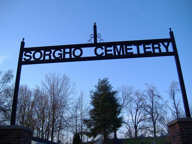
| Description | : | Cemetery associated with the Sorgho Baptist Church. The cemetery is located behind the church. Located near the Junction of Highway 1554 and the Audubon Parkway west of Sorgho. November 2014 - The separation of those buried in this cemetery from those buried in the Pleasant Grove Baptist Church cemetery is now completed. The two cemeteries had been previously combined on FindAGrave as the same cemetery in error. This cemetery is several miles to the west of Sorgho while Pleasant Grove is several miles to the east of town. |
frequently asked questions (FAQ):
-
Where is Sorgho Baptist Church Cemetery?
Sorgho Baptist Church Cemetery is located at Sorgho, Daviess County ,Kentucky ,USA.
-
Sorgho Baptist Church Cemetery cemetery's updated grave count on graveviews.com?
28 memorials
-
Where are the coordinates of the Sorgho Baptist Church Cemetery?
Latitude: 37.7552700
Longitude: -87.2588600
Nearby Cemetories:
1. Little Flock Baptist Cemetery
Sorgho, Daviess County, USA
Coordinate: 37.7573600, -87.2687700
2. Saint Mary Magdalene Catholic Cemetery
Sorgho, Daviess County, USA
Coordinate: 37.7503050, -87.2487870
3. Hitchcock Family Cemetery
Sorgho, Daviess County, USA
Coordinate: 37.7423261, -87.2686245
4. Wiles Cemetery
Birk City, Daviess County, USA
Coordinate: 37.7815370, -87.2699000
5. Calhoon Curdsville Cemetery
Curdsville, Daviess County, USA
Coordinate: 37.7440000, -87.3020000
6. Crabtree Cemetery
Sorgho, Daviess County, USA
Coordinate: 37.7560000, -87.2120000
7. Pleasant Grove Baptist Church Cemetery
Sorgho, Daviess County, USA
Coordinate: 37.7552300, -87.2037700
8. Pendleton Cemetery
Stanley, Daviess County, USA
Coordinate: 37.7986300, -87.2271100
9. Saint Raphael Cemetery
West Louisville, Daviess County, USA
Coordinate: 37.7033900, -87.2489000
10. Welden Cemetery
Hebbardsville, Henderson County, USA
Coordinate: 37.7503200, -87.3253800
11. Saint Raphael Original Log Church and Cemetery
West Louisville, Daviess County, USA
Coordinate: 37.7009600, -87.2442900
12. Lancaster Cemetery
Owensboro, Daviess County, USA
Coordinate: 37.7921400, -87.2015000
13. Saint Peter Cemetery
Stanley, Daviess County, USA
Coordinate: 37.8147011, -87.2533035
14. Stanley Catholic Cemetery
Stanley, Daviess County, USA
Coordinate: 37.8168900, -87.2528200
15. Fern Hill Cemetery
Owensboro, Daviess County, USA
Coordinate: 37.7835999, -87.1872025
16. Harold Cemetery
Sorgho, Daviess County, USA
Coordinate: 37.7473602, -87.1791942
17. Sands Cemetery
Daviess County, USA
Coordinate: 37.7651960, -87.1794200
18. Scherer Cemetery
Stanley, Daviess County, USA
Coordinate: 37.8204200, -87.2492300
19. Barbour Cemetery
Owensboro, Daviess County, USA
Coordinate: 37.7485000, -87.1730160
20. Worthington Family Cemetery
Daviess County, USA
Coordinate: 37.7611480, -87.1728200
21. Atheys Chapel Cemetery
Rome, Daviess County, USA
Coordinate: 37.7227800, -87.1815980
22. McCain Cemetery
Curdsville, Daviess County, USA
Coordinate: 37.7322006, -87.3480988
23. Pleasant Hill Cemetery
Hebbardsville, Henderson County, USA
Coordinate: 37.7933620, -87.3439570
24. Mount Saint Joseph Cemetery
Maple Mount, Daviess County, USA
Coordinate: 37.6931000, -87.3216570