
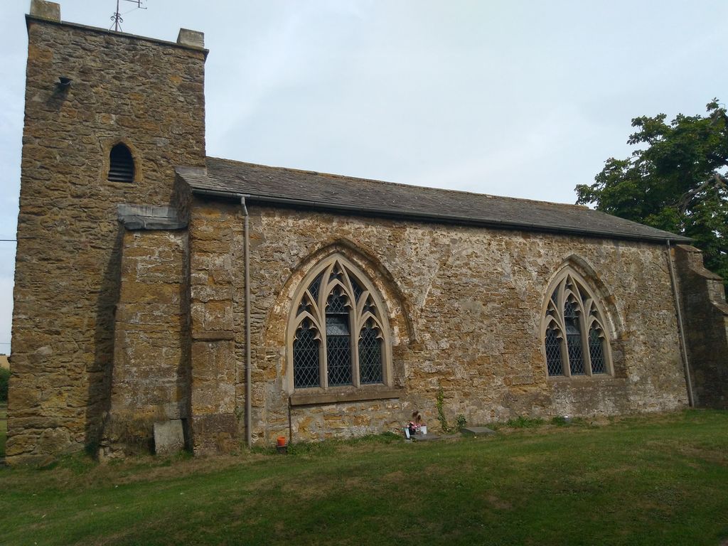
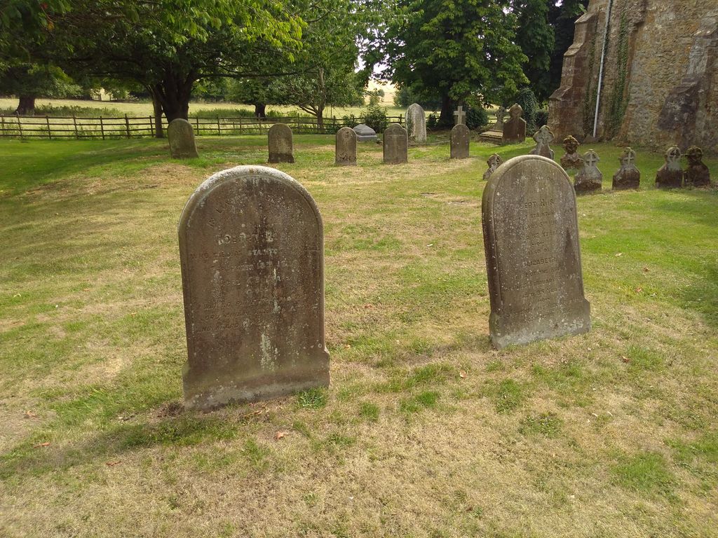
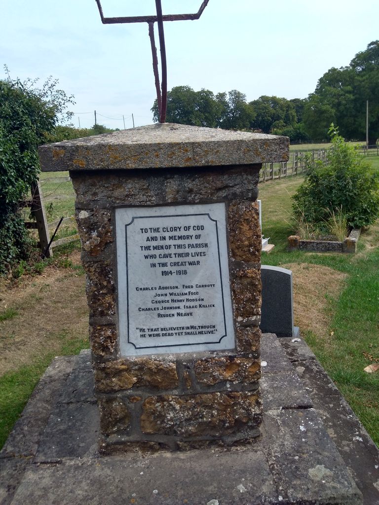
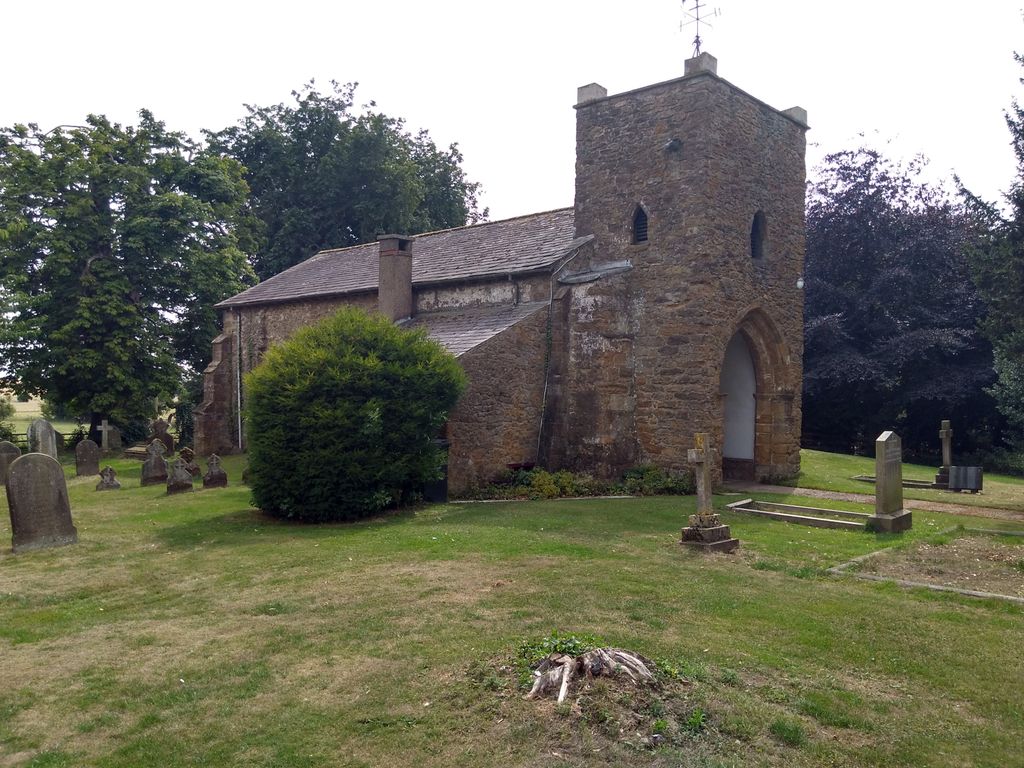
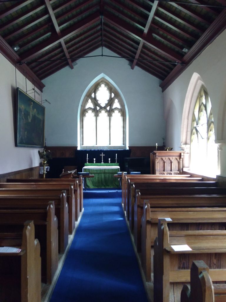
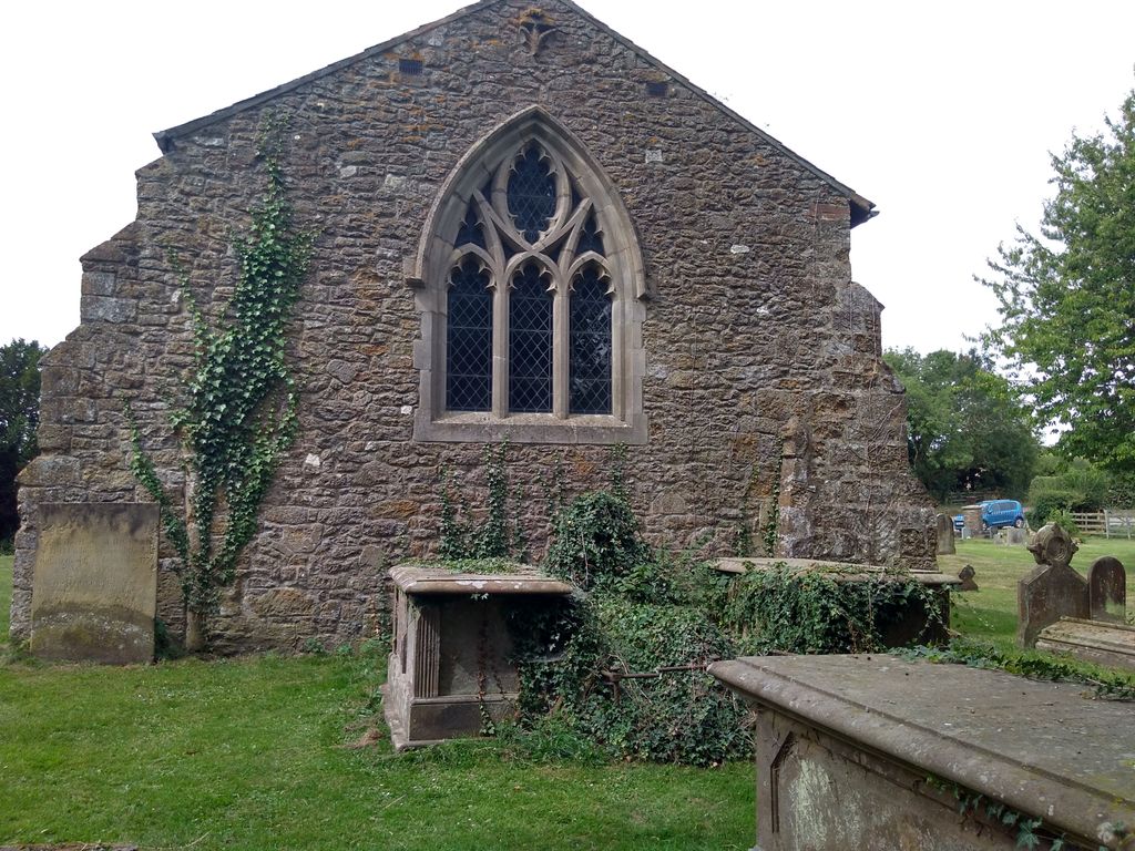
| Memorials | : | 0 |
| Location | : | Stainton-le-Vale, West Lindsey District, England |
| Coordinate | : | 53.4333900, -0.2309600 |
frequently asked questions (FAQ):
-
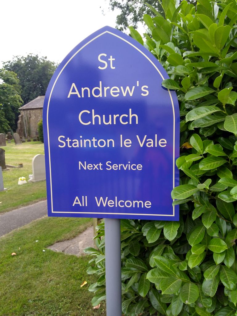
Where is St. Andrew's Churchyard?
St. Andrew's Churchyard is located at Brookfield Close Stainton-le-Vale, West Lindsey District ,Lincolnshire , LN8 6HPEngland.
-
St. Andrew's Churchyard cemetery's updated grave count on graveviews.com?
0 memorials
-
Where are the coordinates of the St. Andrew's Churchyard?
Latitude: 53.4333900
Longitude: -0.2309600
Nearby Cemetories:
1. St. Martin's Churchyard
Kirmond-le-Mire, West Lindsey District, England
Coordinate: 53.4172100, -0.2176900
2. St. Mary's Churchyard
Binbrook, East Lindsey District, England
Coordinate: 53.4283880, -0.1774980
3. St Mary Magdalene Churchyard
Rothwell, West Lindsey District, England
Coordinate: 53.4783820, -0.2693190
4. St Mary & St Peters Churchyard
Ludford, East Lindsey District, England
Coordinate: 53.3868330, -0.1963460
5. St. Thomas the Apostle Churchyard
North Willingham, West Lindsey District, England
Coordinate: 53.3786700, -0.2524900
6. St. Mary's Churchyard
Claxby, West Lindsey District, England
Coordinate: 53.4363000, -0.3287600
7. St Nicholas Church
Cuxwold, West Lindsey District, England
Coordinate: 53.4936120, -0.2347580
8. St Marys Churchyard
Hatcliffe, North East Lincolnshire Unitary Authority, England
Coordinate: 53.4890900, -0.1729800
9. All Saints Churchyard
Sixhills, West Lindsey District, England
Coordinate: 53.3679800, -0.2426600
10. St. Martin Churchyard
East Ravendale, North East Lincolnshire Unitary Authority, England
Coordinate: 53.4793000, -0.1370044
11. St Andrew
Beelsby, North East Lincolnshire Unitary Authority, England
Coordinate: 53.5015700, -0.1810580
12. St Nicholas Churchyard
Cabourne, West Lindsey District, England
Coordinate: 53.5015800, -0.2830600
13. Market Rasen Cemetery
Market Rasen, West Lindsey District, England
Coordinate: 53.3830880, -0.3275890
14. St. Thomas Churchyard
Market Rasen, West Lindsey District, England
Coordinate: 53.3883500, -0.3376700
15. St John The Baptist Churchyard
Nettleton, West Lindsey District, England
Coordinate: 53.4867340, -0.3269800
16. St Faith Church
Kelstern, East Lindsey District, England
Coordinate: 53.3911200, -0.1196310
17. St. Peter and St. Paul Churchyard
Caistor, West Lindsey District, England
Coordinate: 53.4963400, -0.3179900
18. Caistor Congregational Chapelyard
Caistor, West Lindsey District, England
Coordinate: 53.4971540, -0.3181850
19. St. Helen Churchyard
Burgh on Bain, East Lindsey District, England
Coordinate: 53.3604060, -0.1644810
20. Caistor Cemetery
Caistor, West Lindsey District, England
Coordinate: 53.4968870, -0.3299210
21. God's Acre
Middle Rasen, West Lindsey District, England
Coordinate: 53.3904700, -0.3614800
22. St. Mary's Churchyard
Hainton, East Lindsey District, England
Coordinate: 53.3433440, -0.2290450
23. St. Peter & St. Paul Churchyard
Middle Rasen, West Lindsey District, England
Coordinate: 53.3914120, -0.3664170
24. St Peter's Churchyard
Ashby cum Fenby, North East Lincolnshire Unitary Authority, England
Coordinate: 53.4903100, -0.1105200