| Memorials | : | 0 |
| Location | : | Farnham, Waverley Borough, England |
| Phone | : | 01252715412 |
| Website | : | www.StAndrewsFarnham.org |
| Coordinate | : | 51.2131350, -0.8007400 |
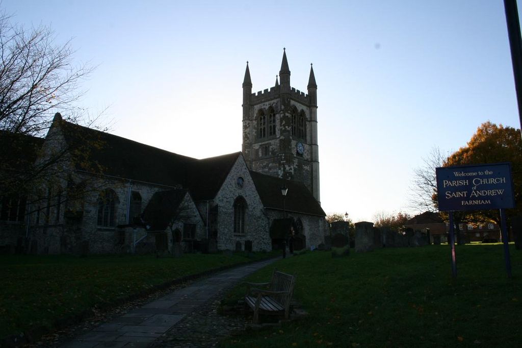
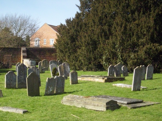
| Description | : | The oldest record of a church in Farnham is found in the Domesday Book of 1986. Although, in 2005–06, a conservation and development project uncovered the foundations of a 7th century Saxon church on the site. The oldest parts of the current building date from the 12th century, between 1150 and 1170. Further building work was completed in 1399 and a new squat tower was built in the early 16th century. Extensive restoration was carried out in the 19th and 20th centuries. The church contains many interesting monuments and sits within a large churchyard. |
frequently asked questions (FAQ):
-
Where is St Andrew Churchyard?
St Andrew Churchyard is located at Upper Church Lane Farnham, Waverley Borough ,Surrey , GU9 7PWEngland.
-
St Andrew Churchyard cemetery's updated grave count on graveviews.com?
0 memorials
-
Where are the coordinates of the St Andrew Churchyard?
Latitude: 51.2131350
Longitude: -0.8007400
Nearby Cemetories:
1. West Street Cemetery
Farnham, Waverley Borough, England
Coordinate: 51.2109000, -0.8093900
2. Saint John the Evangelist Churchyard
Hale, Waverley Borough, England
Coordinate: 51.2280880, -0.7849360
3. St Peter's Churchyard
Wrecclesham, Waverley Borough, England
Coordinate: 51.1976230, -0.8171330
4. Upper Hale Cemetery
Farnham, Waverley Borough, England
Coordinate: 51.2352700, -0.8001800
5. St Mary Churchyard
Ewshot, Hart District, England
Coordinate: 51.2416700, -0.8322800
6. St James Churchyard
Rowledge, Waverley Borough, England
Coordinate: 51.1811200, -0.8275700
7. St Michael the Archangel Churchyard
Aldershot, Rushmoor Borough, England
Coordinate: 51.2414300, -0.7558900
8. Aldershot Crematorium
Aldershot, Rushmoor Borough, England
Coordinate: 51.2325970, -0.7443200
9. All Saints Churchyard
Crondall, Hart District, England
Coordinate: 51.2299830, -0.8633050
10. All Saints Churchyard
Tilford, Waverley Borough, England
Coordinate: 51.1811180, -0.7524490
11. All Saints Churchyard
Guildford Borough, England
Coordinate: 51.1809540, -0.7523820
12. St. Mary the Virgin Churchyard
Frensham, Waverley Borough, England
Coordinate: 51.1659700, -0.7973890
13. Redan Road Cemetery
Aldershot, Rushmoor Borough, England
Coordinate: 51.2495610, -0.7488900
14. Aldershot Jewish Cemetery
Aldershot, Rushmoor Borough, England
Coordinate: 51.2508900, -0.7463000
15. St. Mary's Churchyard
Bentley, East Hampshire District, England
Coordinate: 51.1957900, -0.8791600
16. St Lawrence Churchyard
Seale, Guildford Borough, England
Coordinate: 51.2231840, -0.7170140
17. Christ Church Churchyard
Crookham Village, Hart District, England
Coordinate: 51.2597200, -0.8438180
18. Aldershot Military Cemetery
Aldershot, Rushmoor Borough, England
Coordinate: 51.2554779, -0.7449350
19. St Peter Churchyard
Ash, Guildford Borough, England
Coordinate: 51.2490760, -0.7155380
20. Emery Gates Cemetery
Ash, Guildford Borough, England
Coordinate: 51.2500370, -0.7163210
21. Thursley Road Cemetery
Elstead, Waverley Borough, England
Coordinate: 51.1836610, -0.7066330
22. Fleet Cemetery
Fleet, Hart District, England
Coordinate: 51.2718100, -0.8523700
23. Ash War Memorial
Ash, Guildford Borough, England
Coordinate: 51.2546746, -0.7157783
24. Woolfords Lane Cemetery
Elstead, Waverley Borough, England
Coordinate: 51.1709290, -0.7154740


