
| Memorials | : | 0 |
| Location | : | Ambleside, South Lakeland District, England |
| Coordinate | : | 54.4337370, -2.9610400 |
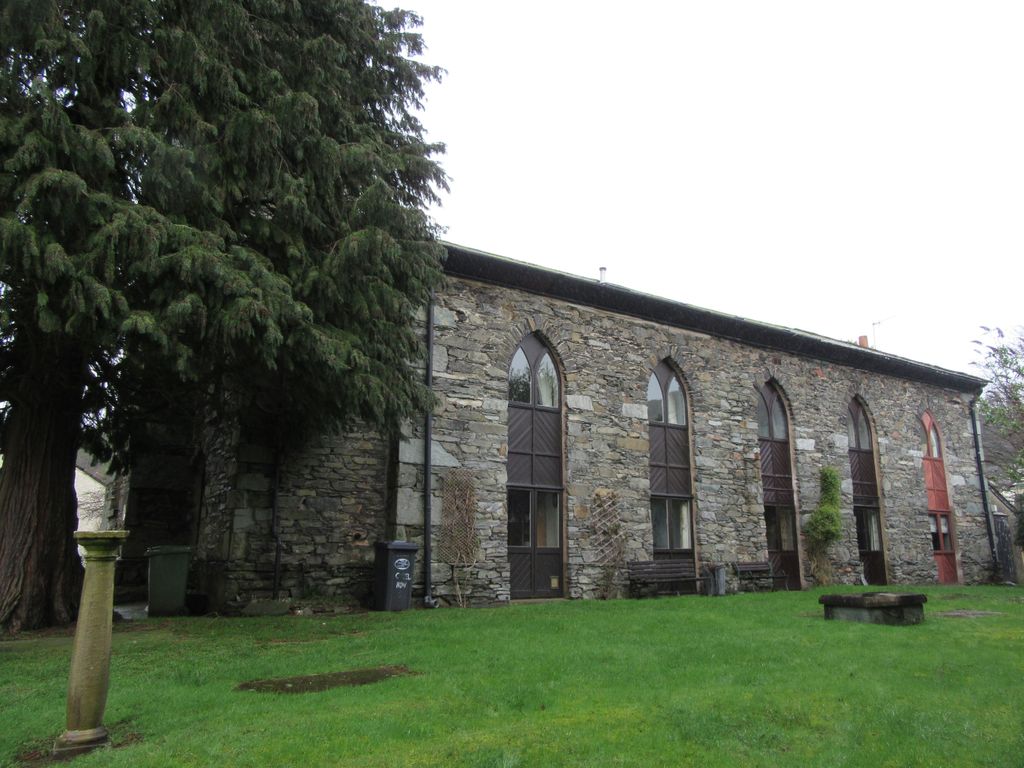
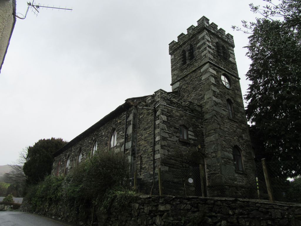
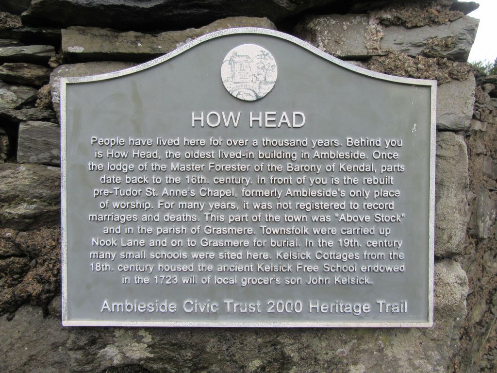
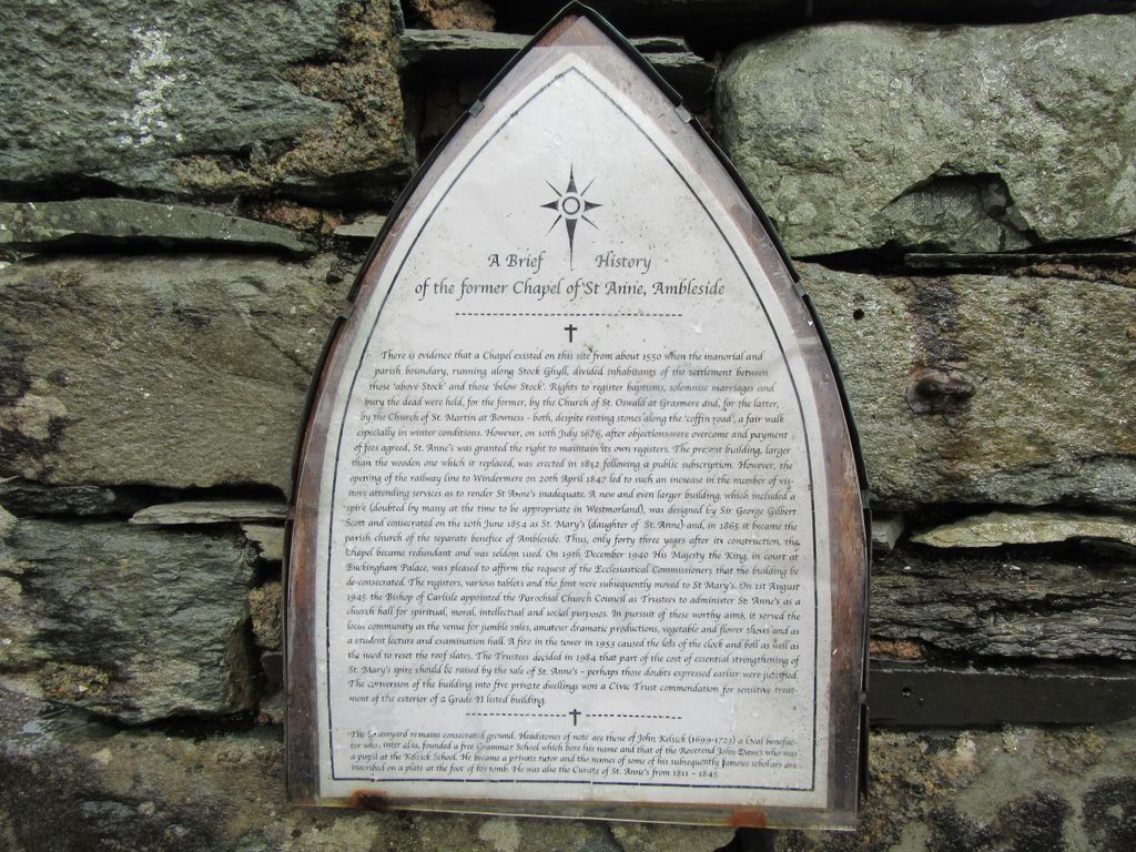
| Description | : | St Anne's Chapel, Ambleside, is surrounded by three roads. The entrance to St Anne's Chapel is at the top of Chapel Hill, Ambleside. Running along the sides of St Anne's Chapel are Kirkstone Road, and Fair View Road. A Chapel has existed on this site since 1550, but was part of the Grasmere parish, where baptisms, marriages, and burials had to be registered. In 1676 St Anne's was granted the right to maintain its own registers. This was Ambleside's only place of worship. The original wooden structure was replaced in 1812 by the still existing Chapel building. With the coming of the railway... Read More |
frequently asked questions (FAQ):
-
Where is St. Anne's Churchyard?
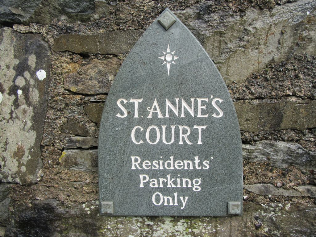
St. Anne's Churchyard is located at St Anne's Court Ambleside, South Lakeland District ,Cumbria ,England.
-
St. Anne's Churchyard cemetery's updated grave count on graveviews.com?
0 memorials
-
Where are the coordinates of the St. Anne's Churchyard?
Latitude: 54.4337370
Longitude: -2.9610400
Nearby Cemetories:
1. St. Mary The Virgin Churchyard
Ambleside, South Lakeland District, England
Coordinate: 54.4307600, -2.9661900
2. St. Mary's Churchyard
Rydal, South Lakeland District, England
Coordinate: 54.4472230, -2.9818800
3. Holy Trinity Churchyard
Brathay, South Lakeland District, England
Coordinate: 54.4209960, -2.9845050
4. Saint Margarets Churchyard
Low Wray, South Lakeland District, England
Coordinate: 54.3982680, -2.9688040
5. Jesus Church Churchyard
Troutbeck, South Lakeland District, England
Coordinate: 54.4170100, -2.9064230
6. St Oswald Churchyard
Grasmere, South Lakeland District, England
Coordinate: 54.4574260, -3.0237290
7. Kelbarrow
Grasmere, South Lakeland District, England
Coordinate: 54.4550290, -3.0314230
8. Grasmere Cemetery
Grasmere, South Lakeland District, England
Coordinate: 54.4659020, -3.0221410
9. Holy Trinity Churchyard
Chapel Stile, South Lakeland District, England
Coordinate: 54.4402700, -3.0486090
10. Langdale Cemetery
Chapel Stile, South Lakeland District, England
Coordinate: 54.4377600, -3.0500180
11. Windermere Cemetery
Windermere, South Lakeland District, England
Coordinate: 54.3823360, -2.9173970
12. Saint Mary's Churchyard
Windermere, South Lakeland District, England
Coordinate: 54.3810140, -2.9099750
13. Society of Friends Burial Ground
Hawkshead, South Lakeland District, England
Coordinate: 54.3739240, -2.9889880
14. St. Michael's And All Angels Churchyard
Hawkshead, South Lakeland District, England
Coordinate: 54.3742210, -2.9988740
15. Hawkshead Hill Baptist Church Cemetery
Hawkshead, South Lakeland District, England
Coordinate: 54.3799490, -3.0207400
16. Mislet & Broadgate Quaker Burial Ground
Windermere, South Lakeland District, England
Coordinate: 54.3892040, -2.8756960
17. St Cuthbert Churchyard
Kentmere, South Lakeland District, England
Coordinate: 54.4294920, -2.8396150
18. Saint Martin's Churchyard
Bowness-on-Windermere, South Lakeland District, England
Coordinate: 54.3639680, -2.9208950
19. Bowness-on-Windermere Cemetery
Bowness-on-Windermere, South Lakeland District, England
Coordinate: 54.3584760, -2.9238880
20. St. Anne's Churchyard
Ings, South Lakeland District, England
Coordinate: 54.3802940, -2.8541350
21. St. Peter's Churchyard
Far Sawrey, South Lakeland District, England
Coordinate: 54.3480230, -2.9582610
22. Coniston Graveyard
Coniston, South Lakeland District, England
Coordinate: 54.3694000, -3.0731000
23. St Andrew Churchyard
Coniston, South Lakeland District, England
Coordinate: 54.3688390, -3.0751230
24. Wythburn Churchyard
Keswick, Allerdale Borough, England
Coordinate: 54.5131190, -3.0451030