
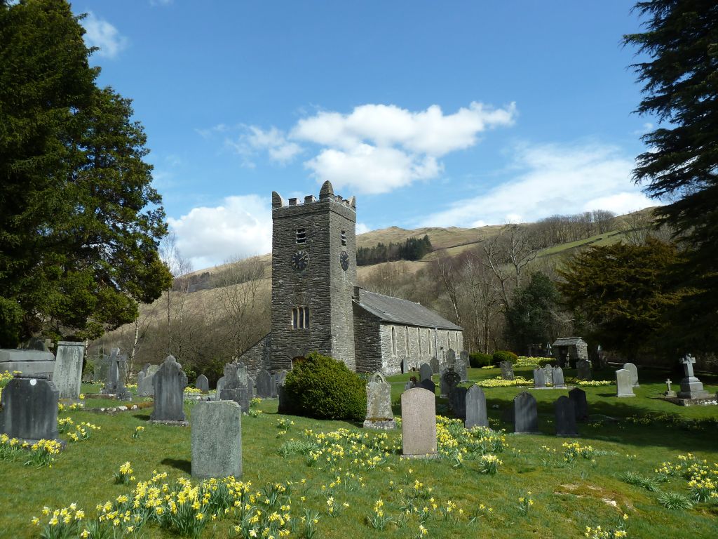
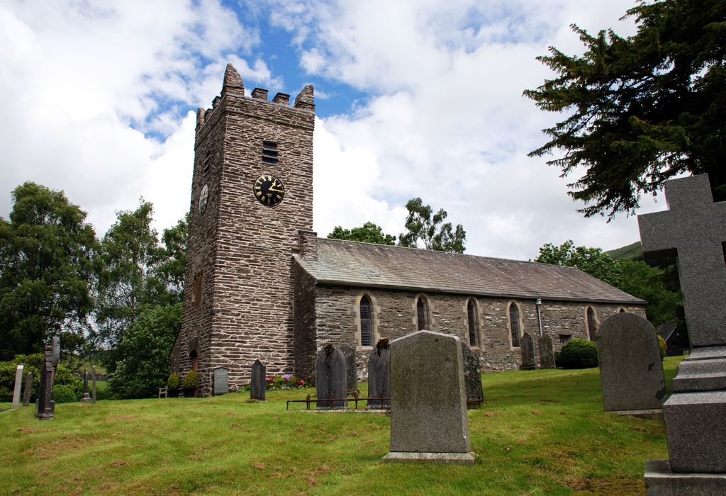
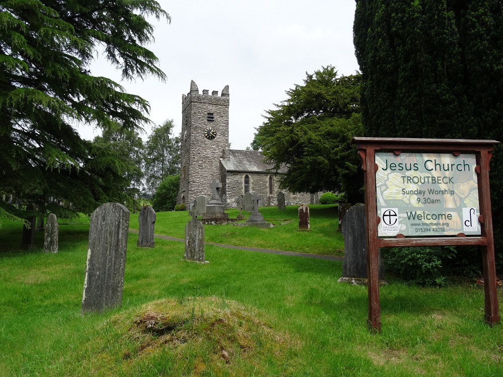
| Memorials | : | 0 |
| Location | : | Troutbeck, South Lakeland District, England |
| Coordinate | : | 54.4170100, -2.9064230 |
frequently asked questions (FAQ):
-
Where is Jesus Church Churchyard?
Jesus Church Churchyard is located at Patterdale Road Troutbeck, South Lakeland District ,Cumbria , LA23 1PEEngland.
-
Jesus Church Churchyard cemetery's updated grave count on graveviews.com?
0 memorials
-
Where are the coordinates of the Jesus Church Churchyard?
Latitude: 54.4170100
Longitude: -2.9064230
Nearby Cemetories:
1. Mislet & Broadgate Quaker Burial Ground
Windermere, South Lakeland District, England
Coordinate: 54.3892040, -2.8756960
2. Windermere Cemetery
Windermere, South Lakeland District, England
Coordinate: 54.3823360, -2.9173970
3. St. Anne's Churchyard
Ambleside, South Lakeland District, England
Coordinate: 54.4337370, -2.9610400
4. Saint Mary's Churchyard
Windermere, South Lakeland District, England
Coordinate: 54.3810140, -2.9099750
5. St. Mary The Virgin Churchyard
Ambleside, South Lakeland District, England
Coordinate: 54.4307600, -2.9661900
6. St Cuthbert Churchyard
Kentmere, South Lakeland District, England
Coordinate: 54.4294920, -2.8396150
7. Saint Margarets Churchyard
Low Wray, South Lakeland District, England
Coordinate: 54.3982680, -2.9688040
8. Holy Trinity Churchyard
Brathay, South Lakeland District, England
Coordinate: 54.4209960, -2.9845050
9. St. Anne's Churchyard
Ings, South Lakeland District, England
Coordinate: 54.3802940, -2.8541350
10. St. Mary's Churchyard
Rydal, South Lakeland District, England
Coordinate: 54.4472230, -2.9818800
11. Saint Martin's Churchyard
Bowness-on-Windermere, South Lakeland District, England
Coordinate: 54.3639680, -2.9208950
12. Bowness-on-Windermere Cemetery
Bowness-on-Windermere, South Lakeland District, England
Coordinate: 54.3584760, -2.9238880
13. St James Churchyard
Staveley, South Lakeland District, England
Coordinate: 54.3801350, -2.8183670
14. Society of Friends Burial Ground
Hawkshead, South Lakeland District, England
Coordinate: 54.3739240, -2.9889880
15. St. Michael's And All Angels Churchyard
Hawkshead, South Lakeland District, England
Coordinate: 54.3742210, -2.9988740
16. St. Peter's Churchyard
Far Sawrey, South Lakeland District, England
Coordinate: 54.3480230, -2.9582610
17. Hawkshead Hill Baptist Church Cemetery
Hawkshead, South Lakeland District, England
Coordinate: 54.3799490, -3.0207400
18. St. Catherine's Churchyard
Crook, South Lakeland District, England
Coordinate: 54.3480260, -2.8462220
19. St Mary Churchyard
Longsleddale, South Lakeland District, England
Coordinate: 54.4189730, -2.7706810
20. St Oswald Churchyard
Grasmere, South Lakeland District, England
Coordinate: 54.4574260, -3.0237290
21. Crook Chapel of Saint Catherine
Crook, South Lakeland District, England
Coordinate: 54.3445250, -2.8477290
22. Kelbarrow
Grasmere, South Lakeland District, England
Coordinate: 54.4550290, -3.0314230
23. Grasmere Cemetery
Grasmere, South Lakeland District, England
Coordinate: 54.4659020, -3.0221410
24. Holy Trinity Churchyard
Chapel Stile, South Lakeland District, England
Coordinate: 54.4402700, -3.0486090