| Memorials | : | 0 |
| Location | : | Windermere, South Lakeland District, England |
| Coordinate | : | 54.3892040, -2.8756960 |
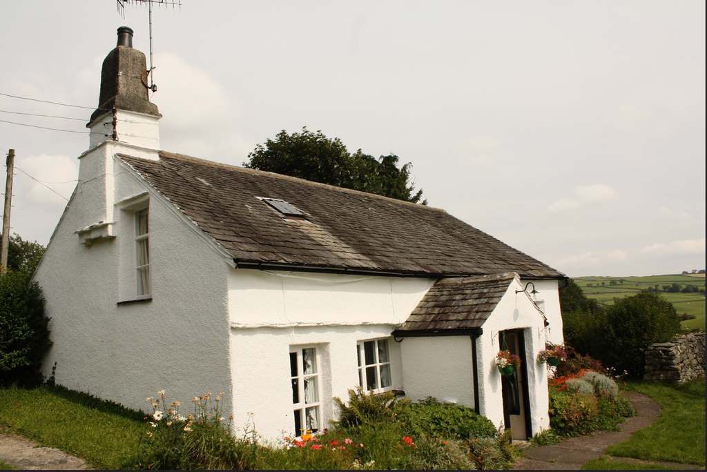
| Description | : | aka Windermere Burial Ground "The Meeting House is crude in the extreme but strongly built and entirely in the manner used in building about here nearly 300 years ago. It is almost buried amongst trees; grand old limes towering above it on all sides. The Burial Ground is a small and square plot at the east end of the House. The House is now used as a cottage [ie:private residence]." - Mislet Meeting House and Burial Ground. The Friend (London), vol. 35 (1895) p. 57. |
frequently asked questions (FAQ):
-
Where is Mislet & Broadgate Quaker Burial Ground?
Mislet & Broadgate Quaker Burial Ground is located at Windermere, South Lakeland District ,Cumbria ,England.
-
Mislet & Broadgate Quaker Burial Ground cemetery's updated grave count on graveviews.com?
0 memorials
-
Where are the coordinates of the Mislet & Broadgate Quaker Burial Ground?
Latitude: 54.3892040
Longitude: -2.8756960
Nearby Cemetories:
1. St. Anne's Churchyard
Ings, South Lakeland District, England
Coordinate: 54.3802940, -2.8541350
2. Saint Mary's Churchyard
Windermere, South Lakeland District, England
Coordinate: 54.3810140, -2.9099750
3. Windermere Cemetery
Windermere, South Lakeland District, England
Coordinate: 54.3823360, -2.9173970
4. Jesus Church Churchyard
Troutbeck, South Lakeland District, England
Coordinate: 54.4170100, -2.9064230
5. St James Churchyard
Staveley, South Lakeland District, England
Coordinate: 54.3801350, -2.8183670
6. Saint Martin's Churchyard
Bowness-on-Windermere, South Lakeland District, England
Coordinate: 54.3639680, -2.9208950
7. Bowness-on-Windermere Cemetery
Bowness-on-Windermere, South Lakeland District, England
Coordinate: 54.3584760, -2.9238880
8. St. Catherine's Churchyard
Crook, South Lakeland District, England
Coordinate: 54.3480260, -2.8462220
9. St Cuthbert Churchyard
Kentmere, South Lakeland District, England
Coordinate: 54.4294920, -2.8396150
10. Crook Chapel of Saint Catherine
Crook, South Lakeland District, England
Coordinate: 54.3445250, -2.8477290
11. Saint Margarets Churchyard
Low Wray, South Lakeland District, England
Coordinate: 54.3982680, -2.9688040
12. Holy Trinity Churchyard
Winster, South Lakeland District, England
Coordinate: 54.3298460, -2.8974880
13. St. Peter's Churchyard
Far Sawrey, South Lakeland District, England
Coordinate: 54.3480230, -2.9582610
14. St. Anne's Churchyard
Ambleside, South Lakeland District, England
Coordinate: 54.4337370, -2.9610400
15. St. Mary The Virgin Churchyard
Ambleside, South Lakeland District, England
Coordinate: 54.4307600, -2.9661900
16. Society of Friends Burial Ground
Hawkshead, South Lakeland District, England
Coordinate: 54.3739240, -2.9889880
17. St Mary Churchyard
Longsleddale, South Lakeland District, England
Coordinate: 54.4189730, -2.7706810
18. All Saints Churchyard
Underbarrow, South Lakeland District, England
Coordinate: 54.3262900, -2.8268240
19. Holy Trinity Churchyard
Brathay, South Lakeland District, England
Coordinate: 54.4209960, -2.9845050
20. St. Michael's And All Angels Churchyard
Hawkshead, South Lakeland District, England
Coordinate: 54.3742210, -2.9988740
21. St Oswald Churchyard
Burneside, South Lakeland District, England
Coordinate: 54.3546500, -2.7634950
22. St. Mary's Churchyard
Crosthwaite, South Lakeland District, England
Coordinate: 54.3129300, -2.8526100
23. Crosthwaite Cemetery
Crosthwaite, South Lakeland District, England
Coordinate: 54.3126000, -2.8546900
24. St. Mary's Churchyard
Rydal, South Lakeland District, England
Coordinate: 54.4472230, -2.9818800

