
| Memorials | : | 65 |
| Location | : | Kildale, Hambleton District, England |
| Coordinate | : | 54.4779100, -1.0689200 |
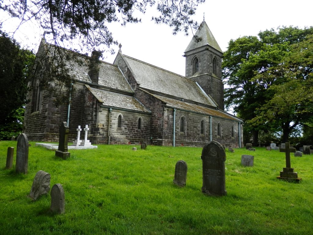
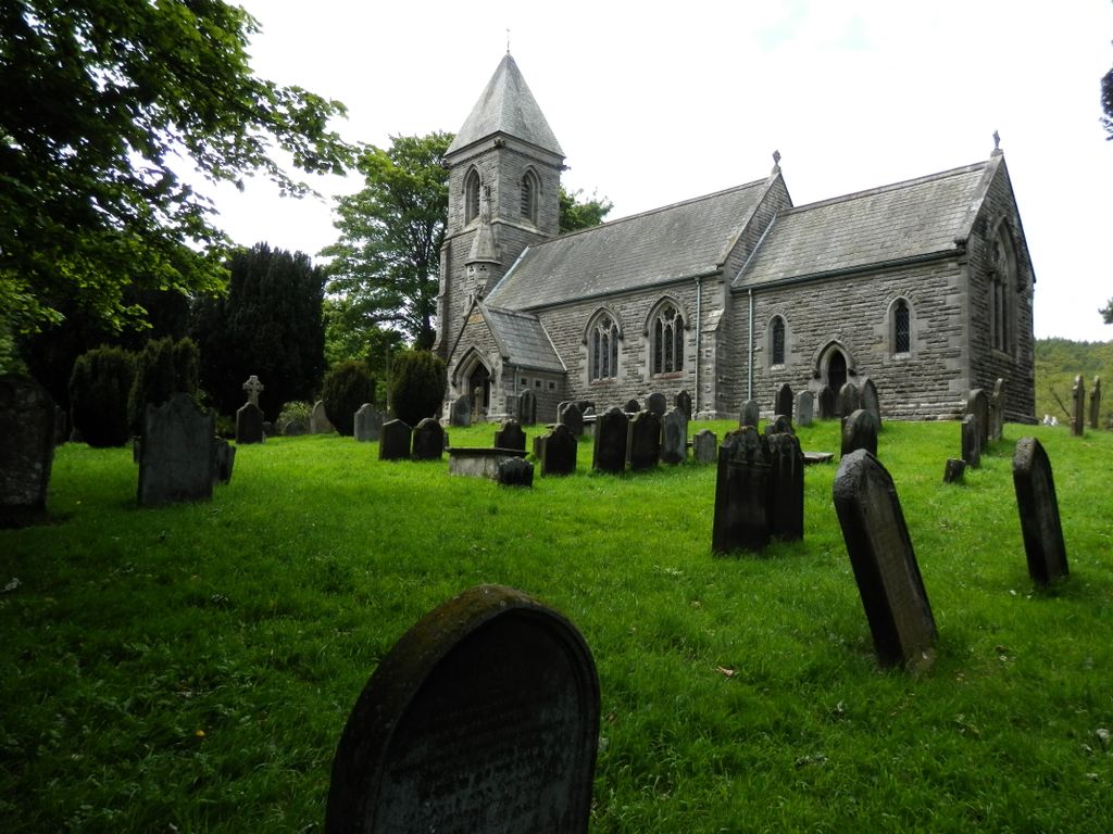
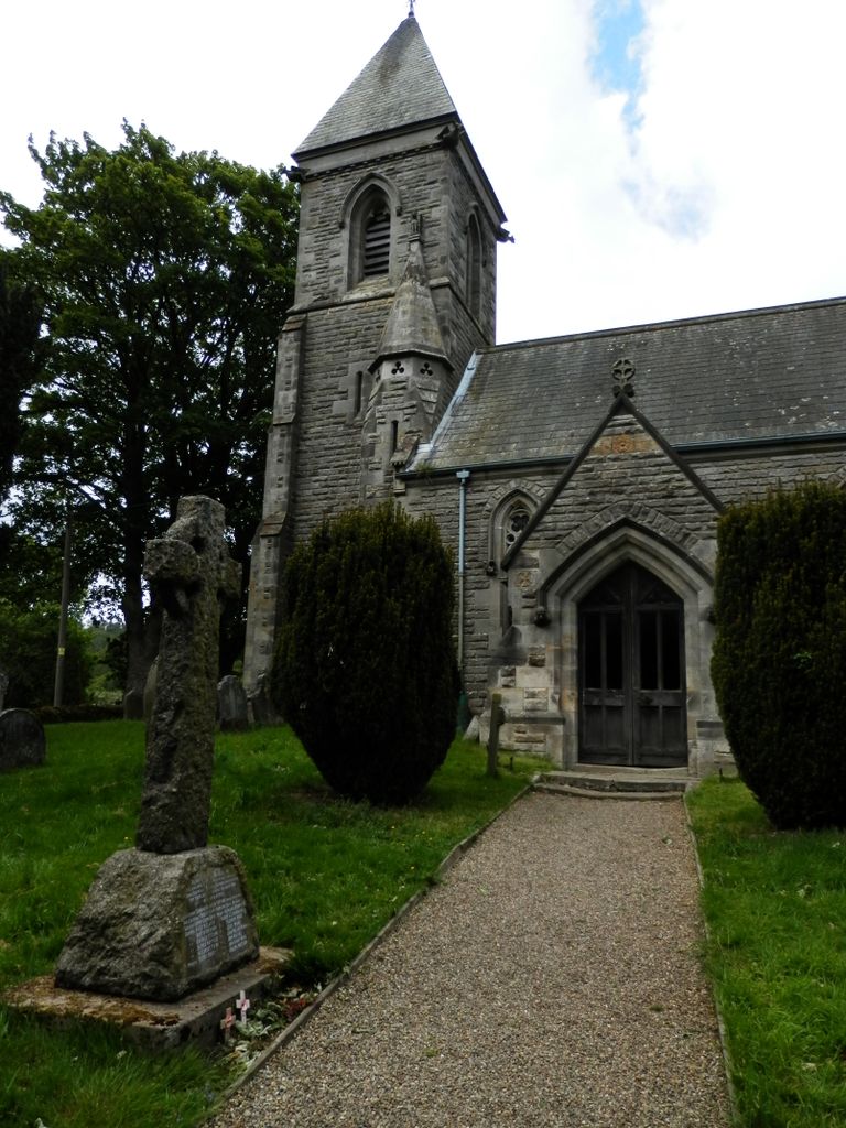
| Description | : | Kildale is a village and civil parish in Hambleton district of North Yorkshire, England. It lies approximately 3 miles (4.8 km) south-east from Great Ayton. The parish church was built in 1868 in dedication to St Cuthbert. It replaced an earlier church of Norman origin and is approached across a footbridge situated at the western end of Kildale Station on the Esk Valley Railway Line (Middlesbrough - Whitby). The churchyard is still in use and affords good views of the surrounding countryside. |
frequently asked questions (FAQ):
-
Where is St Cuthbert Churchyard?
St Cuthbert Churchyard is located at Station Road Kildale, Hambleton District ,North Yorkshire , YO21 2RJEngland.
-
St Cuthbert Churchyard cemetery's updated grave count on graveviews.com?
65 memorials
-
Where are the coordinates of the St Cuthbert Churchyard?
Latitude: 54.4779100
Longitude: -1.0689200
Nearby Cemetories:
1. Emerson Family Mausoleum
Easby, Hambleton District, England
Coordinate: 54.4702280, -1.1098760
2. St. Andrew's Churchyard
Ingleby Greenhow, Hambleton District, England
Coordinate: 54.4487300, -1.1051300
3. Friends Burial Ground
Great Ayton, Hambleton District, England
Coordinate: 54.4880800, -1.1315580
4. Great Ayton Cemetery
Great Ayton, Hambleton District, England
Coordinate: 54.4931360, -1.1390010
5. All Saints Churchyard
Great Ayton, Hambleton District, England
Coordinate: 54.4897000, -1.1429000
6. St. Oswald's Churchyard
Newton under Roseberry, Redcar and Cleveland Unitary Authority, England
Coordinate: 54.5115243, -1.1223073
7. St Peter Churchyard
Commondale, Scarborough Borough, England
Coordinate: 54.4863700, -0.9766200
8. Quakers Burial Ground
Guisborough, Redcar and Cleveland Unitary Authority, England
Coordinate: 54.5355100, -1.0569760
9. Guisborough Priory
Guisborough, Redcar and Cleveland Unitary Authority, England
Coordinate: 54.5361700, -1.0489500
10. St. Nicholas Churchyard
Guisborough, Redcar and Cleveland Unitary Authority, England
Coordinate: 54.5366500, -1.0482800
11. Christ Church Churchyard Westerdale
Westerdale, Scarborough Borough, England
Coordinate: 54.4450870, -0.9781360
12. St. Augustine's Churchyard
Kirkby-in-Cleveland, Hambleton District, England
Coordinate: 54.4470300, -1.1715250
13. St Peter and St Paul Churchyard Cemetery Extension
Stokesley, Hambleton District, England
Coordinate: 54.4693040, -1.1853160
14. Guisborough Cemetery
Guisborough, Redcar and Cleveland Unitary Authority, England
Coordinate: 54.5448330, -1.0430940
15. St Mary Churchyard
Nunthorpe, Middlesbrough Unitary Authority, England
Coordinate: 54.5187530, -1.1670180
16. St Peter and St Paul Churchyard
Stokesley, Hambleton District, England
Coordinate: 54.4696430, -1.1902080
17. Quakers Burial Ground
Castleton, Scarborough Borough, England
Coordinate: 54.4614010, -0.9478360
18. Westerdale Green Burial Ground
Westerdale, Scarborough Borough, England
Coordinate: 54.4409040, -0.9555864
19. St Aidan Churchyard
Boosbeck, Redcar and Cleveland Unitary Authority, England
Coordinate: 54.5428560, -0.9786800
20. Boosbeck Cemetery
Boosbeck, Redcar and Cleveland Unitary Authority, England
Coordinate: 54.5434900, -0.9779200
21. St. Hilda's Churchyard
Chop Gate, Hambleton District, England
Coordinate: 54.3988950, -1.1299120
22. St Hilda Churchyard
Danby, Scarborough Borough, England
Coordinate: 54.4475240, -0.9281480
23. St Mary Churchyard
Moorsholm, Redcar and Cleveland Unitary Authority, England
Coordinate: 54.5207800, -0.9375800
24. St. Cuthbert's Churchyard
Ormesby, Middlesbrough Unitary Authority, England
Coordinate: 54.5428600, -1.1808090