
| Memorials | : | 0 |
| Location | : | Silk Willoughby, North Kesteven District, England |
| Coordinate | : | 52.9736976, -0.4263297 |
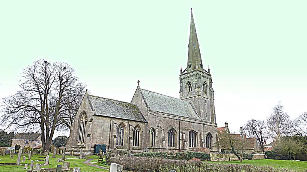
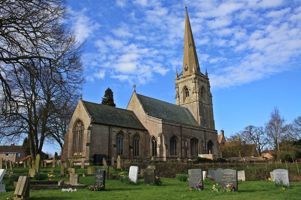
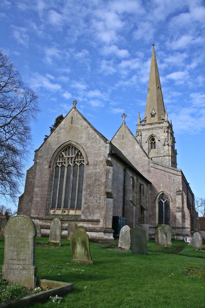
| Description | : | The church of St Denis/St Denys was built in the 12th century in Decorated style, and extended in the 14th in Perpendicular. It was extensively restored in the early 20th century. The Anglican parish register dates from 1559. The person for whom the present church was built was William Armine,who bought the manors of Silkby and Wilgebi (hence Silk Willoughby) from Rodger de Mortayne and Isabelle,his wife, in 1329/30.He became Bishop of Norwich( 1325-1336), Lord Chancellor of England (1326) and Lord High Treasurer (1331-1332). His tomb can be found in the Chancel. |
frequently asked questions (FAQ):
-
Where is St Denys Churchyard?
St Denys Churchyard is located at Silk Willoughby, North Kesteven District ,Lincolnshire ,England.
-
St Denys Churchyard cemetery's updated grave count on graveviews.com?
0 memorials
-
Where are the coordinates of the St Denys Churchyard?
Latitude: 52.9736976
Longitude: -0.4263297
Nearby Cemetories:
1. St. Denis Churchyard
Silk Willoughby, North Kesteven District, England
Coordinate: 52.9738460, -0.4268830
2. St Botolph Churchyard
Quarrington, North Kesteven District, England
Coordinate: 52.9872010, -0.4312350
3. Rauceby Hospital Cemetery
Quarrington, North Kesteven District, England
Coordinate: 52.9807077, -0.4549731
4. St Denys Churchyard
Sleaford, North Kesteven District, England
Coordinate: 52.9996510, -0.4088960
5. Sleaford Cemetery
Sleaford, North Kesteven District, England
Coordinate: 53.0027590, -0.4056790
6. St Thomas Churchyard
Aunsby, North Kesteven District, England
Coordinate: 52.9367820, -0.4470450
7. St. Andrew's Churchyard
Scredington, North Kesteven District, England
Coordinate: 52.9498300, -0.3701700
8. St Peter & St Paul Churchyard
Osbournby, North Kesteven District, England
Coordinate: 52.9298800, -0.4105100
9. St Peter's Churchyard
North Rauceby, North Kesteven District, England
Coordinate: 53.0056400, -0.4796500
10. St. Mary's Churchyard
Wilsford, North Kesteven District, England
Coordinate: 52.9751600, -0.5023700
11. St. Denys Churchyard
Kirkby la Thorpe, North Kesteven District, England
Coordinate: 53.0008270, -0.3636800
12. St. Lucia Churchyard
Dembleby, North Kesteven District, England
Coordinate: 52.9268000, -0.4512300
13. St Andrew Churchyard
Leasingham, North Kesteven District, England
Coordinate: 53.0239040, -0.4262600
14. St Andrew Churchyard
Kelby, North Kesteven District, England
Coordinate: 52.9608000, -0.5074000
15. St. Andrew's Churchyard
South Kesteven District, England
Coordinate: 52.9608000, -0.5074000
16. St. Michael's and All Angels Churchyard
Heydour, South Kesteven District, England
Coordinate: 52.9444900, -0.4987800
17. Saint Michael Churchyard
Heydour, South Kesteven District, England
Coordinate: 52.9443700, -0.4987000
18. St. Andrew Churchyard
Burton Pedwardine, North Kesteven District, England
Coordinate: 52.9646176, -0.3348618
19. St. Andrew's Churchyard
Asgarby, North Kesteven District, England
Coordinate: 52.9941750, -0.3383450
20. St Andrew Churchyard
Cranwell, North Kesteven District, England
Coordinate: 53.0370660, -0.4612070
21. St. Martin Churchyard
Ancaster, South Kesteven District, England
Coordinate: 52.9804810, -0.5377820
22. St Peter Church
Threekingham, North Kesteven District, England
Coordinate: 52.9116000, -0.3812000
23. Ancaster Cemetery
Ancaster, South Kesteven District, England
Coordinate: 52.9814450, -0.5387892
24. St Nicholas Churchyard
Walcot, North Kesteven District, England
Coordinate: 52.9035930, -0.4252890