
| Memorials | : | 4 |
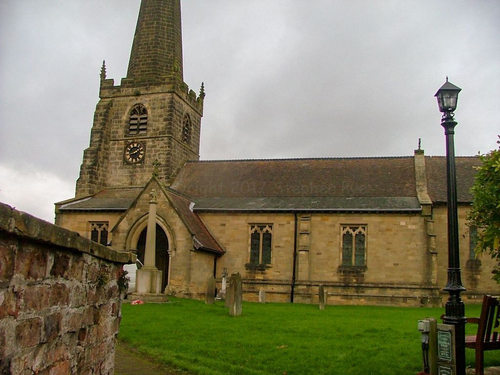
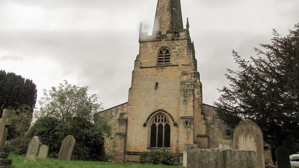
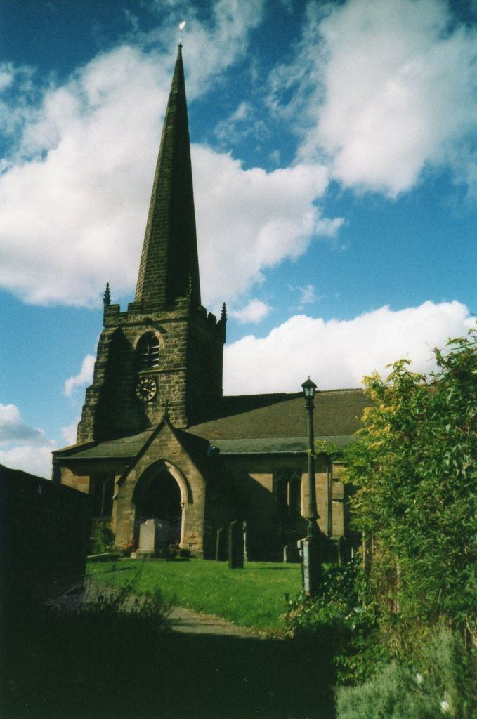
| Location | : | Bishop Wilton, East Riding of Yorkshire Unitary Authority, England |
| Coordinate | : | 53.9862300, -0.7838500 |
frequently asked questions (FAQ):
-
Where is St. Edith Churchyard?
St. Edith Churchyard is located at Bishop Wilton, East Riding of Yorkshire Unitary Authority ,East Riding of Yorkshire ,England.
-
St. Edith Churchyard cemetery's updated grave count on graveviews.com?
4 memorials
-
Where are the coordinates of the St. Edith Churchyard?
Latitude: 53.9862300
Longitude: -0.7838500

Nearby Cemetories:
1. St Ethelburga Churchyard
Great Givendale, East Riding of Yorkshire Unitary Authority, England
Coordinate: 53.9745030, -0.7617170
2. All Saints Churchyard
Kirby Underdale, East Riding of Yorkshire Unitary Authority, England
Coordinate: 54.0166200, -0.7677100
3. St Martin Churchyard
Fangfoss, East Riding of Yorkshire Unitary Authority, England
Coordinate: 53.9704970, -0.8324690
4. St Andrew Churchyard
Bugthorpe, East Riding of Yorkshire Unitary Authority, England
Coordinate: 54.0108100, -0.8226900
5. St Mary Churchyard
Full Sutton, East Riding of Yorkshire Unitary Authority, England
Coordinate: 53.9897620, -0.8613700
6. St Catherine Churchyard
Barmby Moor, East Riding of Yorkshire Unitary Authority, England
Coordinate: 53.9307670, -0.8189520
7. St John the Baptist
Acklam, Ryedale District, England
Coordinate: 54.0451010, -0.8006330
8. St John the Evangelist Churchyard
Buttercrambe, Ryedale District, England
Coordinate: 54.0137300, -0.8812900
9. St. Mary's Churchyard
Thixendale, Ryedale District, England
Coordinate: 54.0387360, -0.7154888
10. St Botolph Churchyard
Allerthorpe, East Riding of Yorkshire Unitary Authority, England
Coordinate: 53.9171530, -0.8052080
11. Saint Mary's Churchyard
Huggate, East Riding of Yorkshire Unitary Authority, England
Coordinate: 53.9878100, -0.6560000
12. St Peter and St Paul Churchyard
Scrayingham, Ryedale District, England
Coordinate: 54.0342510, -0.8826130
13. St. Mary's Churchyard
Fridaythorpe, East Riding of Yorkshire Unitary Authority, England
Coordinate: 54.0220090, -0.6667190
14. St Martin Churchyard
Hayton, East Riding of Yorkshire Unitary Authority, England
Coordinate: 53.9038010, -0.7518530
15. All Saints Churchyard
Low Catton, East Riding of Yorkshire Unitary Authority, England
Coordinate: 53.9769280, -0.9268720
16. St Giles Churchyard
Burnby, East Riding of Yorkshire Unitary Authority, England
Coordinate: 53.9067790, -0.7292650
17. St Botolph Churchyard
Bossall, Ryedale District, England
Coordinate: 54.0375570, -0.9047540
18. Howsham Churchyard
Howsham, Ryedale District, England
Coordinate: 54.0565520, -0.8755670
19. Burythorpe Churchyard
Burythorpe, Ryedale District, England
Coordinate: 54.0752951, -0.7955984
20. St Mary Churchyard
Birdsall, Ryedale District, England
Coordinate: 54.0780000, -0.7508000
21. St Peter Churchyard
Upper Helmsley, Ryedale District, England
Coordinate: 54.0044650, -0.9409770
22. St Paul Churchyard
Kexby, York Unitary Authority, England
Coordinate: 53.9505970, -0.9339900
23. St. Mary's Churchyard
Gate Helmsley, Ryedale District, England
Coordinate: 53.9883720, -0.9481980
24. St. Martin Churchyard
Wharram Percy, Ryedale District, England
Coordinate: 54.0665700, -0.6901300