
| Memorials | : | 17 |
| Location | : | Thixendale, Ryedale District, England |
| Coordinate | : | 54.0387360, -0.7154888 |
frequently asked questions (FAQ):
-
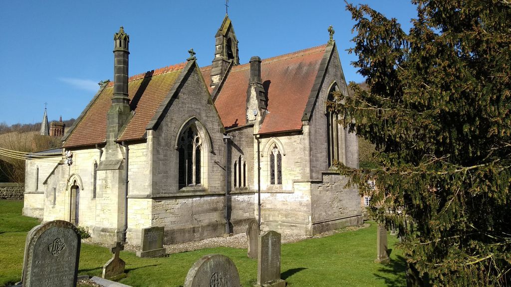
Where is St. Mary's Churchyard?
St. Mary's Churchyard is located at Thixendale, Ryedale District ,North Yorkshire ,England.
-
St. Mary's Churchyard cemetery's updated grave count on graveviews.com?
17 memorials
-
Where are the coordinates of the St. Mary's Churchyard?
Latitude: 54.0387360
Longitude: -0.7154888
Nearby Cemetories:
1. St. Martin Churchyard
Wharram Percy, Ryedale District, England
Coordinate: 54.0665700, -0.6901300
2. St. Mary's Churchyard
Fridaythorpe, East Riding of Yorkshire Unitary Authority, England
Coordinate: 54.0220090, -0.6667190
3. All Saints Churchyard
Kirby Underdale, East Riding of Yorkshire Unitary Authority, England
Coordinate: 54.0166200, -0.7677100
4. St Mary Churchyard
Birdsall, Ryedale District, England
Coordinate: 54.0780000, -0.7508000
5. St. Mary's Churchyard
Fimber, East Riding of Yorkshire Unitary Authority, England
Coordinate: 54.0337830, -0.6361950
6. St. Mary's Churchyard
Wharram le Street, Ryedale District, England
Coordinate: 54.0820040, -0.6810779
7. St John the Baptist
Acklam, Ryedale District, England
Coordinate: 54.0451010, -0.8006330
8. Burythorpe Churchyard
Burythorpe, Ryedale District, England
Coordinate: 54.0752951, -0.7955984
9. St. Nicholas Churchyard
North Grimston, Ryedale District, England
Coordinate: 54.0989220, -0.7148680
10. Saint Mary's Churchyard
Huggate, East Riding of Yorkshire Unitary Authority, England
Coordinate: 53.9878100, -0.6560000
11. St. Edith Churchyard
Bishop Wilton, East Riding of Yorkshire Unitary Authority, England
Coordinate: 53.9862300, -0.7838500
12. St Andrew Churchyard
Langton, Ryedale District, England
Coordinate: 54.0934510, -0.7834680
13. St Andrew Churchyard
Bugthorpe, East Riding of Yorkshire Unitary Authority, England
Coordinate: 54.0108100, -0.8226900
14. St Ethelburga Churchyard
Great Givendale, East Riding of Yorkshire Unitary Authority, England
Coordinate: 53.9745030, -0.7617170
15. St. Andrew's Churchyard
Kirby Grindalythe, Ryedale District, England
Coordinate: 54.0955440, -0.6200050
16. All Saints Churchyard
Settrington, Ryedale District, England
Coordinate: 54.1212780, -0.7178830
17. St. Mary's Churchyard
Westow, Ryedale District, England
Coordinate: 54.0846190, -0.8406850
18. Settrington Cemetery
Settrington, Ryedale District, England
Coordinate: 54.1254200, -0.7221700
19. Howsham Churchyard
Howsham, Ryedale District, England
Coordinate: 54.0565520, -0.8755670
20. St Martin Churchyard
Fangfoss, East Riding of Yorkshire Unitary Authority, England
Coordinate: 53.9704970, -0.8324690
21. St Peter and St Paul Churchyard
Scrayingham, Ryedale District, England
Coordinate: 54.0342510, -0.8826130
22. St Mary Churchyard
Full Sutton, East Riding of Yorkshire Unitary Authority, England
Coordinate: 53.9897620, -0.8613700
23. St Peter Churchyard
Norton, Ryedale District, England
Coordinate: 54.1289040, -0.7861910
24. Norton Cemetery
Norton, Ryedale District, England
Coordinate: 54.1306400, -0.7834200