
| Memorials | : | 0 |
| Location | : | Emneth, Kings Lynn and West Norfolk Borough, England |
| Coordinate | : | 52.6438200, 0.1989100 |
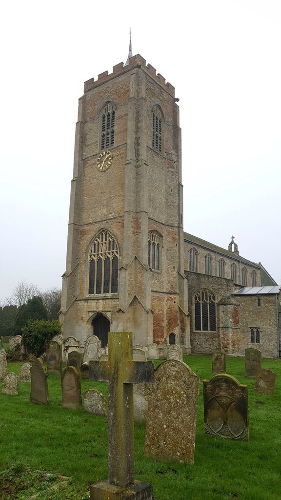
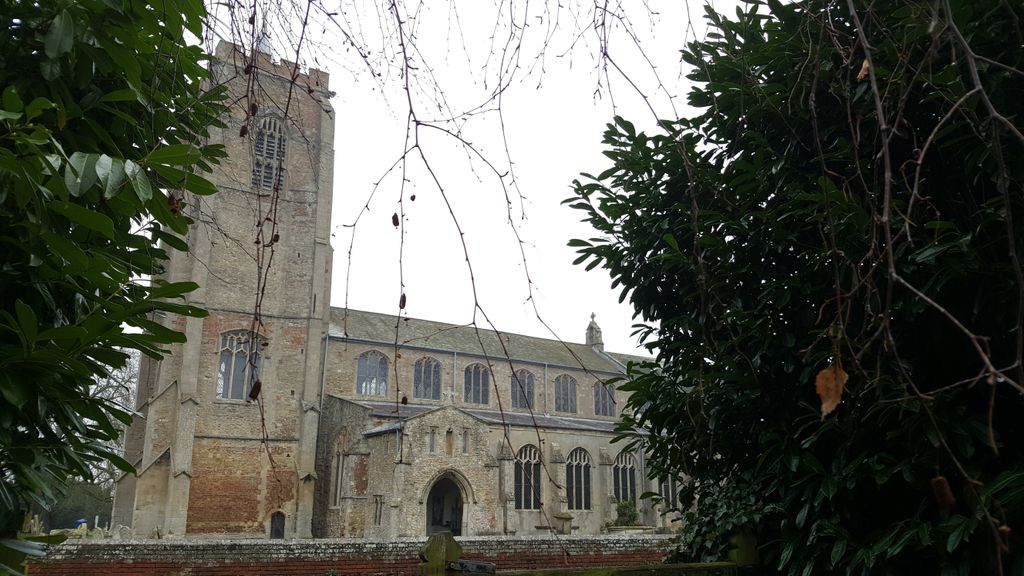
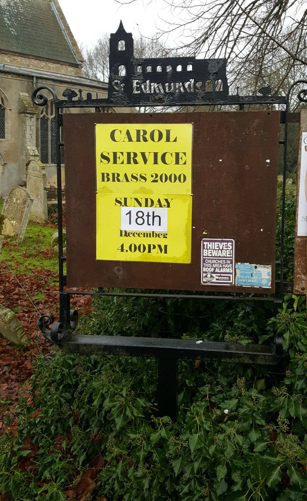
| Description | : | The oldest memorials are coffin-lids, one with a border and a cross of leaves. Only the matrix is left of the 11-foot-long brass of a cross-legged knight dressed in chain mail of about 1300. Sir Thomas Hewar, who died in 1631, planned for himself the fine alabaster tomb on which he lies in gold and white armour and a ruff, with his wife in a black gown and ruff. He had paid Nicholas Stone a London Mason the huge sum of £95 for the tomb in 1617. At their feet lies a sleeping child. The Reverend Wilbert Awdry, the author of... Read More |
frequently asked questions (FAQ):
-
Where is St. Edmund Churchyard?
St. Edmund Churchyard is located at Church Road Emneth, Kings Lynn and West Norfolk Borough ,Norfolk , PE14 8AFEngland.
-
St. Edmund Churchyard cemetery's updated grave count on graveviews.com?
0 memorials
-
Where are the coordinates of the St. Edmund Churchyard?
Latitude: 52.6438200
Longitude: 0.1989100
Nearby Cemetories:
1. All Saints
Wisbech, Fenland District, England
Coordinate: 52.6398010, 0.1707000
2. Elm Cemetery
Wisbech, Fenland District, England
Coordinate: 52.6360700, 0.1691800
3. St Peter & St Paul Churchyard
Wisbech, Fenland District, England
Coordinate: 52.6639880, 0.1626020
4. All Saints Churchyard
Walsoken, Kings Lynn and West Norfolk Borough, England
Coordinate: 52.6721700, 0.1816130
5. St Augustine Churchyard
Wisbech, Fenland District, England
Coordinate: 52.6679000, 0.1633300
6. Marshland St. James Cemetery
Marshland St James, Kings Lynn and West Norfolk Borough, England
Coordinate: 52.6604540, 0.2465520
7. Mount Pleasant Cemetery
Wisbech, Fenland District, England
Coordinate: 52.6719840, 0.1644770
8. St. Clement Churchyard
Outwell, Kings Lynn and West Norfolk Borough, England
Coordinate: 52.6096650, 0.2340700
9. Outwell Cemetery
Outwell, Kings Lynn and West Norfolk Borough, England
Coordinate: 52.6092800, 0.2363600
10. Upwell Cemetery
Upwell, Kings Lynn and West Norfolk Borough, England
Coordinate: 52.6023700, 0.2229300
11. St. Peter's Churchyard
Upwell, Kings Lynn and West Norfolk Borough, England
Coordinate: 52.6018160, 0.2219280
12. Upwell Baptist Chapel
Upwell, Kings Lynn and West Norfolk Borough, England
Coordinate: 52.5878110, 0.2070450
13. St Mary Churchyard
Wisbech St Mary, Fenland District, England
Coordinate: 52.6523950, 0.0983170
14. Gorefield Congregational Churchyard
Gorefield, Fenland District, England
Coordinate: 52.6865500, 0.0968700
15. St Paul Churchyard
Gorefield, Fenland District, England
Coordinate: 52.6873400, 0.0944700
16. Guyhirn Old Churchyard
Guyhirn, Fenland District, England
Coordinate: 52.6155700, 0.0714900
17. St. Peter's Churchyard
Walpole, Kings Lynn and West Norfolk Borough, England
Coordinate: 52.7284200, 0.2219100
18. Tilney St. Lawrence Churchyard
Tilney St Lawrence, Kings Lynn and West Norfolk Borough, England
Coordinate: 52.7089510, 0.2923460
19. Nordelph Cemetery
Nordelph, Kings Lynn and West Norfolk Borough, England
Coordinate: 52.5836400, 0.3015100
20. Walpole St Andrew - Extension
Walpole, Kings Lynn and West Norfolk Borough, England
Coordinate: 52.7314600, 0.2162800
21. St. John's Churchyard
Terrington St John, Kings Lynn and West Norfolk Borough, England
Coordinate: 52.7183750, 0.2778270
22. Walpole St Andrew
Walpole, Kings Lynn and West Norfolk Borough, England
Coordinate: 52.7349520, 0.2227630
23. St. Peter's Churchyard
Stow Bridge, Kings Lynn and West Norfolk Borough, England
Coordinate: 52.6312500, 0.3508300
24. Christ Church Churchyard
Christchurch, Fenland District, England
Coordinate: 52.5456560, 0.2007360