
| Memorials | : | 0 |
| Location | : | Guyhirn, Fenland District, England |
| Coordinate | : | 52.6155700, 0.0714900 |
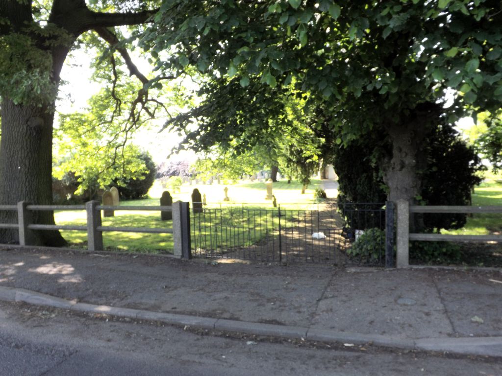
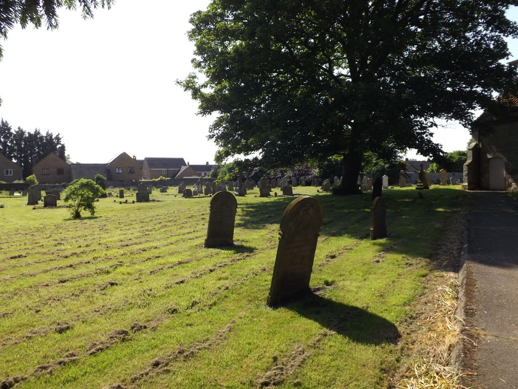
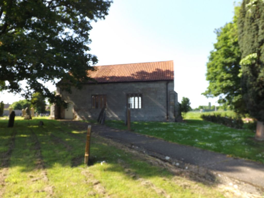
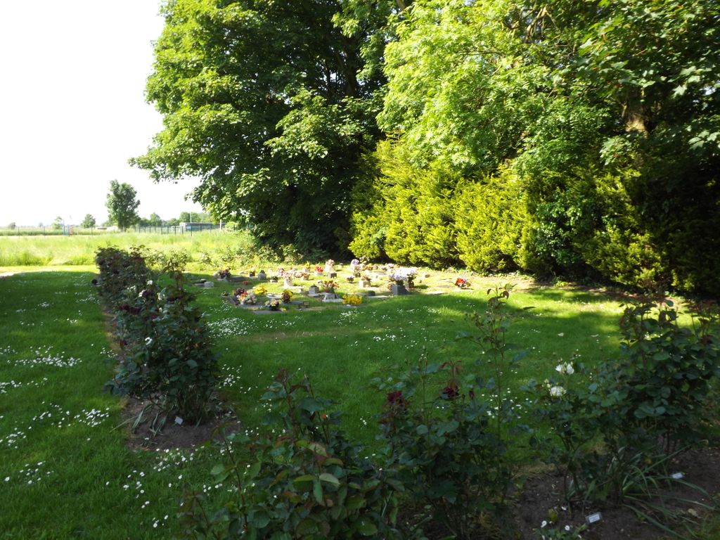
| Description | : | Guyhirn is a small village near the town of Wisbech in Cambridgeshire, England. The village sits on the northern bank of the River Nene. It is at a junction of two major "A" roads, where the A141 leaves the A47.This is on the road to Wisbech. The old Church has been partly demolished. |
frequently asked questions (FAQ):
-
Where is Guyhirn Old Churchyard?
Guyhirn Old Churchyard is located at High Road Guyhirn, Fenland District ,Cambridgeshire ,England.
-
Guyhirn Old Churchyard cemetery's updated grave count on graveviews.com?
0 memorials
-
Where are the coordinates of the Guyhirn Old Churchyard?
Latitude: 52.6155700
Longitude: 0.0714900
Nearby Cemetories:
1. St Mary Churchyard
Wisbech St Mary, Fenland District, England
Coordinate: 52.6523950, 0.0983170
2. Emmanual Anglican Cemetery
Parson Drove, Fenland District, England
Coordinate: 52.6574955, 0.0285929
3. St. Mary's Churchyard
March, Fenland District, England
Coordinate: 52.5648400, 0.0632100
4. Station Road Cemetery
March, Fenland District, England
Coordinate: 52.5565100, 0.0920400
5. Elm Cemetery
Wisbech, Fenland District, England
Coordinate: 52.6360700, 0.1691800
6. All Saints
Wisbech, Fenland District, England
Coordinate: 52.6398010, 0.1707000
7. Gorefield Congregational Churchyard
Gorefield, Fenland District, England
Coordinate: 52.6865500, 0.0968700
8. St Paul Churchyard
Gorefield, Fenland District, England
Coordinate: 52.6873400, 0.0944700
9. St Peter & St Paul Churchyard
Wisbech, Fenland District, England
Coordinate: 52.6639880, 0.1626020
10. Eastwood Cemetery
March, Fenland District, England
Coordinate: 52.5433080, 0.0954320
11. St Augustine Churchyard
Wisbech, Fenland District, England
Coordinate: 52.6679000, 0.1633300
12. St. Wendreda's Churchyard
March, Fenland District, England
Coordinate: 52.5364880, 0.0849940
13. Mount Pleasant Cemetery
Wisbech, Fenland District, England
Coordinate: 52.6719840, 0.1644770
14. St. Edmund Churchyard
Emneth, Kings Lynn and West Norfolk Borough, England
Coordinate: 52.6438200, 0.1989100
15. Upwell Baptist Chapel
Upwell, Kings Lynn and West Norfolk Borough, England
Coordinate: 52.5878110, 0.2070450
16. Holy Trinity Churchyard
Gedney Hill, South Holland District, England
Coordinate: 52.6826080, -0.0211840
17. All Saints Churchyard
Walsoken, Kings Lynn and West Norfolk Borough, England
Coordinate: 52.6721700, 0.1816130
18. St. Peter's Churchyard
Upwell, Kings Lynn and West Norfolk Borough, England
Coordinate: 52.6018160, 0.2219280
19. Upwell Cemetery
Upwell, Kings Lynn and West Norfolk Borough, England
Coordinate: 52.6023700, 0.2229300
20. St. Clement Churchyard
Outwell, Kings Lynn and West Norfolk Borough, England
Coordinate: 52.6096650, 0.2340700
21. Outwell Cemetery
Outwell, Kings Lynn and West Norfolk Borough, England
Coordinate: 52.6092800, 0.2363600
22. Holy Trinity Churchyard
Coates, Fenland District, England
Coordinate: 52.5626500, -0.0756700
23. Christ Church Churchyard
Christchurch, Fenland District, England
Coordinate: 52.5456560, 0.2007360
24. Thorney Cemetery
Thorney, Peterborough Unitary Authority, England
Coordinate: 52.6163700, -0.1044200