
| Memorials | : | 3 |
| Location | : | Motupiko, Tasman District, New Zealand |
| Coordinate | : | -41.4559860, 172.8137230 |
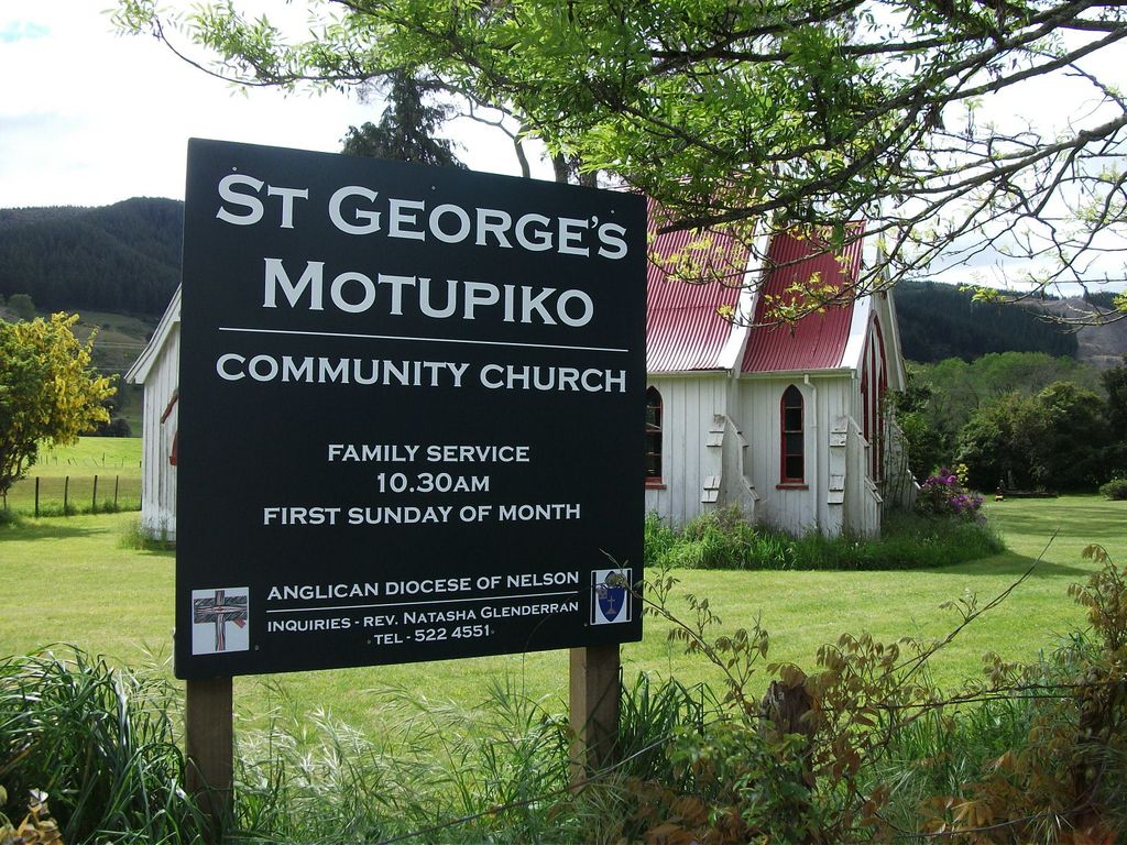
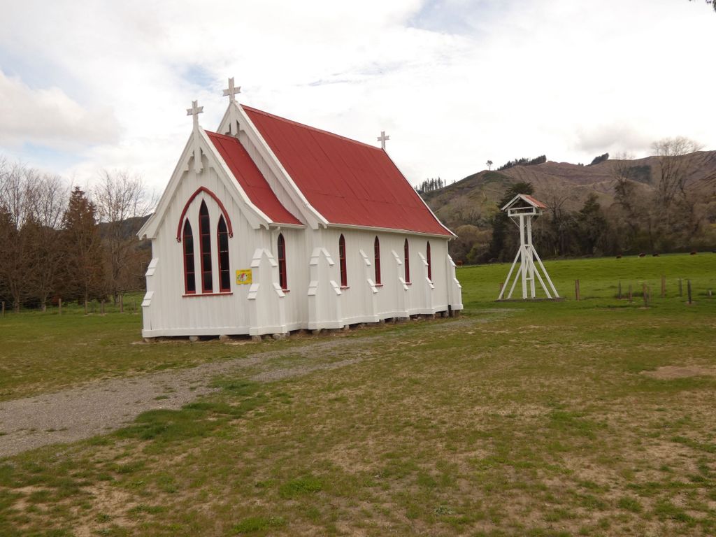
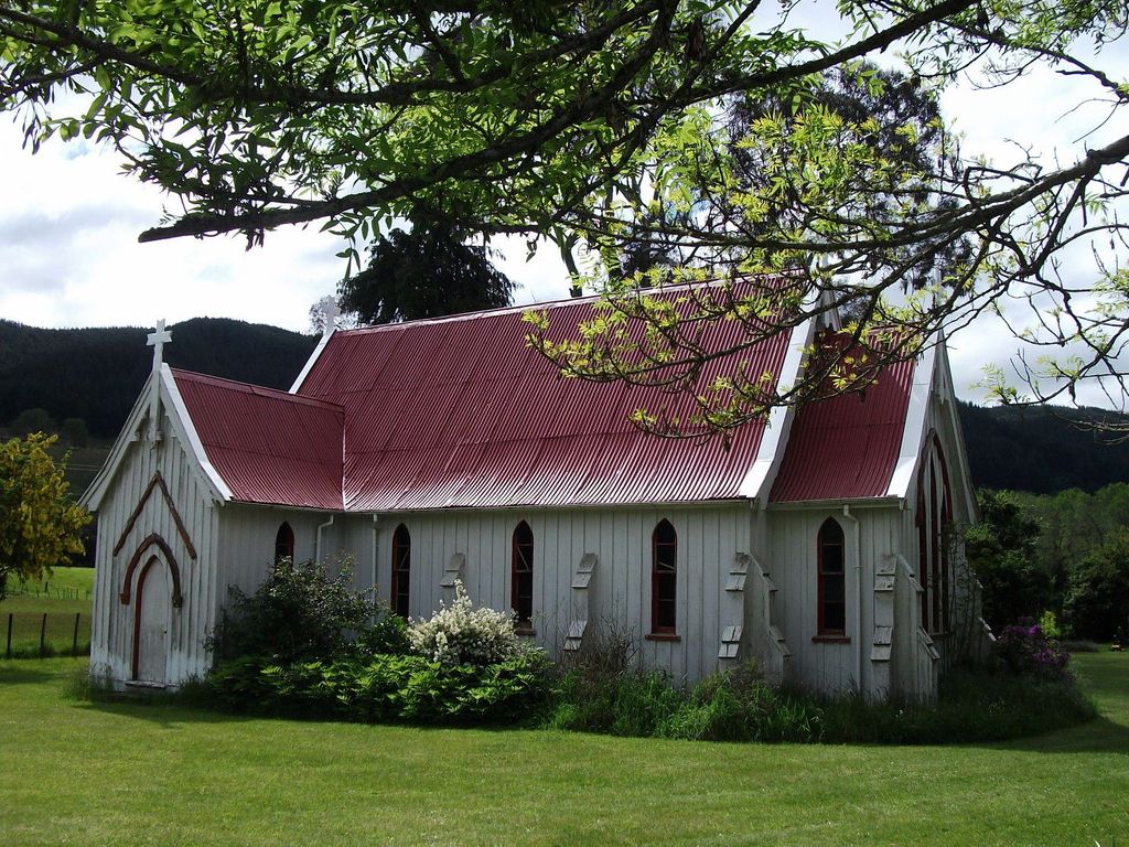
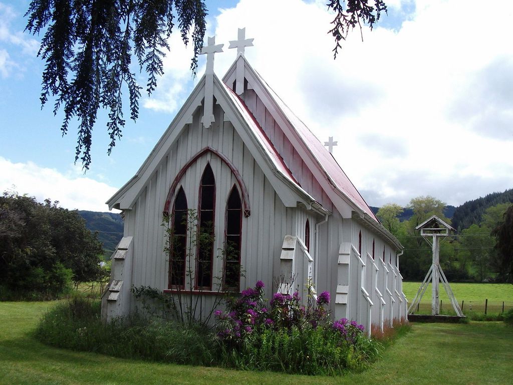
| Description | : | When travelling along the straight stretch of State Highway 6 which passes through Motupiko, St George's Church is located at the southern end on the west side of the road after a gentle bend. There is a sign directing people to Quinney's Bush approximately 100m south of the church. |
frequently asked questions (FAQ):
-
Where is St. George's Anglican Churchyard?
St. George's Anglican Churchyard is located at 228 Kohatu-Kawatiri Highwa Motupiko, Tasman District ,Tasman , 7072New Zealand.
-
St. George's Anglican Churchyard cemetery's updated grave count on graveviews.com?
3 memorials
-
Where are the coordinates of the St. George's Anglican Churchyard?
Latitude: -41.4559860
Longitude: 172.8137230
Nearby Cemetories:
1. St. James Anglican Churchyard
Tadmor, Tasman District, New Zealand
Coordinate: -41.4340550, 172.7595360
2. Mararewa Cemetery
Tapawera, Tasman District, New Zealand
Coordinate: -41.4125200, 172.8399180
3. Foxhill Cemetery
Foxhill, Tasman District, New Zealand
Coordinate: -41.4421470, 172.9618070
4. Drovers Graves
Golden Downs, Tasman District, New Zealand
Coordinate: -41.5658300, 172.8880600
5. Stanley Brook Cemetery
Stanley Brook, Tasman District, New Zealand
Coordinate: -41.3311820, 172.8206200
6. Dovedale Cemetery
Dovedale, Tasman District, New Zealand
Coordinate: -41.2900770, 172.8970380
7. Saint Johns Churchyard
Wakefield, Tasman District, New Zealand
Coordinate: -41.4101250, 173.0479030
8. Saint Joseph's Church Cemetery
Wakefield, Tasman District, New Zealand
Coordinate: -41.4053900, 173.0506100
9. Spring Grove Cemetery
Wakefield, Tasman District, New Zealand
Coordinate: -41.4013610, 173.0822780
10. Spring Grove School Burials
Spring Grove, Tasman District, New Zealand
Coordinate: -41.3852900, 173.0903000
11. Saint Pauls Churchyard
Brightwater, Tasman District, New Zealand
Coordinate: -41.3705220, 173.1032750
12. St. Paul's Lutheran Churchyard
Upper Moutere, Tasman District, New Zealand
Coordinate: -41.2703770, 173.0058870
13. St Michael's Churchyard
Brightwater, Tasman District, New Zealand
Coordinate: -41.3383330, 173.1060180
14. Waimea West Cemetery
Brightwater, Tasman District, New Zealand
Coordinate: -41.3364880, 173.1062950
15. Hope Gardens of Remembrance and Crematorium
Hope, Tasman District, New Zealand
Coordinate: -41.3781226, 173.1329303
16. Busch Graves
Hope, Tasman District, New Zealand
Coordinate: -41.4048597, 173.1533852
17. Saint Peter & Paul Catholic Churchyard
Appleby, Tasman District, New Zealand
Coordinate: -41.3172800, 173.1117800
18. Moutere Hills Cemetery
Upper Moutere, Tasman District, New Zealand
Coordinate: -41.2365927, 173.0102027
19. St John's Lutheran Churchyard
Hope, Tasman District, New Zealand
Coordinate: -41.3496940, 173.1488400
20. Saint Alban's Appleby Churchyard
Appleby, Tasman District, New Zealand
Coordinate: -41.3173900, 173.1370900
21. Waiwhero Cemetery
Ngatimoti, Tasman District, New Zealand
Coordinate: -41.1879690, 172.9304540
22. Pioneer Family Grave
Hope, Tasman District, New Zealand
Coordinate: -41.3589679, 173.1671130
23. Richmond Cemetery
Richmond, Tasman District, New Zealand
Coordinate: -41.3485780, 173.1782300
24. Fletts Cemetery
Lower Moutere, Tasman District, New Zealand
Coordinate: -41.1715560, 172.9992190