
| Memorials | : | 2 |
| Location | : | York, York Unitary Authority, England |
| Coordinate | : | 53.9548420, -1.0757670 |
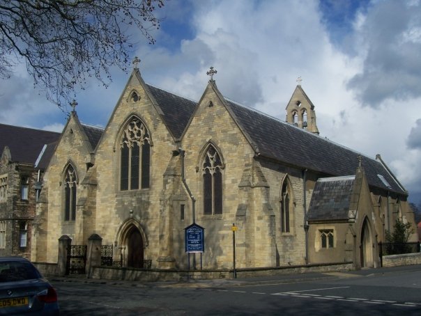
| Description | : | This was the original site of an Anglican church known as St George at Beanhills. St George parish was united with |
frequently asked questions (FAQ):
-
Where is St George Churchyard?
St George Churchyard is located at York, York Unitary Authority ,North Yorkshire ,England.
-
St George Churchyard cemetery's updated grave count on graveviews.com?
2 memorials
-
Where are the coordinates of the St George Churchyard?
Latitude: 53.9548420
Longitude: -1.0757670
Nearby Cemetories:
1. York Castle Prison Cemetery
York, York Unitary Authority, England
Coordinate: 53.9551950, -1.0782660
2. St Denys Churchyard
York, York Unitary Authority, England
Coordinate: 53.9567080, -1.0762240
3. St Margaret Churchyard
York, York Unitary Authority, England
Coordinate: 53.9565370, -1.0729530
4. Greyfriars Abbey Church (Defunct)
York, York Unitary Authority, England
Coordinate: 53.9553090, -1.0814240
5. St. Mary Castlegate Churchyard
York, York Unitary Authority, England
Coordinate: 53.9570800, -1.0804370
6. St Helen Churchyard
York, York Unitary Authority, England
Coordinate: 53.9509330, -1.0753630
7. St. Lawrence's Churchyard
York, York Unitary Authority, England
Coordinate: 53.9540530, -1.0688730
8. St John Churchyard
York, York Unitary Authority, England
Coordinate: 53.9591850, -1.0761680
9. All Saints Pavement Churchyard
York, York Unitary Authority, England
Coordinate: 53.9581090, -1.0808820
10. St Crux Hungate Burial Ground
York, York Unitary Authority, England
Coordinate: 53.9593540, -1.0774470
11. St Crux Churchyard
York, York Unitary Authority, England
Coordinate: 53.9589890, -1.0795460
12. St Clement Priory Churchyard (Defunct)
York, York Unitary Authority, England
Coordinate: 53.9524710, -1.0827970
13. Carmelite Friary of York (Defunct)
York, York Unitary Authority, England
Coordinate: 53.9577020, -1.0822860
14. Saint Peter's
York, York Unitary Authority, England
Coordinate: 53.9577400, -1.0822600
15. York Cemetery
York, York Unitary Authority, England
Coordinate: 53.9503960, -1.0723530
16. All Saints Peasholme (Defunct)
York, York Unitary Authority, England
Coordinate: 53.9597200, -1.0759220
17. Central Methodist Hall
York, York Unitary Authority, England
Coordinate: 53.9594090, -1.0788330
18. St Saviour Churchyard
York, York Unitary Authority, England
Coordinate: 53.9596100, -1.0780000
19. St Michael Churchyard
York, York Unitary Authority, England
Coordinate: 53.9577900, -1.0825600
20. Friends Burial Ground
York, York Unitary Authority, England
Coordinate: 53.9550140, -1.0846700
21. St Peter the Little (Defunct)
York, York Unitary Authority, England
Coordinate: 53.9585310, -1.0821170
22. St Mary Bishophill Senior Churchyard
York, York Unitary Authority, England
Coordinate: 53.9551780, -1.0849680
23. York Unitarian Chapelyard
York, York Unitary Authority, England
Coordinate: 53.9602950, -1.0775710
24. Holy Trinity Kings Court Churchyard
York, York Unitary Authority, England
Coordinate: 53.9599760, -1.0800800