| Memorials | : | 1 |
| Location | : | Chideock, West Dorset District, England |
| Coordinate | : | 50.7325000, -2.8211000 |
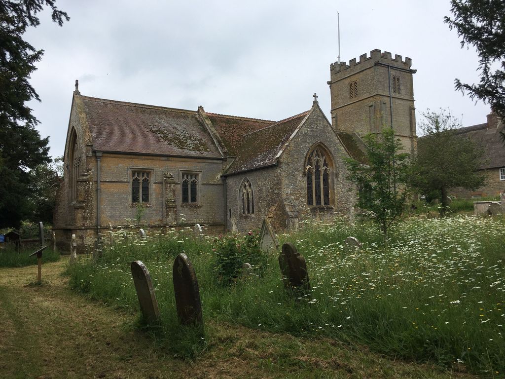
| Description | : | Formerly a chapel of Whitchurch Canonicorum, the walls are of local rubble with ashlar and dressings of the same material; the roofs are covered with tiles and lead. The earliest part of the existing building is the North Transept which was added to the nave, now largely rebuilt, probably in the 14th century. The West Tower was built early in the 15th century and shortly afterwards the S. arcade of the Nave was built and the South Chapel, South Aisle and South Porch were added. The church was drastically restored in 1880, when the Chancel was rebuilt. |
frequently asked questions (FAQ):
-
Where is St. Giles Churchyard?
St. Giles Churchyard is located at Chideock, West Dorset District ,Dorset ,England.
-
St. Giles Churchyard cemetery's updated grave count on graveviews.com?
1 memorials
-
Where are the coordinates of the St. Giles Churchyard?
Latitude: 50.7325000
Longitude: -2.8211000
Nearby Cemetories:
1. Chideock Manor
Chideock, West Dorset District, England
Coordinate: 50.7377620, -2.8229350
2. Stanton St. Gabriel Churchyard
Morcombelake, West Dorset District, England
Coordinate: 50.7407480, -2.8443460
3. St Peter Churchyard
Eype, West Dorset District, England
Coordinate: 50.7233600, -2.7794800
4. St Swithun Churchyard
Allington, West Dorset District, England
Coordinate: 50.7349230, -2.7642530
5. St Saviour's Churchyard
Dottery, West Dorset District, England
Coordinate: 50.7536000, -2.7694000
6. St. Mary's Churchyard
Bridport, West Dorset District, England
Coordinate: 50.7305630, -2.7580380
7. Quaker Burial Ground
Bridport, West Dorset District, England
Coordinate: 50.7285000, -2.7577000
8. St Mary's Churchyard
Catherston Leweston, West Dorset District, England
Coordinate: 50.7456790, -2.8948410
9. Old Church Cemetery
Bothenhampton, West Dorset District, England
Coordinate: 50.7230130, -2.7449430
10. Bridport Cemetery
Bridport, West Dorset District, England
Coordinate: 50.7335280, -2.7423070
11. United Reformed Church Cemetery
Charmouth, West Dorset District, England
Coordinate: 50.7391100, -2.8995100
12. St Andrew Churchyard
Charmouth, West Dorset District, England
Coordinate: 50.7384330, -2.9022810
13. Holy Trinity Churchyard
Bradpole, West Dorset District, England
Coordinate: 50.7458520, -2.7378410
14. St Mary Churchyard
Pilsdon, West Dorset District, England
Coordinate: 50.7925420, -2.8317720
15. Charmouth Cemetery
Charmouth, West Dorset District, England
Coordinate: 50.7429500, -2.9175000
16. St Mary Magdalene Churchyard
Loders, West Dorset District, England
Coordinate: 50.7458420, -2.7226110
17. St Stephen Churchyard
Bettiscombe, West Dorset District, England
Coordinate: 50.7962210, -2.8540230
18. St Mary Churchyard
Burton Bradstock, West Dorset District, England
Coordinate: 50.7028730, -2.7254190
19. St. Mary's Churchyard
Marshwood, West Dorset District, England
Coordinate: 50.7929400, -2.8775200
20. St Michael the Archangel Churchyard
Lyme Regis, West Dorset District, England
Coordinate: 50.7257540, -2.9317900
21. Christ's Churchyard
Melplash, West Dorset District, England
Coordinate: 50.7751300, -2.7324000
22. Lyme Regis Cemetery
Lyme Regis, West Dorset District, England
Coordinate: 50.7304320, -2.9334380
23. St Mary Churchyard
Netherbury, West Dorset District, England
Coordinate: 50.7922890, -2.7529110
24. St Michaels Cemetery
Melplash, West Dorset District, England
Coordinate: 50.7832180, -2.7306110


