
| Memorials | : | 101 |
| Location | : | Canterbury, City of Canterbury, England |
| Coordinate | : | 51.2816050, 1.0887840 |
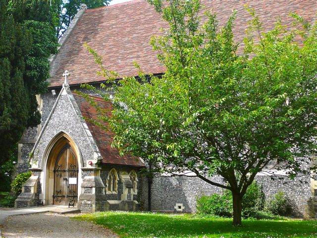
| Description | : | The Church of St Gregory, off North Holmes Road, was designed by George Gilbert Scott, and built in 1851. It was made redundant in 1975 and is now used by Canterbury Christ Church University as St Gregory's Centre for music studies and concerts. A projected extension to the east of the Centre and concert hall, due to open in 2012, was suspended in 2011, and an area previously used for parking has been grassed over. The building site is now inaccessible. Parts of the graveyard have already been cleared, with markers moved to the North boundary wall; other parts are... Read More |
frequently asked questions (FAQ):
-
Where is St Gregory Churchyard?
St Gregory Churchyard is located at Canterbury, City of Canterbury ,Kent ,England.
-
St Gregory Churchyard cemetery's updated grave count on graveviews.com?
101 memorials
-
Where are the coordinates of the St Gregory Churchyard?
Latitude: 51.2816050
Longitude: 1.0887840
Nearby Cemetories:
1. St Mary Northgate Cemetery
Canterbury, City of Canterbury, England
Coordinate: 51.2811320, 1.0859300
2. St Gregory's Priory (defunct)
Canterbury, City of Canterbury, England
Coordinate: 51.2831127, 1.0855358
3. St Augustine Abbey Ruins
Canterbury, City of Canterbury, England
Coordinate: 51.2781280, 1.0882060
4. St. John the Baptist Hospital Chapelyard
Canterbury, City of Canterbury, England
Coordinate: 51.2832713, 1.0837677
5. St Paul Without the Walls
Canterbury, City of Canterbury, England
Coordinate: 51.2779380, 1.0853180
6. Canterbury Cathedral
Canterbury, City of Canterbury, England
Coordinate: 51.2796936, 1.0826840
7. St Martin Churchyard
Canterbury, City of Canterbury, England
Coordinate: 51.2780170, 1.0937160
8. St Mary Magdalene Church Demolished
Canterbury, City of Canterbury, England
Coordinate: 51.2784510, 1.0830170
9. St George's Church Demolished
Canterbury, City of Canterbury, England
Coordinate: 51.2773770, 1.0827380
10. All Saints Church Demolished
Canterbury, City of Canterbury, England
Coordinate: 51.2802800, 1.0783450
11. St Mary Breadman Church Demolished
Canterbury, City of Canterbury, England
Coordinate: 51.2798870, 1.0784520
12. St Margaret's Churchyard
Canterbury, City of Canterbury, England
Coordinate: 51.2781780, 1.0795840
13. St Mary Bredin Old Church (Defunct)
Canterbury, City of Canterbury, England
Coordinate: 51.2773455, 1.0803962
14. St Peter the Apostle Churchyard
Canterbury, City of Canterbury, England
Coordinate: 51.2807260, 1.0775370
15. St Peters Methodist Church
Canterbury, City of Canterbury, England
Coordinate: 51.2801720, 1.0771480
16. Holy Cross Church
Canterbury, City of Canterbury, England
Coordinate: 51.2811350, 1.0755710
17. Westgate Gardens
Canterbury, City of Canterbury, England
Coordinate: 51.2805250, 1.0745040
18. Dane John Gardens
Canterbury, City of Canterbury, England
Coordinate: 51.2754210, 1.0780390
19. St Mary de Castro Churchyard
Canterbury, City of Canterbury, England
Coordinate: 51.2762400, 1.0766820
20. St. Mildred with St. Mary de Castro Church
Canterbury, City of Canterbury, England
Coordinate: 51.2764810, 1.0743320
21. St. Dunstan Churchyard
Canterbury, City of Canterbury, England
Coordinate: 51.2836820, 1.0707800
22. Canterbury Jewish Cemetery
Canterbury, City of Canterbury, England
Coordinate: 51.2846135, 1.0706660
23. Canterbury City Cemetery
Canterbury, City of Canterbury, England
Coordinate: 51.2843285, 1.0637640
24. Wincheap Non-Conformist Burial Ground
Canterbury, City of Canterbury, England
Coordinate: 51.2718430, 1.0672940