
| Memorials | : | 4 |
| Location | : | South Oxfordshire District, England |
| Coordinate | : | 51.5769360, -0.9532550 |
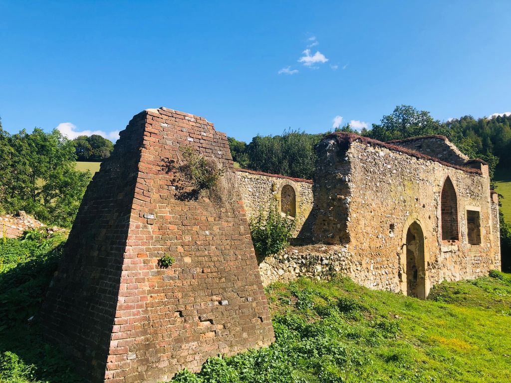
| Description | : | St. James' church, Bix Brand is located in a valley in the Chiltern hills and is the ruin of a mediaeval church. The village of Bix Brand that once surrounded St. James', was a mediaeval settlement which fell into decline by the 18th century in favour of the modern village of Bix, a mile to the south. The church today stands in isolation by the minor road to Bix Bottom. It is mostly hidden from view by the trees that surround the graveyard. The roof was removed shortly after it was abandoned in 1875... Read More |
frequently asked questions (FAQ):
-
Where is St. James' Old Churchyard?
St. James' Old Churchyard is located at Bix Brand, South Oxfordshire District South Oxfordshire District ,Oxfordshire ,England.
-
St. James' Old Churchyard cemetery's updated grave count on graveviews.com?
4 memorials
-
Where are the coordinates of the St. James' Old Churchyard?
Latitude: 51.5769360
Longitude: -0.9532550


Nearby Cemetories:
1. St. James's Churchyard
Bix and Assendon, South Oxfordshire District, England
Coordinate: 51.5610070, -0.9511270
2. St. Mary the Virgin Churchyard
Fawley, Wycombe District, England
Coordinate: 51.5743000, -0.9140000
3. Stonor Park Cemetery
Henley-on-Thames, South Oxfordshire District, England
Coordinate: 51.5967370, -0.9289660
4. St. Bartholomew's Churchyard
Nettlebed, South Oxfordshire District, England
Coordinate: 51.5752360, -0.9936230
5. Pishill Parish Church Cemetery
Pishill, South Oxfordshire District, England
Coordinate: 51.6027550, -0.9527530
6. Henley-on-Thames Cemetery
Henley-on-Thames, South Oxfordshire District, England
Coordinate: 51.5543570, -0.9271320
7. St. Pauls Highmoor Cross
Highmoor, South Oxfordshire District, England
Coordinate: 51.5532740, -0.9910110
8. St. Nicholas' Churchyard
Rotherfield Greys, South Oxfordshire District, England
Coordinate: 51.5351017, -0.9541395
9. St. Botolph Old Cemetery
Swyncombe, South Oxfordshire District, England
Coordinate: 51.6065347, -1.0157358
10. St. Botolph's New Graveyard
Swyncombe, South Oxfordshire District, England
Coordinate: 51.6064829, -1.0167999
11. St. John the Evangalist Churchyard
Stoke Row, South Oxfordshire District, England
Coordinate: 51.5510570, -1.0226630
12. Stoke Row Independant Chapel
Stoke Row, South Oxfordshire District, England
Coordinate: 51.5510570, -1.0226630
13. Stoke Row Independent Chapel Cemetery
Stoke Row, South Oxfordshire District, England
Coordinate: 51.5510570, -1.0226630
14. All Saints Churchyard
Rotherfield Peppard, South Oxfordshire District, England
Coordinate: 51.5280531, -0.9725009
15. St. Mary the Virgin Churchyard
Henley-on-Thames, South Oxfordshire District, England
Coordinate: 51.5377790, -0.9017520
16. Saint Mary the Virgin Churchyard
Hambleden, Wycombe District, England
Coordinate: 51.5773100, -0.8709500
17. Holy Trinity Churchyard
Henley-on-Thames, South Oxfordshire District, England
Coordinate: 51.5338500, -0.9066600
18. St Mary's Churchyard
Turville, Wycombe District, England
Coordinate: 51.6139860, -0.8938190
19. Christ Church
Henley-on-Thames, South Oxfordshire District, England
Coordinate: 51.5347880, -0.9032820
20. Holy Trinity Churchyard
Nuffield, South Oxfordshire District, England
Coordinate: 51.5810040, -1.0378960
21. St Nicholas Churchyard
Ibstone, Wycombe District, England
Coordinate: 51.6247660, -0.9093120
22. St. Bartholomew Churchyard
Fingest, Wycombe District, England
Coordinate: 51.6137200, -0.8791500
23. St Margaret's Churchyard
Harpsden, South Oxfordshire District, England
Coordinate: 51.5219160, -0.9012270
24. Checkendon Churchyard
Checkendon, South Oxfordshire District, England
Coordinate: 51.5424461, -1.0449720