
| Memorials | : | 0 |
| Location | : | Gawsworth, Cheshire East Unitary Authority, England |
| Coordinate | : | 53.2241390, -2.1661520 |
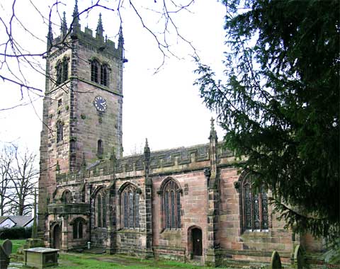
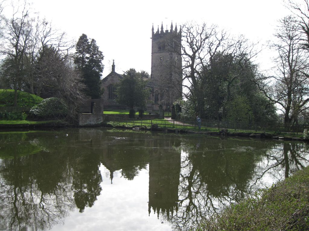
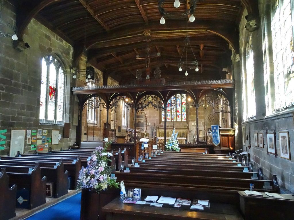
| Description | : | St James' Church, is in the village of Gawsworth, Cheshire, England near Gawsworth Hall. It is an active Anglican parish church in the diocese of Chester. it is included on the list of 'best' English parish churches. The church has been described as a "very strange" church in that it has no aisles, a very wide nave and no structural separation of the chancel and nave. There is a record of a chapel on the site in the 13th century but the present building dates from the 15th century. The nave is the oldest part of the church dating from... Read More |
frequently asked questions (FAQ):
-
Where is St James Churchyard?
St James Churchyard is located at Gawsworth, Cheshire East Unitary Authority ,Cheshire ,England.
-
St James Churchyard cemetery's updated grave count on graveviews.com?
0 memorials
-
Where are the coordinates of the St James Churchyard?
Latitude: 53.2241390
Longitude: -2.1661520
Nearby Cemetories:
1. Maggoty Wood
Gawsworth, Cheshire East Unitary Authority, England
Coordinate: 53.2234560, -2.1652510
2. Brunswick Wesleyan Methodist Chapel Chapelyard
Sutton (Macclesfield), Cheshire East Unitary Authority, England
Coordinate: 53.2359570, -2.1213260
3. St Thomas Churchyard
Henbury, Cheshire East Unitary Authority, England
Coordinate: 53.2594420, -2.1792260
4. St James Churchyard
Sutton (Macclesfield), Cheshire East Unitary Authority, England
Coordinate: 53.2378520, -2.1063910
5. St James and St Paul Churchyard
Marton, Cheshire East Unitary Authority, England
Coordinate: 53.2087950, -2.2257460
6. All Saints Churchyard
Siddington, Cheshire East Unitary Authority, England
Coordinate: 53.2342820, -2.2317890
7. St. Alban's Churchyard
Macclesfield, Cheshire East Unitary Authority, England
Coordinate: 53.2599190, -2.1339940
8. St. Michael's & All Angels Churchyard
Macclesfield, Cheshire East Unitary Authority, England
Coordinate: 53.2572950, -2.1195970
9. St Paul Churchyard
Macclesfield, Cheshire East Unitary Authority, England
Coordinate: 53.2574100, -2.1192400
10. Macclesfield Cemetery
Macclesfield, Cheshire East Unitary Authority, England
Coordinate: 53.2652260, -2.1376130
11. St. Mary the Virgin Churchyard
Bosley, Cheshire East Unitary Authority, England
Coordinate: 53.1871110, -2.1241630
12. Macclesfield Crematorium
Macclesfield, Cheshire East Unitary Authority, England
Coordinate: 53.2656340, -2.1373290
13. Holy Trinity Churchyard
Hurdsfield, Cheshire East Unitary Authority, England
Coordinate: 53.2647300, -2.1124600
14. St John the Evangelist Churchyard
Buglawton, Cheshire East Unitary Authority, England
Coordinate: 53.1701320, -2.1959370
15. Alderley Park
Nether Alderley, Cheshire East Unitary Authority, England
Coordinate: 53.2715440, -2.2352370
16. St Peter Churchyard
Prestbury, Cheshire East Unitary Authority, England
Coordinate: 53.2892070, -2.1505100
17. St Peter's Churchyard
Congleton, Cheshire East Unitary Authority, England
Coordinate: 53.1617900, -2.2115000
18. Lower Withington Methodist Burial Ground
Lower Withington, Cheshire East Unitary Authority, England
Coordinate: 53.2243360, -2.2800790
19. St. Michael's Churchyard
Wincle, Cheshire East Unitary Authority, England
Coordinate: 53.1933190, -2.0620740
20. Congleton Cemetery
Congleton, Cheshire East Unitary Authority, England
Coordinate: 53.1590430, -2.2112310
21. St Marys Churchyard
Nether Alderley, Cheshire East Unitary Authority, England
Coordinate: 53.2820200, -2.2388500
22. St John the Evangelist Churchyard
Chelford, Cheshire East Unitary Authority, England
Coordinate: 53.2623790, -2.2727070
23. St . Stephen's Church Forest Chapel
Macclesfield Forest, Cheshire East Unitary Authority, England
Coordinate: 53.2462260, -2.0399720
24. St Lawrence Churchyard
Rushton Spencer, Staffordshire Moorlands District, England
Coordinate: 53.1556630, -2.0996440