
| Memorials | : | 2 |
| Location | : | Macclesfield, Cheshire East Unitary Authority, England |
| Coordinate | : | 53.2572950, -2.1195970 |
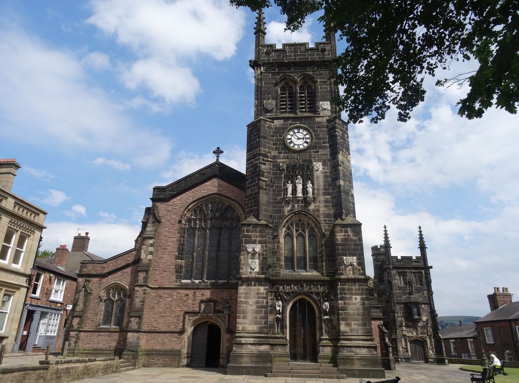
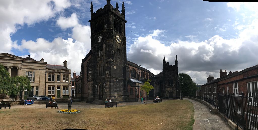
| Description | : | The first church on this site, a chapel built around 1220, was extended or rebuilt about 1278, by Queen Eleanor, wife of Edward I, and dedicated to All Saints or All Hallows. There have been two major reconstructions, the last being in 1898–1901. Two ancient chapels remain dating from the 15th and 16th centuries. Inside the church are a number of tombs and memorials, mainly to the memory of the Savage and Legh families. A chapel, known as the Legh chapel was built in 1422, for Sir Piers Legh who fought and was knighted at the Battle of Agincourt; he... Read More |
frequently asked questions (FAQ):
-
Where is St. Michael's & All Angels Churchyard?
St. Michael's & All Angels Churchyard is located at Macclesfield, Cheshire East Unitary Authority ,Cheshire ,England.
-
St. Michael's & All Angels Churchyard cemetery's updated grave count on graveviews.com?
2 memorials
-
Where are the coordinates of the St. Michael's & All Angels Churchyard?
Latitude: 53.2572950
Longitude: -2.1195970
Nearby Cemetories:
1. St Paul Churchyard
Macclesfield, Cheshire East Unitary Authority, England
Coordinate: 53.2574100, -2.1192400
2. Holy Trinity Churchyard
Hurdsfield, Cheshire East Unitary Authority, England
Coordinate: 53.2647300, -2.1124600
3. St. Alban's Churchyard
Macclesfield, Cheshire East Unitary Authority, England
Coordinate: 53.2599190, -2.1339940
4. Macclesfield Cemetery
Macclesfield, Cheshire East Unitary Authority, England
Coordinate: 53.2652260, -2.1376130
5. Macclesfield Crematorium
Macclesfield, Cheshire East Unitary Authority, England
Coordinate: 53.2656340, -2.1373290
6. St James Churchyard
Sutton (Macclesfield), Cheshire East Unitary Authority, England
Coordinate: 53.2378520, -2.1063910
7. Brunswick Wesleyan Methodist Chapel Chapelyard
Sutton (Macclesfield), Cheshire East Unitary Authority, England
Coordinate: 53.2359570, -2.1213260
8. St Thomas Churchyard
Henbury, Cheshire East Unitary Authority, England
Coordinate: 53.2594420, -2.1792260
9. St Peter Churchyard
Prestbury, Cheshire East Unitary Authority, England
Coordinate: 53.2892070, -2.1505100
10. Wesleyan Chapel Chapelyard
Rainow, Cheshire East Unitary Authority, England
Coordinate: 53.2835470, -2.0709590
11. St John the Baptist Churchyard
Bollington, Cheshire East Unitary Authority, England
Coordinate: 53.2969600, -2.0926100
12. St James Churchyard
Gawsworth, Cheshire East Unitary Authority, England
Coordinate: 53.2241390, -2.1661520
13. Maggoty Wood
Gawsworth, Cheshire East Unitary Authority, England
Coordinate: 53.2234560, -2.1652510
14. St . Stephen's Church Forest Chapel
Macclesfield Forest, Cheshire East Unitary Authority, England
Coordinate: 53.2462260, -2.0399720
15. St. Christopher Churchyard
Pott Shrigley, Cheshire East Unitary Authority, England
Coordinate: 53.3096500, -2.0842900
16. St. John the Evangelist Churchyard
Cheshire East Unitary Authority, England
Coordinate: 53.2862960, -2.0256440
17. St. Saviour Churchyard
Wildboarclough, Cheshire East Unitary Authority, England
Coordinate: 53.2161170, -2.0254580
18. St. Mary the Virgin Churchyard
Bosley, Cheshire East Unitary Authority, England
Coordinate: 53.1871110, -2.1241630
19. Alderley Park
Nether Alderley, Cheshire East Unitary Authority, England
Coordinate: 53.2715440, -2.2352370
20. All Saints Churchyard
Siddington, Cheshire East Unitary Authority, England
Coordinate: 53.2342820, -2.2317890
21. St. Michael's Churchyard
Wincle, Cheshire East Unitary Authority, England
Coordinate: 53.1933190, -2.0620740
22. St Marys Churchyard
Nether Alderley, Cheshire East Unitary Authority, England
Coordinate: 53.2820200, -2.2388500
23. St James and St Paul Churchyard
Marton, Cheshire East Unitary Authority, England
Coordinate: 53.2087950, -2.2257460
24. Dean Row Chapelyard
Wilmslow, Cheshire East Unitary Authority, England
Coordinate: 53.3304820, -2.1951770