
| Memorials | : | 0 |
| Location | : | Aldgate, City of London, England |
| Coordinate | : | 51.5128970, -0.0790280 |
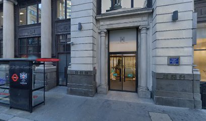
| Description | : | The area which was to become Duke's Place was occupied until its dissolution in 1531 by the Priory of Holy Trinity, Christ Church. Henry VIII then gave the land to Sir Thomas Audley who cleared it and built houses on the site, although fragments of the medieval buildings still survived at the beginning of the nineteenth century. The area was eventually inherited by Audley's son-in-law, the Duke of Norfolk, from whom the name "Duke's Place" is derived. In the early 17th century the residents of the former priory precinct, finding worship at St Katherine Cree "uncongenial" sought permission from the... Read More |
frequently asked questions (FAQ):
-
Where is St. James Duke's Place Churchyard?
St. James Duke's Place Churchyard is located at Aldgate, City of London, Greater London, England Aldgate, City of London ,Greater London ,England.
-
St. James Duke's Place Churchyard cemetery's updated grave count on graveviews.com?
0 memorials
-
Where are the coordinates of the St. James Duke's Place Churchyard?
Latitude: 51.5128970
Longitude: -0.0790280
Nearby Cemetories:
1. St Katherine Cree Churchyard
London, City of London, England
Coordinate: 51.5134315, -0.0791360
2. Priory of Holy Trinity
Aldgate, City of London, England
Coordinate: 51.5138190, -0.0780890
3. All Hallows Staining Tower
London, City of London, England
Coordinate: 51.5115776, -0.0804890
4. St Botolph without Aldgate Churchyard
Aldgate, City of London, England
Coordinate: 51.5140120, -0.0763420
5. St Olave Hart Street Churchyard
London, City of London, England
Coordinate: 51.5108930, -0.0795990
6. Church of the Crutched Friars
London, City of London, England
Coordinate: 51.5108000, -0.0785000
7. Abbey of the Minoresses of St. Clare without Aldgate Churchyard
Aldgate, City of London, England
Coordinate: 51.5125370, -0.0749860
8. St Helen’s Bishopsgate
Bishopsgate, City of London, England
Coordinate: 51.5148000, -0.0818000
9. Holy Trinity Minories Churchyard
Aldgate, City of London, England
Coordinate: 51.5115140, -0.0745780
10. St. Ethelburga the Virgin Churchyard
Bishopsgate, City of London, England
Coordinate: 51.5155450, -0.0820020
11. Tower Hill Memorial
London Borough of Tower Hamlets, England
Coordinate: 51.5096016, -0.0777000
12. St Martin Outwich
Bishopsgate, City of London, England
Coordinate: 51.5143060, -0.0841640
13. All Hallows by the Tower Churchyard
London, City of London, England
Coordinate: 51.5093600, -0.0794020
14. St. Benet's Churchyard
Bridge, City of London, England
Coordinate: 51.5115240, -0.0846030
15. St. Dunstan-in-the-East Churchyard
London, City of London, England
Coordinate: 51.5096540, -0.0824830
16. All Hallows Lombard Street
London, City of London, England
Coordinate: 51.5123000, -0.0854000
17. St. Mary-at-Hill Churchyard
Billingsgate, City of London, England
Coordinate: 51.5101050, -0.0836680
18. St Michael Cornhill Churchyard
London, City of London, England
Coordinate: 51.5131910, -0.0854760
19. St. Botholph without Bishopsgate
Finsbury, London Borough of Islington, England
Coordinate: 51.5166840, -0.0815590
20. St Botolph Church
Bishopsgate, City of London, England
Coordinate: 51.5167080, -0.0816560
21. St. Peter le Poer Churchyard
Broad Street, City of London, England
Coordinate: 51.5153070, -0.0848680
22. St. George's Botolph Lane
Billingsgate, City of London, England
Coordinate: 51.5101840, -0.0847730
23. Chapel of Saint Peter-ad-Vincula
London Borough of Tower Hamlets, England
Coordinate: 51.5085335, -0.0769200
24. St. Leonard's Churchyard
Bridge, City of London, England
Coordinate: 51.5105870, -0.0855570