
| Memorials | : | 0 |
| Location | : | Churchill, Wyre Forest District, England |
| Coordinate | : | 52.4120960, -2.1782860 |
frequently asked questions (FAQ):
-
Where is St James the Great Churchyard?
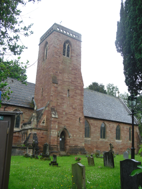
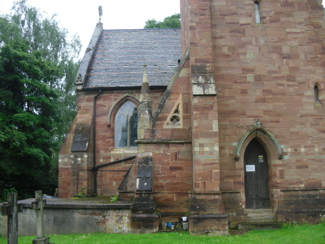
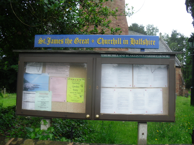
St James the Great Churchyard is located at Churchill Lane Churchill, Wyre Forest District ,Worcestershire , DY10 3LYEngland.
-
St James the Great Churchyard cemetery's updated grave count on graveviews.com?
0 memorials
-
Where are the coordinates of the St James the Great Churchyard?
Latitude: 52.4120960
Longitude: -2.1782860
Nearby Cemetories:
1. St. James The Great Churchyard
Blakedown, Wyre Forest District, England
Coordinate: 52.4052560, -2.1755792
2. St. Peter's Churchyard
Broome, Wyre Forest District, England
Coordinate: 52.4038450, -2.1453780
3. Hagley Cemetery
Hagley, Bromsgrove District, England
Coordinate: 52.4215800, -2.1391200
4. Roman Catholic Cemetery
Stourbridge, Metropolitan Borough of Dudley, England
Coordinate: 52.4403800, -2.1629600
5. St. Peter's Churchyard
Cookley, Wyre Forest District, England
Coordinate: 52.4193280, -2.2334370
6. St. Peter Churchyard
Pedmore, Metropolitan Borough of Dudley, England
Coordinate: 52.4375700, -2.1306900
7. St John the Baptist Churchyard
Hagley, Bromsgrove District, England
Coordinate: 52.4247940, -2.1180030
8. Stourbridge Cemetery and Crematorium
Stourbridge, Metropolitan Borough of Dudley, England
Coordinate: 52.4530270, -2.1682470
9. Holy Trinity Churchyard
Belbroughton, Bromsgrove District, England
Coordinate: 52.3897160, -2.1203190
10. St. Mary the Virgin Churchyard
Stone, Wyre Forest District, England
Coordinate: 52.3721100, -2.2046900
11. St. Leonard's Churchyard
Clent, Bromsgrove District, England
Coordinate: 52.4121240, -2.1065080
12. St Marys Churchyard
Harvington, Wyre Forest District, England
Coordinate: 52.3677780, -2.1808330
13. St George Churchyard
Kidderminster, Wyre Forest District, England
Coordinate: 52.3903090, -2.2425290
14. St John the Baptist Churchyard
Wolverley, Wyre Forest District, England
Coordinate: 52.4115868, -2.2533950
15. St. James' Churchyard
Wollaston, Metropolitan Borough of Dudley, England
Coordinate: 52.4602799, -2.1605207
16. St. Mary and All Saints Churchyard
Kidderminster, Wyre Forest District, England
Coordinate: 52.3902820, -2.2510700
17. St. Cassian's Churchyard
Chaddesley Corbett, Wyre Forest District, England
Coordinate: 52.3603300, -2.1610400
18. Kidderminster Cemetery
Kidderminster, Wyre Forest District, England
Coordinate: 52.3838330, -2.2521340
19. Holy Trinity Churchyard
Amblecote, Metropolitan Borough of Dudley, England
Coordinate: 52.4629900, -2.1489400
20. Amblecote
Stourbridge, Metropolitan Borough of Dudley, England
Coordinate: 52.4630297, -2.1490620
21. St John the Baptist Churchyard
Kidderminster, Wyre Forest District, England
Coordinate: 52.3870500, -2.2612100
22. Lye and Wollescote Cemetery
Lye, Metropolitan Borough of Dudley, England
Coordinate: 52.4543500, -2.1153700
23. St Kenelm's Churchyard
Romsley, Bromsgrove District, England
Coordinate: 52.4243600, -2.0830100
24. Christ Church, The Lye and Stambermill
Lye, Metropolitan Borough of Dudley, England
Coordinate: 52.4574720, -2.1140040