
| Memorials | : | 0 |
| Location | : | Great Easton, Uttlesford District, England |
| Coordinate | : | 51.9046125, 0.3354719 |
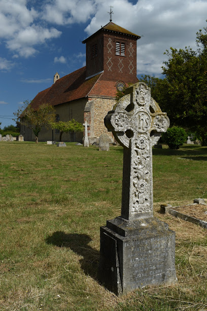
| Description | : | Built in the early 12th century on the site of an earlier Saxon church. Its construction contains Roman bricks. The north and south transepts have disappeared, and only thickened walls indicate the position of the crossing tower. By 1460, the tower had disappeared. |
frequently asked questions (FAQ):
-
Where is St John and St Giles Churchyard?
St John and St Giles Churchyard is located at Great Easton, Uttlesford District ,Essex ,England.
-
St John and St Giles Churchyard cemetery's updated grave count on graveviews.com?
0 memorials
-
Where are the coordinates of the St John and St Giles Churchyard?
Latitude: 51.9046125
Longitude: 0.3354719
Nearby Cemetories:
1. St Mary the Virgin Churchyard
Little Easton, Uttlesford District, England
Coordinate: 51.8869280, 0.3299070
2. Great Dunmow Cemetery
Great Dunmow, Uttlesford District, England
Coordinate: 51.8825180, 0.3652100
3. St Mary the Virgin Churchyard
Great Dunmow, Uttlesford District, England
Coordinate: 51.8813920, 0.3660360
4. St Mary the Virgin Churchyard
Lindsell, Uttlesford District, England
Coordinate: 51.9183600, 0.3886400
5. All Saints Churchyard
Little Canfield, Uttlesford District, England
Coordinate: 51.8645410, 0.3033900
6. Congregational Chapelyard
Thaxted, Uttlesford District, England
Coordinate: 51.9536600, 0.3396500
7. St John the Baptist Churchyard
Thaxted, Uttlesford District, England
Coordinate: 51.9543000, 0.3422000
8. St Mary the Virgin Churchyard
Stebbing, Uttlesford District, England
Coordinate: 51.8895200, 0.4165300
9. St Mary Churchyard
Little Dunmow, Uttlesford District, England
Coordinate: 51.8654120, 0.4036350
10. St Mary the Virgin Churchyard
Henham, Uttlesford District, England
Coordinate: 51.9342500, 0.2456300
11. St Katherine Churchyard
Little Bardfield, Uttlesford District, England
Coordinate: 51.9504800, 0.4080100
12. St Mary Churchyard
Great Canfield, Uttlesford District, England
Coordinate: 51.8388000, 0.3110930
13. Holy Cross Churchyard
Felsted, Uttlesford District, England
Coordinate: 51.8569970, 0.4335410
14. St. Mary the Virgin Churchyard
Stansted Mountfitchet, Uttlesford District, England
Coordinate: 51.8953440, 0.2091880
15. Felsted Congregational Burial Ground
Felsted, Uttlesford District, England
Coordinate: 51.8524490, 0.4358640
16. All Saints Churchyard
High Roding, Uttlesford District, England
Coordinate: 51.8246620, 0.3083740
17. St Mary the Virgin Churchyard
Widdington, Uttlesford District, England
Coordinate: 51.9629600, 0.2397600
18. St. Mary the Virgin Churchyard
Saffron Walden, Uttlesford District, England
Coordinate: 51.9768000, 0.4055000
19. St Peter Churchyard
Ugley, Uttlesford District, England
Coordinate: 51.9364900, 0.2086500
20. St Mary the Virgin and All Saints Churchyard
Debden, Uttlesford District, England
Coordinate: 51.9759030, 0.2568160
21. St Mary the Virgin Churchyard
Birchanger, Uttlesford District, England
Coordinate: 51.8831930, 0.1885850
22. St Mary the Virgin Churchyard
Aythorpe Roding, Uttlesford District, England
Coordinate: 51.8143370, 0.2971010
23. St Michael churchyard
Great Sampford, Uttlesford District, England
Coordinate: 51.9924800, 0.3909300
24. Great Sampford Baptist Chapelyard
Great Sampford, Uttlesford District, England
Coordinate: 51.9929100, 0.3911000