
| Memorials | : | 0 |
| Location | : | Alton, Staffordshire Moorlands District, England |
| Coordinate | : | 52.9783380, -1.8919190 |
frequently asked questions (FAQ):
-
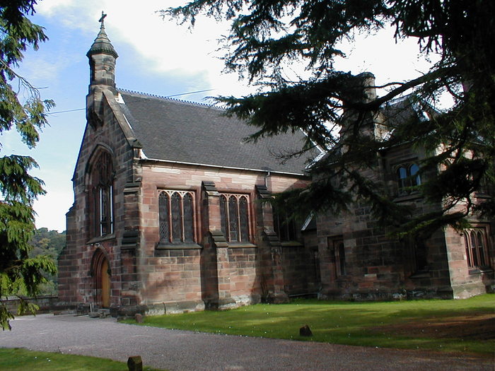
Where is St John Churchyard?
St John Churchyard is located at Alton, Staffordshire Moorlands District ,Staffordshire ,England.
-
St John Churchyard cemetery's updated grave count on graveviews.com?
0 memorials
-
Where are the coordinates of the St John Churchyard?
Latitude: 52.9783380
Longitude: -1.8919190
Nearby Cemetories:
1. St. Peter's Churchyard
Alton, Staffordshire Moorlands District, England
Coordinate: 52.9783470, -1.8918600
2. St Leonard Churchyard
Bradley in the Moors, Staffordshire Moorlands District, England
Coordinate: 52.9693440, -1.9135150
3. Croxden Abbey
Croxden, East Staffordshire Borough, England
Coordinate: 52.9549890, -1.9042630
4. Holy Trinity Churchyard
Oakamoor, Staffordshire Moorlands District, England
Coordinate: 53.0003870, -1.9236580
5. St. John the Baptist Churchyard
Cotton, Staffordshire Moorlands District, England
Coordinate: 53.0150546, -1.9026792
6. Saint Peter's Cemetery
Ellastone, East Staffordshire Borough, England
Coordinate: 52.9882900, -1.8275000
7. Cotton Cemetery
Cotton, Staffordshire Moorlands District, England
Coordinate: 53.0188110, -1.9113960
8. St. Mary and St. Barlock Churchyard
Norbury, Derbyshire Dales District, England
Coordinate: 52.9787350, -1.8146430
9. St Chad Churchyard
Cheadle, Staffordshire Moorlands District, England
Coordinate: 52.9675320, -1.9729500
10. St Mildred Churchyard
Whiston, Staffordshire Moorlands District, England
Coordinate: 53.0211310, -1.9477990
11. St. Mary and All Saints Churchyard
Checkley, Staffordshire Moorlands District, England
Coordinate: 52.9384190, -1.9598100
12. St. Mary's Churchyard
Stanton, East Staffordshire Borough, England
Coordinate: 53.0109590, -1.8136560
13. St Michael and All Angels Churchyard
Stramshall, East Staffordshire Borough, England
Coordinate: 52.9201040, -1.8836100
14. St Giles ROman Catholic Churchyard
Cheadle, Staffordshire Moorlands District, England
Coordinate: 52.9860280, -1.9889960
15. Christ Church Churchyard
Upper Tean, Staffordshire Moorlands District, England
Coordinate: 52.9529687, -1.9831798
16. Baptist Chapel Churchyard Cemetery
Walkern, East Hertfordshire District, England
Coordinate: 53.0228400, -1.9644900
17. St Mary and St Laurence Churchyard
Cauldon, Staffordshire Moorlands District, England
Coordinate: 53.0423040, -1.8845550
18. St. Mark the Evangelist Churchyard
Foxt, Staffordshire Moorlands District, England
Coordinate: 53.0362440, -1.9473820
19. St. Werburgh Churchyard
Kingsley, Staffordshire Moorlands District, England
Coordinate: 53.0195390, -1.9815730
20. St. Giles Churchyard
Marston Montgomery, Derbyshire Dales District, England
Coordinate: 52.9382120, -1.8007610
21. All Saints Churchyard
Leigh, East Staffordshire Borough, England
Coordinate: 52.9199520, -1.9657840
22. St. Peter's Churchyard
Snelston, Derbyshire Dales District, England
Coordinate: 52.9871570, -1.7700260
23. St. John the Baptist Churchyard
Mayfield, East Staffordshire Borough, England
Coordinate: 52.9998700, -1.7716970
24. St Mary's Churchyard
Calton, Staffordshire Moorlands District, England
Coordinate: 53.0489970, -1.8472480