
| Memorials | : | 0 |
| Location | : | Walkern, East Hertfordshire District, England |
| Coordinate | : | 53.0228400, -1.9644900 |
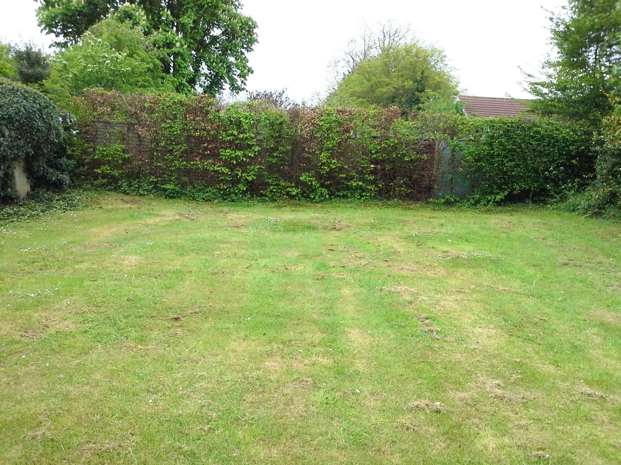
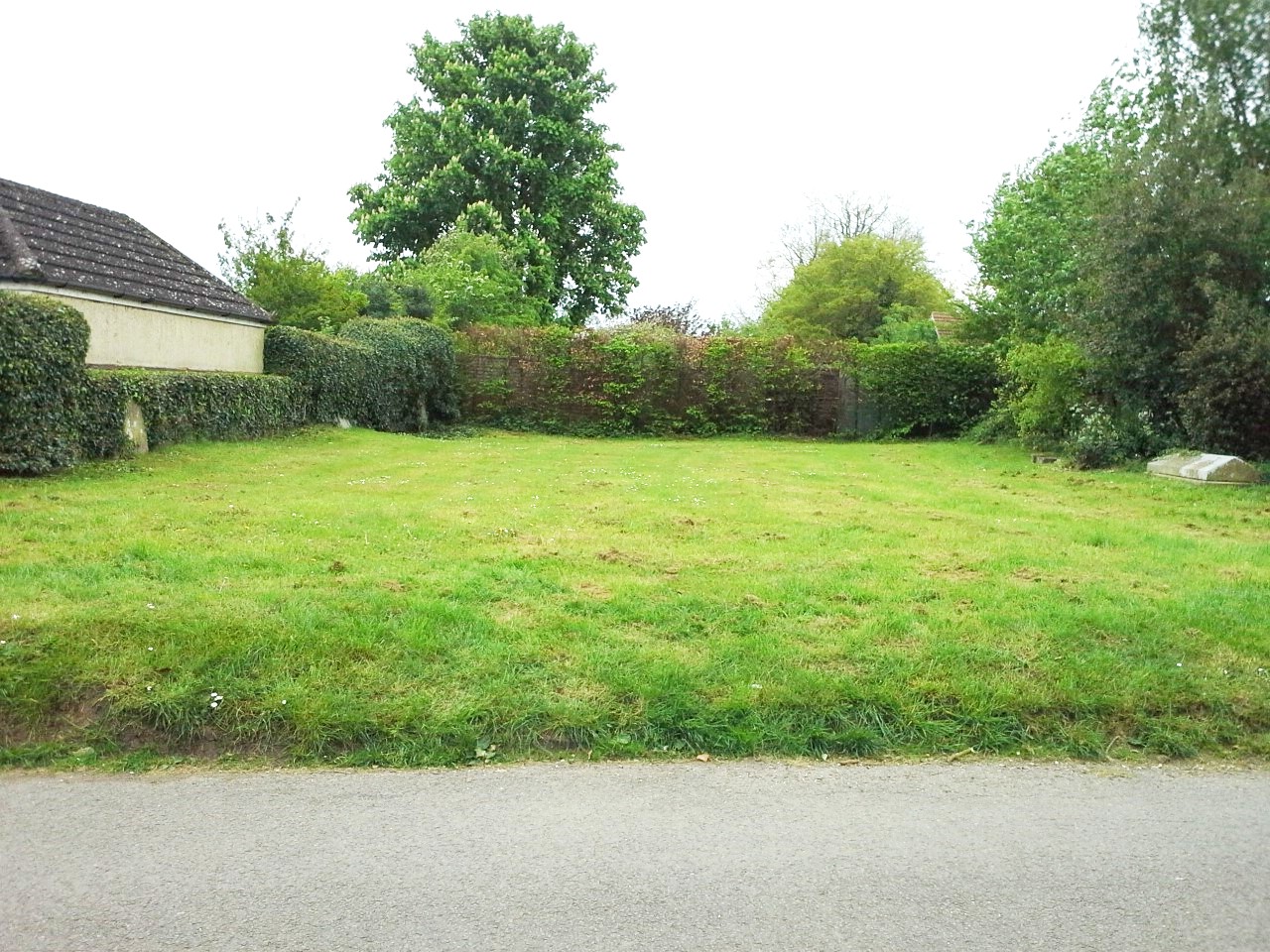
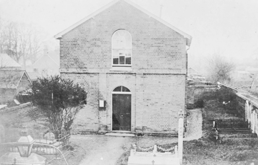
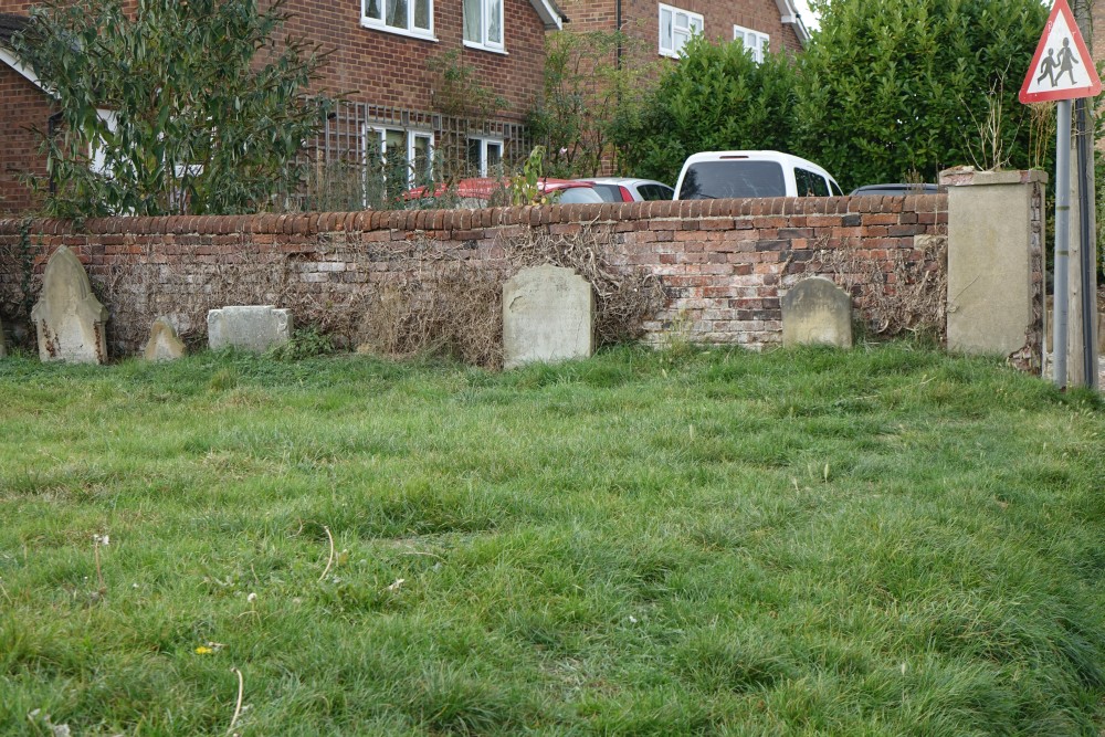
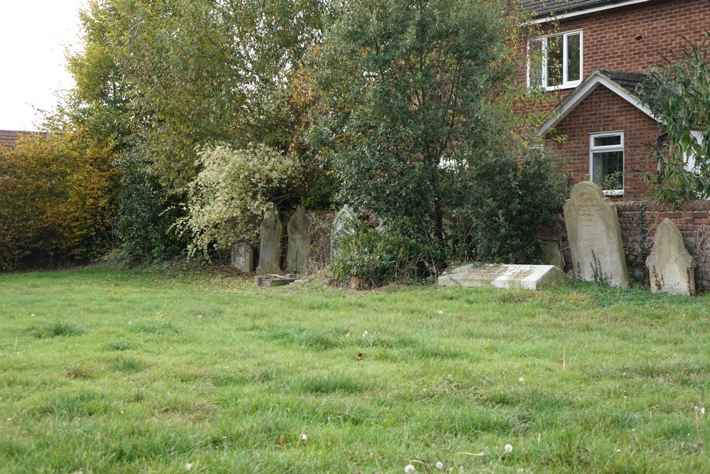
| Description | : | Strict Baptist Chapel (Froghall) AKA Strict Baptist Chapel of Walkern, Strict Baptist Chapel Churchyard This is a small cemetery in Froghall Lane; that belonged to the Walkern Strict Baptist Chapel. Many of the gravestones in the cemetery are now fragile, worn, difficult to read and some are almost being held in place by the ivy growing round them. The Baptist Chapel is no long there and was demolished in the early 1950s due to the structure deteriorating. The available registers go from 1862 to 1937. The Baptist Chapel stood in the middle of the lot which explains why the graves were around the brick... Read More |
frequently asked questions (FAQ):
-
Where is Baptist Chapel Churchyard Cemetery?
Baptist Chapel Churchyard Cemetery is located at Froghall Lane Walkern, East Hertfordshire District ,Hertfordshire , ST10England.
-
Baptist Chapel Churchyard Cemetery cemetery's updated grave count on graveviews.com?
0 memorials
-
Where are the coordinates of the Baptist Chapel Churchyard Cemetery?
Latitude: 53.0228400
Longitude: -1.9644900
Nearby Cemetories:
1. St Mildred Churchyard
Whiston, Staffordshire Moorlands District, England
Coordinate: 53.0211310, -1.9477990
2. St. Werburgh Churchyard
Kingsley, Staffordshire Moorlands District, England
Coordinate: 53.0195390, -1.9815730
3. St. Mark the Evangelist Churchyard
Foxt, Staffordshire Moorlands District, England
Coordinate: 53.0362440, -1.9473820
4. Cotton Cemetery
Cotton, Staffordshire Moorlands District, England
Coordinate: 53.0188110, -1.9113960
5. Holy Trinity Churchyard
Oakamoor, Staffordshire Moorlands District, England
Coordinate: 53.0003870, -1.9236580
6. St. John the Baptist Churchyard
Cotton, Staffordshire Moorlands District, England
Coordinate: 53.0150546, -1.9026792
7. St Giles ROman Catholic Churchyard
Cheadle, Staffordshire Moorlands District, England
Coordinate: 52.9860280, -1.9889960
8. St Mary and St Laurence Churchyard
Cauldon, Staffordshire Moorlands District, England
Coordinate: 53.0423040, -1.8845550
9. St Chad Churchyard
Cheadle, Staffordshire Moorlands District, England
Coordinate: 52.9675320, -1.9729500
10. St John the Baptist Churchyard
Wetley Rocks, Staffordshire Moorlands District, England
Coordinate: 53.0409100, -2.0555020
11. All Saints Churchyard
Dilhorne, Staffordshire Moorlands District, England
Coordinate: 52.9875710, -2.0452820
12. St Leonard Churchyard
Bradley in the Moors, Staffordshire Moorlands District, England
Coordinate: 52.9693440, -1.9135150
13. St John Churchyard
Alton, Staffordshire Moorlands District, England
Coordinate: 52.9783380, -1.8919190
14. St. Peter's Churchyard
Alton, Staffordshire Moorlands District, England
Coordinate: 52.9783470, -1.8918600
15. St. James and St. Bartholomew Churchyard
Waterfall, Staffordshire Moorlands District, England
Coordinate: 53.0620350, -1.8791780
16. St Edward the Confessor Churchyard
Cheddleton, Staffordshire Moorlands District, England
Coordinate: 53.0689530, -2.0448230
17. St Edwards Lawn Cemetery
Cheddleton, Staffordshire Moorlands District, England
Coordinate: 53.0744437, -2.0385063
18. Christ Church Churchyard
Upper Tean, Staffordshire Moorlands District, England
Coordinate: 52.9529687, -1.9831798
19. St. Luke Churchyard
Onecote, Staffordshire Moorlands District, England
Coordinate: 53.0935720, -1.9289360
20. St. Margaret Churchyard
Draycott, Staffordshire Moorlands District, England
Coordinate: 52.9594640, -2.0297030
21. St Mary's Churchyard
Calton, Staffordshire Moorlands District, England
Coordinate: 53.0489970, -1.8472480
22. Croxden Abbey
Croxden, East Staffordshire Borough, England
Coordinate: 52.9549890, -1.9042630
23. St Peter Churchyard
Caverswall, Staffordshire Moorlands District, England
Coordinate: 52.9824410, -2.0733810
24. St Peter Churchyard
Forsbrook, Staffordshire Moorlands District, England
Coordinate: 52.9675780, -2.0593040