
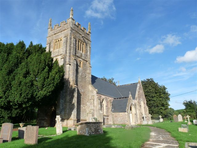
| Memorials | : | 0 |
| Location | : | Durston, Taunton Deane Borough, England |
| Coordinate | : | 51.0478800, -3.0128490 |
frequently asked questions (FAQ):
-
Where is St John the Baptist Churchyard?
St John the Baptist Churchyard is located at Durston, Taunton Deane Borough ,Somerset ,England.
-
St John the Baptist Churchyard cemetery's updated grave count on graveviews.com?
0 memorials
-
Where are the coordinates of the St John the Baptist Churchyard?
Latitude: 51.0478800
Longitude: -3.0128490
Nearby Cemetories:
1. Buckland Priory
Durston, Taunton Deane Borough, England
Coordinate: 51.0476530, -2.9988180
2. St. Michael's Churchyard
North Newton, Sedgemoor District, England
Coordinate: 51.0650279, -2.9974435
3. St. Augustine Churchyard
West Monkton, Taunton Deane Borough, England
Coordinate: 51.0507000, -3.0528000
4. Saint Giles Church
Thurloxton, Sedgemoor District, England
Coordinate: 51.0684800, -3.0365270
5. St. Peter's Churchyard
North Newton, Sedgemoor District, England
Coordinate: 51.0751380, -2.9990730
6. St. Michael's Churchyard
Creech St Michael, Taunton Deane Borough, England
Coordinate: 51.0223660, -3.0355780
7. St. Peter & St. Paul's Churchyard
North Curry, Taunton Deane Borough, England
Coordinate: 51.0258710, -2.9716440
8. Independent Baptist Churchyard
North Curry, Taunton Deane Borough, England
Coordinate: 51.0189703, -2.9779346
9. St. George Churchyard
Ruishton, Taunton Deane Borough, England
Coordinate: 51.0206300, -3.0511400
10. Methodist Churchyard
North Curry, Taunton Deane Borough, England
Coordinate: 51.0213358, -2.9731175
11. Ruishton Church Cemetery
Ruishton, Taunton Deane Borough, England
Coordinate: 51.0204630, -3.0520420
12. East Lyng St Bartholomew
Lyng, Sedgemoor District, England
Coordinate: 51.0553000, -2.9534000
13. Holy Cross at Thornfalcon
Taunton, Taunton Deane Borough, England
Coordinate: 51.0100970, -3.0229420
14. St Mary Churchyard
Cheddon Fitzpaine, Taunton Deane Borough, England
Coordinate: 51.0426420, -3.0811930
15. St. Mary Parish Churchyard
North Petherton, Sedgemoor District, England
Coordinate: 51.0920790, -3.0149060
16. The Baptist Chapel
Stoke St Gregory, Taunton Deane Borough, England
Coordinate: 51.0430441, -2.9375476
17. Heathfield Cemetery
North Petherton, Sedgemoor District, England
Coordinate: 51.0957200, -3.0081100
18. Athelney Abbey (Defunct)
Athelney, Sedgemoor District, England
Coordinate: 51.0593000, -2.9345800
19. Stoke St Gregory
Stoke St Gregory, Taunton Deane Borough, England
Coordinate: 51.0398130, -2.9310570
20. Northmoor Green St. Peter & St. John Churchyard
North Petherton, Sedgemoor District, England
Coordinate: 51.0841694, -2.9486911
21. Stoke St. Mary Churchyard
Stoke St Mary, Taunton Deane Borough, England
Coordinate: 50.9955000, -3.0477000
22. Taunton Priory of St Peter and St Paul
Taunton, Taunton Deane Borough, England
Coordinate: 51.0188270, -3.0988810
23. Ebenezer Chapelyard
Burrowbridge, Taunton Deane Borough, England
Coordinate: 51.0727744, -2.9222989
24. Blessed Virgin Mary Churchyard
Kingston St Mary, Taunton Deane Borough, England
Coordinate: 51.0610300, -3.1104300