
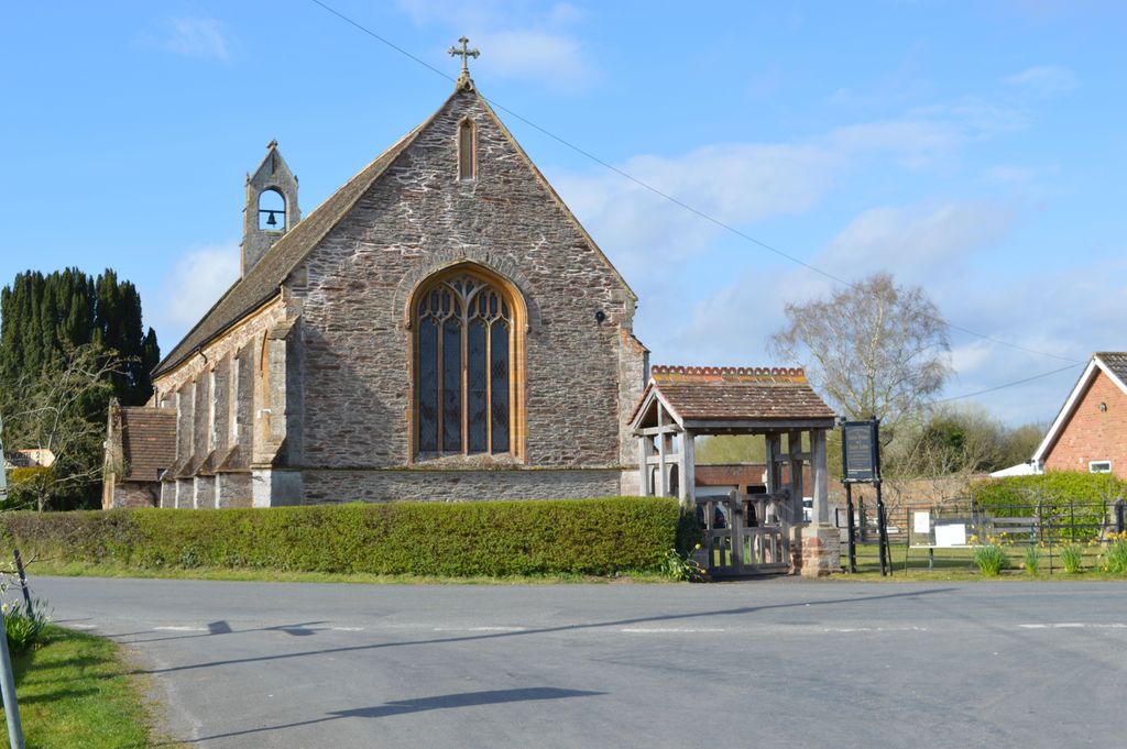
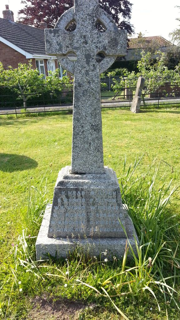
| Memorials | : | 4 |
| Location | : | North Petherton, Sedgemoor District, England |
| Coordinate | : | 51.0841694, -2.9486911 |
frequently asked questions (FAQ):
-
Where is Northmoor Green St. Peter & St. John Churchyard?
Northmoor Green St. Peter & St. John Churchyard is located at North Petherton, Sedgemoor District ,Somerset ,England.
-
Northmoor Green St. Peter & St. John Churchyard cemetery's updated grave count on graveviews.com?
3 memorials
-
Where are the coordinates of the Northmoor Green St. Peter & St. John Churchyard?
Latitude: 51.0841694
Longitude: -2.9486911
Nearby Cemetories:
1. Ebenezer Chapelyard
Burrowbridge, Taunton Deane Borough, England
Coordinate: 51.0727744, -2.9222989
2. St Michael Churchyard
Burrowbridge, Taunton Deane Borough, England
Coordinate: 51.0698090, -2.9174960
3. Athelney Abbey (Defunct)
Athelney, Sedgemoor District, England
Coordinate: 51.0593000, -2.9345800
4. The Old Chapel
Westonzoyland, Sedgemoor District, England
Coordinate: 51.1077425, -2.9285237
5. Westonzoyland Cemetery New
Westonzoyland, Sedgemoor District, England
Coordinate: 51.1096271, -2.9349336
6. Westonzoyland Cemetery
Westonzoyland, Sedgemoor District, England
Coordinate: 51.1078900, -2.9264440
7. St. Mary's Churchyard
Westonzoyland, Sedgemoor District, England
Coordinate: 51.1087000, -2.9273800
8. East Lyng St Bartholomew
Lyng, Sedgemoor District, England
Coordinate: 51.0553000, -2.9534000
9. St. Peter's Churchyard
North Newton, Sedgemoor District, England
Coordinate: 51.0751380, -2.9990730
10. Holy Cross Churchyard
Middlezoy, Sedgemoor District, England
Coordinate: 51.0937200, -2.8941260
11. St. Michael's Churchyard
North Newton, Sedgemoor District, England
Coordinate: 51.0650279, -2.9974435
12. Othery Cemetery
Othery, Sedgemoor District, England
Coordinate: 51.0771222, -2.8906189
13. Heathfield Cemetery
North Petherton, Sedgemoor District, England
Coordinate: 51.0957200, -3.0081100
14. The Baptist Chapel
Stoke St Gregory, Taunton Deane Borough, England
Coordinate: 51.0430441, -2.9375476
15. St. Mary Parish Churchyard
North Petherton, Sedgemoor District, England
Coordinate: 51.0920790, -3.0149060
16. Stoke St Gregory
Stoke St Gregory, Taunton Deane Borough, England
Coordinate: 51.0398130, -2.9310570
17. Buckland Priory
Durston, Taunton Deane Borough, England
Coordinate: 51.0476530, -2.9988180
18. Church of the Blessed Virgin Mary Churchyard
Chedzoy, Sedgemoor District, England
Coordinate: 51.1344600, -2.9429400
19. Former Holy Trinity Churchyard
Bridgwater, Sedgemoor District, England
Coordinate: 51.1261850, -3.0021850
20. St John the Baptist Churchyard
Durston, Taunton Deane Borough, England
Coordinate: 51.0478800, -3.0128490
21. Sutton Mallet Churchyard
Sutton Mallet, Sedgemoor District, England
Coordinate: 51.1282540, -2.8974536
22. Bridgwater Baptist Church
Bridgwater, Sedgemoor District, England
Coordinate: 51.1272613, -3.0046282
23. Gray Friar's
Bridgwater, Sedgemoor District, England
Coordinate: 51.1264260, -3.0065160
24. St John The Baptist Churchyard
Bridgwater, Sedgemoor District, England
Coordinate: 51.1311160, -2.9969910