
| Memorials | : | 43 |
| Location | : | North Curry, Taunton Deane Borough, England |
| Coordinate | : | 51.0258710, -2.9716440 |
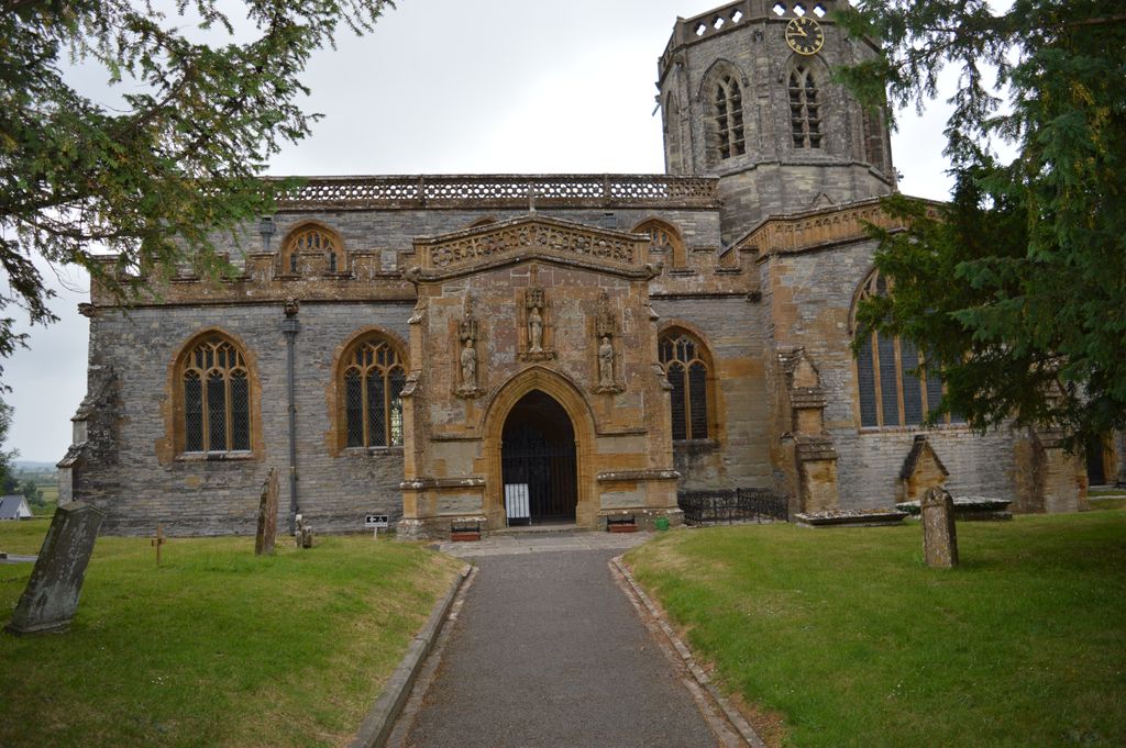
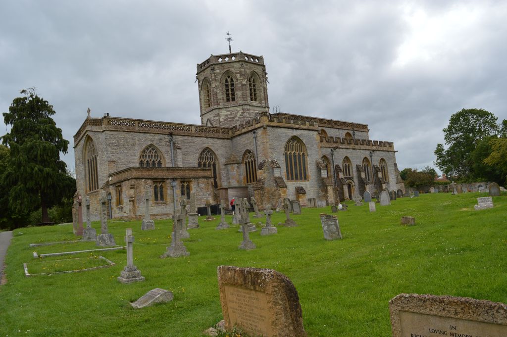
| Description | : | The Church of St Peter & St Paul in North Curry, Somerset, England, is nicknamed, ‘The Cathedral of the Moors'. A wooden church was erected on the promontory as early as the 9th century. Around the year 1100, the timber church was rebuilt in stone. The current church was built circa 1300 and added to across the centuries. Around the church exterior are numerous grotesque carvings, known locally as 'hunky-punks,' thought to be of pagan origin. In August 2007, North Curry Church was incorporated into the Athelney benefice of the Church of England. The vicar of the Athelney benefice covers the... Read More |
frequently asked questions (FAQ):
-
Where is St. Peter & St. Paul's Churchyard?
St. Peter & St. Paul's Churchyard is located at North Curry, Taunton Deane Borough ,Somerset ,England.
-
St. Peter & St. Paul's Churchyard cemetery's updated grave count on graveviews.com?
38 memorials
-
Where are the coordinates of the St. Peter & St. Paul's Churchyard?
Latitude: 51.0258710
Longitude: -2.9716440
Nearby Cemetories:
1. Methodist Churchyard
North Curry, Taunton Deane Borough, England
Coordinate: 51.0213358, -2.9731175
2. Independent Baptist Churchyard
North Curry, Taunton Deane Borough, England
Coordinate: 51.0189703, -2.9779346
3. The Baptist Chapel
Stoke St Gregory, Taunton Deane Borough, England
Coordinate: 51.0430441, -2.9375476
4. Buckland Priory
Durston, Taunton Deane Borough, England
Coordinate: 51.0476530, -2.9988180
5. Stoke St Gregory
Stoke St Gregory, Taunton Deane Borough, England
Coordinate: 51.0398130, -2.9310570
6. East Lyng St Bartholomew
Lyng, Sedgemoor District, England
Coordinate: 51.0553000, -2.9534000
7. St John the Baptist Churchyard
Durston, Taunton Deane Borough, England
Coordinate: 51.0478800, -3.0128490
8. Holy Cross at Thornfalcon
Taunton, Taunton Deane Borough, England
Coordinate: 51.0100970, -3.0229420
9. St. Martin's Churchyard
Fivehead, South Somerset District, England
Coordinate: 51.0017010, -2.9239810
10. St. Michael's Churchyard
Creech St Michael, Taunton Deane Borough, England
Coordinate: 51.0223660, -3.0355780
11. Athelney Abbey (Defunct)
Athelney, Sedgemoor District, England
Coordinate: 51.0593000, -2.9345800
12. Fivehead Cemetery
Fivehead, South Somerset District, England
Coordinate: 50.9969923, -2.9231360
13. St. John the Baptist Churchyard
Hatch Beauchamp, Taunton Deane Borough, England
Coordinate: 50.9852830, -2.9900880
14. St. Michael's Churchyard
North Newton, Sedgemoor District, England
Coordinate: 51.0650279, -2.9974435
15. All Saints Churchyard
Curry Mallet, South Somerset District, England
Coordinate: 50.9836110, -2.9497220
16. St. James' Churchyard
Beercrocombe, South Somerset District, England
Coordinate: 50.9791730, -2.9619190
17. St. Catherine's Churchyard
Fivehead, South Somerset District, England
Coordinate: 51.0083009, -2.9000973
18. St. George Churchyard
Ruishton, Taunton Deane Borough, England
Coordinate: 51.0206300, -3.0511400
19. Ruishton Church Cemetery
Ruishton, Taunton Deane Borough, England
Coordinate: 51.0204630, -3.0520420
20. St Mary the Virgin Churchyard
Isle Abbotts, South Somerset District, England
Coordinate: 50.9842010, -2.9240160
21. Saint Andrew's Churchyard
West Hatch, Taunton Deane Borough, England
Coordinate: 50.9840980, -3.0195000
22. Baptist Chapel
Isle Abbotts, South Somerset District, England
Coordinate: 50.9820340, -2.9282940
23. Hatch Beauchamp Baptist Churchyard
Hatch Beauchamp, Taunton Deane Borough, England
Coordinate: 50.9765290, -2.9975820
24. St. Peter's Churchyard
North Newton, Sedgemoor District, England
Coordinate: 51.0751380, -2.9990730