
| Memorials | : | 172 |
| Location | : | Keynsham, Bath and North East Somerset Unitary Authority, England |
| Coordinate | : | 51.4174570, -2.4987140 |
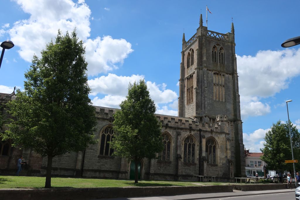
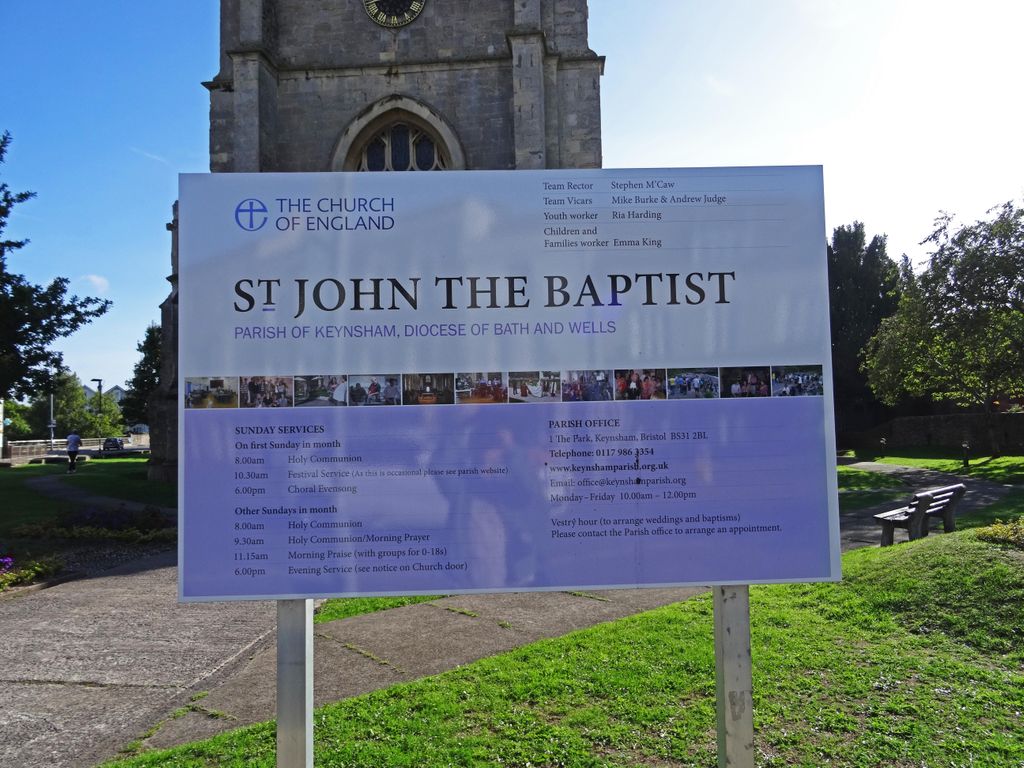
| Description | : | The parish church of Saint John near to Keynsham, Bath and North East Somerset. Keynsham listed In The Domesday Book of 1066 as Cainesham-meaning Saint Keyne's home. Saint Keyne's father was Brychan and it is believed they both lived in the 5th century. St John the baptist church is the most notable building in the town and built during the reign of Charles II.It has been designated as a grade II listed building. |
frequently asked questions (FAQ):
-
Where is St. John the Baptist Churchyard?
St. John the Baptist Churchyard is located at Keynsham, Bath and North East Somerset Unitary Authority ,Somerset ,England.
-
St. John the Baptist Churchyard cemetery's updated grave count on graveviews.com?
162 memorials
-
Where are the coordinates of the St. John the Baptist Churchyard?
Latitude: 51.4174570
Longitude: -2.4987140


Nearby Cemetories:
1. Ebenezer Baptist Church
Keynsham, Bath and North East Somerset Unitary Authority, England
Coordinate: 51.4160710, -2.4983170
2. Keynsham Abbey
Keynsham, Bath and North East Somerset Unitary Authority, England
Coordinate: 51.4172000, -2.4961000
3. Keynsham Cemetery
Keynsham, Bath and North East Somerset Unitary Authority, England
Coordinate: 51.4212975, -2.5116095
4. Queen Charlton St. Margaret Churchyard
Compton Dando, Bath and North East Somerset Unitary Authority, England
Coordinate: 51.4009300, -2.5271800
5. Saint Margaret Churchyard
Compton Dando, Bath and North East Somerset Unitary Authority, England
Coordinate: 51.4009330, -2.5272136
6. St Anne Churchyard
Oldland, South Gloucestershire Unitary Authority, England
Coordinate: 51.4381800, -2.4780900
7. St. Mary Churchyard
Bitton, South Gloucestershire Unitary Authority, England
Coordinate: 51.4223600, -2.4599100
8. Hanham Baptist Church Cemetery
Hanham, South Gloucestershire Unitary Authority, England
Coordinate: 51.4474802, -2.5107480
9. Blessed Virgin Mary Churchyard
Saltford, Bath and North East Somerset Unitary Authority, England
Coordinate: 51.4056845, -2.4528274
10. Saint Michael Churchyard
Keynsham, Bath and North East Somerset Unitary Authority, England
Coordinate: 51.3865690, -2.4830350
11. Brislington Cemetery
Brislington, Bristol Unitary Authority, England
Coordinate: 51.4355480, -2.5438020
12. Christ Church Churchyard
Hanham, South Gloucestershire Unitary Authority, England
Coordinate: 51.4484992, -2.5222650
13. Hanham United Reform Church Cemetery
Hanham, South Gloucestershire Unitary Authority, England
Coordinate: 51.4509706, -2.5189809
14. Ebenezer Methodist Chapel
Warmley, South Gloucestershire Unitary Authority, England
Coordinate: 51.4514960, -2.4779637
15. Whitchurch Cemetery
Bristol Unitary Authority, England
Coordinate: 51.3990278, -2.5506809
16. Blessed Virgin Mary Churchyard
Compton Dando, Bath and North East Somerset Unitary Authority, England
Coordinate: 51.3796870, -2.5100920
17. Christ Church Churchyard
Bristol, Bristol Unitary Authority, England
Coordinate: 51.4213270, -2.5632460
18. St. Barnabas Church of England Churchyard
Bristol, Bristol Unitary Authority, England
Coordinate: 51.4570643, -2.4704304
19. St. Barnabas Churchyard
Warmley, South Gloucestershire Unitary Authority, England
Coordinate: 51.4570800, -2.4704100
20. St. Nicholas Churchyard
Kelston, Bath and North East Somerset Unitary Authority, England
Coordinate: 51.4006420, -2.4344010
21. St. Martin Churchyard
Northstoke, Bath and North East Somerset Unitary Authority, England
Coordinate: 51.4202400, -2.4273800
22. Holy Trinity Churchyard
Kingswood, South Gloucestershire Unitary Authority, England
Coordinate: 51.4619990, -2.5040620
23. Master's Church Cemetery
Kingswood, South Gloucestershire Unitary Authority, England
Coordinate: 51.4630871, -2.5068932
24. St Michael the Archangel Churchyard
Bristol Unitary Authority, England
Coordinate: 51.4619199, -2.5211279